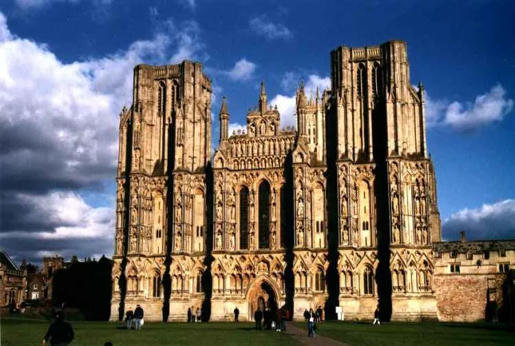
- Population
- 11,145
- 11.1K
- Elevation
- 42 m
- above sea level
- Local time
- UTC+00:00
- Europe/London · UTC+00:00
- Airports
- BRS Bristol Airport20 km
- CWL Cardiff International Airport53 km
About Wells
Wells is a town. Location: Wells, Mendip District. Population: 11,145. Elevation: 42 m.
Wells () is a cathedral city and civil parish in Somerset, England. It is located on the southern edge of the Mendip Hills, 22 miles (35 km) south-west of Bath, 23 miles (37 km) south of Bristol, and 24 miles (39 km) north-east of Taunton. At the 2021 census, the population of the parish was 11,145 and the population of the built-up area, which extends into the neighbouring parish of St Cuthbert Out, was 12,105. Wells has held city status since medieval times, because of the presence of Wells Cathedral.
Source: Wikipedia · CC BY-SA 4.0
Photos of Wells
-

Chris' Buet · CC BY-SA 2.0 -

Andrew Abbott · CC BY-SA 2.0 -

Neil Owen · CC BY-SA 2.0 -

Neil Owen · CC BY-SA 2.0 -

Ant Basterfield · CC BY-SA 2.0


Travel notes for Wells
From Wikivoyage
Wells is the smallest city in England, with a population of around 10,000. It is in Somerset in the south-west of the country.
Understand+
The city is dominated by the magnificent Gothic cathedral and is famous for its remarkably intact ecclesiastical quarter. This area contains the Bishop's Palace – the seat of the Bishop of Bath and Wells – and the Vicar's Close, a medieval street purported to be the oldest continuously-inhabited street in Europe. The city takes its name from the natural wells found in the Cathedral grounds, which feed the moat and ponds around the Bishop's Palace. The majority of the Edgar Wright comedy Hot Fuzz was filmed in and around Wells.
Tourist information:
Wells visitor information
Get in+
By plane:
The nearest airport is 1 Bristol Airport (BRS IATA), around 20 mi (32 km) away. You can hire a car at the airport or catch the bus into Bristol in order to catch a bus to Wells. In common with many rural towns, Wells has no train station.
By car:
From Bristol, take the A37 south until you reach the A371, then head west into Wells. From Bath, take the A39 west into the A37, and then on to the A371 west into Wells. If coming from the South, exit the M5 at junction 23, then take the A39 "Bath Road" through Glastonbury and continue North to Wells.
By train:
These stations near Wells are reachable from Bristol and London Paddington:
Castle Cary station: bus, changing in Shepton Mallet;
Weston-super-Mare Milton station: direct bus;
Bristol Temple Meads: direct bus;
Bath Spa station: direct bus.
By bus:
There is an hourly bus service, number 376, from Bristol to Street. Get on at Bristol bus station or at Bristol Temple Meads rail station. This service is run by FirstGroup and up-to-date timetables can be found here.
Bristol → Pensford → Wells → Glastonbury → Street
Source: Wikivoyage · CC BY-SA 4.0 · abridged
Population of Wells over time
| 2001 | 10,406 | |
|---|---|---|
| 2011 | 10,536 | |
| 2021 | 11,145 |
Censuses and official estimates; source: Wikidata.
Climate of Wells
Best months for sightseeingBest months for sightseeing: June–August.
This month · November
A cold month
Day 11° · Night 5° · Rain 93 mm
- Hottest month
- July (day 21°)
- Coldest month
- February (night 2°)
- Wettest month
- December (104 mm)
- Driest month
- April (59 mm)
Bars: average monthly low and high temperature. Below: precipitation. Monthly averages for 1970–2000 at about 18 km resolution, adjusted for elevation. Highlighted months are mild and relatively dry. Source: WorldClim 2.1 (CC BY 4.0).
Show values as a table
| Month | Jan | Feb | Mar | Apr | May | Jun | Jul | Aug | Sep | Oct | Nov | Dec |
|---|---|---|---|---|---|---|---|---|---|---|---|---|
| Average high (°C) | 8° | 8° | 10° | 12° | 16° | 19° | 21° | 21° | 18° | 14° | 11° | 9° |
| Average low (°C) | 2° | 2° | 3° | 4° | 7° | 10° | 12° | 12° | 11° | 8° | 5° | 4° |
| Precipitation (mm) | 101 | 71 | 78 | 59 | 65 | 69 | 59 | 73 | 84 | 89 | 93 | 104 |
How to get to Wells
The nearest airport is Bristol Airport (BRS), 20 km to the north as the crow flies. The nearest large city is Bath, 27 km to the northeast.
Airports
- Bristol Airport (BRS) Bristol 20 kmnorth
- Cardiff International Airport (CWL) Cardiff 53 kmnorthwest
- Bournemouth Airport (BOH) Bournemouth 74 kmsoutheast
Nearby large cities
- Bath Population: 101.6K 27 kmnortheast
- Bristol Population: 479K 28 kmnorth
- Cardiff Population: 372.1K 48 kmnorthwest
- Newport Population: 161.5K 49 kmnorthwest
- Swindon Population: 201.7K 72 kmnortheast
Straight-line distances; road distances are longer. Airport data: OurAirports.
Day trips from Wells
Within 100 km: 611 historic and cultural sites, 1,324 natural sites, 140 lakes, rivers and coasts.
0–25 km128 places
- Denny Island Island 15 kmN
- Cheddar Reservoir Lake 13 kmNW
- Chew Valley Lake Lake 14 kmN
- Barrow Gurney Reservoir 1 Lake 22 kmN
25–60 km667 places
- Charmouth Beach Beach 56 kmS
- Kilve Beach Beach 40 kmW
- Steep Holm Island 35 kmNW
- Flat Holm Island 38 kmNW
60–100 km1,280 places
- Brownsea Island Island 75 kmSE
- Avon Beach Beach 83 kmSE
- Chesil Beach Beach 64 kmS
- Studland Beach Beach 78 kmSE
Straight-line distances.
Nearby attractions & nature
Everything nearby-
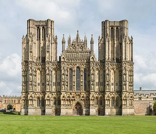 Wells Cathedral Attraction, Wells0.5 km NE
-
St Cuthberts Attraction, Wells0.1 km NW
-
Arthur's Point Mountain, St. Cuthbert Out1.9 km NW
-
Hay Hill Mountain, St. Cuthbert Out2.3 km SW
-
Launcherly Hill Mountain, North Wootton2.8 km S
-
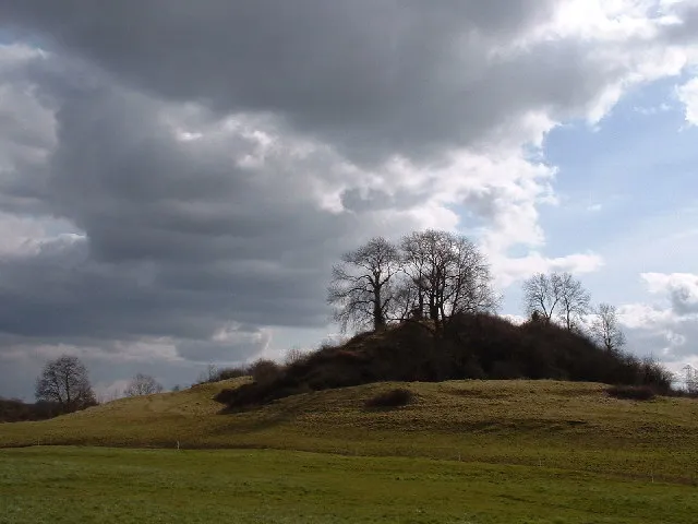 Fenny Castle Historic site, Wookey4.5 km SW
-
Ben Knowle Hill Mountain, St. Cuthbert Out3.2 km W
-
Pen Hill Mountain, St. Cuthbert Out3.6 km NE
Sources & licences
Data last updated: · 2 independent sources