Wills Neck
Located in West Bagborough, Taunton Deane District Coordinates: 51°06′34″ N 3°11′37″ W
- Elevation
- 386 m
- above sea level
- Local time
- UTC+00:00
- Europe/London · UTC+00:00
- Airports
- CWL Cardiff International Airport34 km
- EXT Exeter International Airport45 km
About Wills Neck
Wills Neck is a mountain. Location: West Bagborough, Taunton Deane District. Elevation: 386 m. The best months to visit are June–August. The nearest airport is Cardiff International Airport (34 km). Nearby sights include Lydeard Hill and Black Hill.
Photos of Wills Neck
-
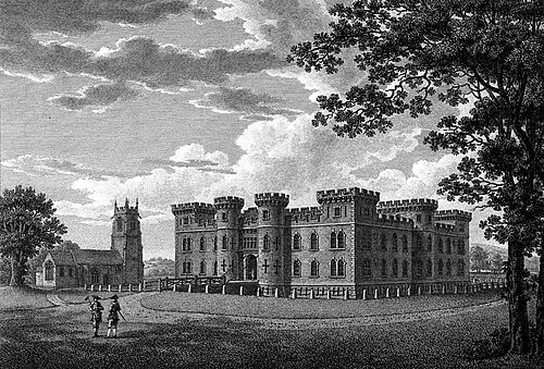
Enmore Castle William Watts · Public domain

Climate of Wills Neck
Best months for sightseeingBest months for sightseeing: June–August.
This month · November
A wet month
Day 9° · Night 3° · Rain 119 mm
- Hottest month
- July (day 19°)
- Coldest month
- February (night 0°)
- Wettest month
- November (119 mm)
- Driest month
- April (63 mm)
Bars: average monthly low and high temperature. Below: precipitation. Monthly averages for 1970–2000 at about 18 km resolution, adjusted for elevation. Highlighted months are mild and relatively dry. Source: WorldClim 2.1 (CC BY 4.0).
Show values as a table
| Month | Jan | Feb | Mar | Apr | May | Jun | Jul | Aug | Sep | Oct | Nov | Dec |
|---|---|---|---|---|---|---|---|---|---|---|---|---|
| Average high (°C) | 6° | 6° | 8° | 10° | 14° | 16° | 19° | 19° | 16° | 12° | 9° | 7° |
| Average low (°C) | 1° | 0° | 2° | 2° | 5° | 8° | 10° | 10° | 8° | 6° | 3° | 2° |
| Precipitation (mm) | 113 | 83 | 85 | 63 | 64 | 66 | 72 | 84 | 94 | 107 | 119 | 117 |
How to get to Wills Neck
The nearest airport is Cardiff International Airport (CWL), 34 km to the north as the crow flies. The nearest large city is Cardiff, 41 km to the north.
Airports
- Cardiff International Airport (CWL) Cardiff 34 kmnorth
- Exeter International Airport (EXT) Exeter, Devon 45 kmsouth
- Bristol Airport (BRS) Bristol 45 kmnortheast
Nearby large cities
- Cardiff Population: 372.1K 41 kmnorth
- Exeter Population: 130.7K 49 kmsouthwest
- Newport Population: 161.5K 55 kmnorth
- Bristol Population: 479K 57 kmnortheast
- Bath Population: 101.6K 65 kmnortheast
Straight-line distances; road distances are longer. Airport data: OurAirports.
Day trips from Wills Neck
Within 100 km: 563 historic and cultural sites, 1,460 natural sites, 157 lakes, rivers and coasts.
0–25 km114 places
- Kilve Beach Beach 10 kmN
- Stert Island Island 18 kmNE
- Fenning Island Island 17 kmNE
- Wimbleball Lake Lake 20 kmW
25–60 km748 places
- Charmouth Beach Beach 47 kmSE
- Steep Holm Island 26 kmN
- Flat Holm Island 30 kmN
- Barry Island Island 32 kmN
60–100 km1,318 places
- Brownsea Island Island 98 kmSE
- Goodrington Sands Beach 81 kmS
- Chesil Beach Beach 69 kmSE
- Saunton Sands Beach 72 kmW
Straight-line distances.
Nearest towns and villages
-
Triscombe Village, West Bagborough1 km W
-
West Bagborough Village, West Bagborough1.9 km S
-
Shopnoller Village, West Bagborough2.5 km S
-
Rich's Holford Village, Lydeard St. Lawrence2.3 km SW
-
Seven Ash Village, Combe Florey2.3 km SW
-
Over Stowey Village, Sedgemoor District2.7 km NE
Nearby attractions & nature
Everything nearby-
Lydeard Hill Mountain, West Bagborough1.7 km SE
-
Black Hill Mountain, Holford3.4 km NW
-
Cothelstone Hill Mountain, Cothelstone3.5 km SE
-
Dowsborough Mountain, Holford4 km N
-
Broomfield Hill Mountain, Broomfield5.3 km E
-
Homelea Hill Mountain, Halse6.2 km SW
-
Willett Hill Mountain, Elworthy7.2 km W
-
Stowey Castle Historic site, Nether Stowey4.9 km NE
Sources & licences
Data last updated: