Thornemead Hill
Located in Exford, West Somerset District Coordinates: 51°07′29″ N 3°42′11″ W
- Elevation
- 412 m
- above sea level
- Local time
- UTC+00:00
- Europe/London · UTC+00:00
- Airports
- CWL Cardiff International Airport39 km
- EXT Exeter International Airport48 km
About Thornemead Hill
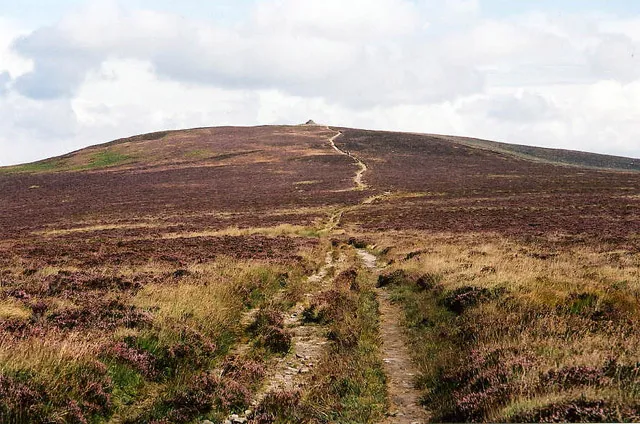
Thornemead Hill is a mountain. Location: Exford, West Somerset District. Elevation: 412 m. The best months to visit are June–August. The nearest airport is Cardiff International Airport (39 km). Nearby sights include Cow Castle and Withypool Common.
Climate of Thornemead Hill
Best months for sightseeingBest months for sightseeing: June–August.
This month · November
A wet month
Day 9° · Night 3° · Rain 159 mm
- Hottest month
- July (day 18°)
- Coldest month
- February (night 1°)
- Wettest month
- December (163 mm)
- Driest month
- May (82 mm)
Bars: average monthly low and high temperature. Below: precipitation. Monthly averages for 1970–2000 at about 18 km resolution, adjusted for elevation. Highlighted months are mild and relatively dry. Source: WorldClim 2.1 (CC BY 4.0).
Show values as a table
| Month | Jan | Feb | Mar | Apr | May | Jun | Jul | Aug | Sep | Oct | Nov | Dec |
|---|---|---|---|---|---|---|---|---|---|---|---|---|
| Average high (°C) | 6° | 6° | 8° | 10° | 14° | 16° | 18° | 18° | 15° | 12° | 9° | 7° |
| Average low (°C) | 1° | 1° | 2° | 2° | 5° | 8° | 10° | 10° | 9° | 6° | 3° | 2° |
| Precipitation (mm) | 160 | 113 | 118 | 87 | 82 | 84 | 84 | 101 | 117 | 138 | 159 | 163 |
How to get to Thornemead Hill
The nearest airport is Cardiff International Airport (CWL), 39 km to the northeast as the crow flies. The nearest large city is Exeter, 46 km to the south.
Airports
- Cardiff International Airport (CWL) Cardiff 39 kmnortheast
- Exeter International Airport (EXT) Exeter, Devon 48 kmsoutheast
- Bristol Airport (BRS) Bristol 75 kmnortheast
Nearby large cities
- Exeter Population: 130.7K 46 kmsouth
- Cardiff Population: 372.1K 54 kmnortheast
- Swansea Population: 300.4K 58 kmnorth
- Newport Population: 161.5K 71 kmnortheast
- Bristol Population: 479K 85 kmnortheast
Straight-line distances; road distances are longer. Airport data: OurAirports.
Day trips from Thornemead Hill
Within 100 km: 524 historic and cultural sites, 1,517 natural sites, 179 lakes, rivers and coasts.
0–25 km142 places
- Wimbleball Lake Lake 18 kmSE
- Culbone Hill Mountain 11 kmN
- Selworthy Beacon Mountain 15 kmNE
- Periton Hill Mountain 15 kmNE
25–60 km631 places
- Saunton Sands Beach 37 kmW
- Mouthmill Beach Beach 52 kmW
- Putsborough Beach Beach 36 kmW
- Kilve Beach Beach 34 kmE
60–100 km1,447 places
- Burgh Island Island 95 kmS
- Goodrington Sands Beach 79 kmS
- Chesil Beach Beach 97 kmSE
- Charmouth Beach Beach 71 kmSE
Straight-line distances.
Nearest towns and villages
-
Exmoor Village, West Somerset District3.6 km W
-
Exford Village, Exford4.5 km E
-
Withypool and Hawkridge Village, West Somerset District5.4 km SE
-
Simonsbath Village, Exmoor4 km NW
-
Withypool Village, Withypool and Hawkridge4.2 km SE
-
Twitchen Village, North Devon District7.5 km S
Nearby attractions & nature
Everything nearby-
Cow Castle Mountain, Exmoor1.5 km W
-
Withypool Common Mountain, Withypool and Hawkridge2.6 km S
-
Horsen Hill Mountain, Exmoor2.8 km SW
-
Road Hill Mountain, Exford4.3 km E
-
Withypool Hill Mountain, Withypool and Hawkridge4.4 km SE
-
North Molton Ridge Mountain, North Molton5.9 km SW
-
Exmoor National Park Natural site, Exmoor5.7 km NW
-
 Dunkery Beacon Mountain, Cutcombe9.2 km NE
Sources & licences
Data last updated: