Staffordshire
Located in England, United Kingdom Coordinates: 52°50′00″ N 2°00′00″ W
- Population
- 867,122
- 867.1K
- Elevation
- 87 m
- above sea level
- Local time
- UTC+00:00
- Europe/London · UTC+00:00
- Places inside
- 8
- listed under Staffordshire
About Staffordshire
Staffordshire is a district. Location: England, United Kingdom. Population: 867,122.
In comparison
- 11 sights and natural places within 10 km Chartley Castle, River Sow
- Listed here: Municipality: 8
Airports nearest to Staffordshire
- East Midlands Airport (EMA) Nottingham, Leicestershire 45 km
- Birmingham Airport (BHX) Birmingham, West Midlands 46 km
- Manchester Airport (MAN) Manchester, Greater Manchester 60 km
Straight-line distance; airports with scheduled flights only. Source: OurAirports (public domain).
Places in Staffordshire
8 places-
Stafford District Municipality134.2K
-
Newcastle-under-Lyme District Municipality128.5K
-
East Staffordshire Municipality116.7K
-
South Staffordshire District Municipality111.2K
-
Lichfield District Municipality103.1K
-
Cannock Chase Municipality98.5K
-
Staffordshire Moorlands Municipality98.1K
-
Tamworth District Municipality77K
Nature and heritage in Staffordshire
-
Wetton Hill Mountain, Wetton
-
Gun Mountain, Leekfrith
-
The Roaches Mountain, Leekfrith
-
Overmoor Mountain, Consall
-
Ashley Heath Mountain, Loggerheads
-
Sheepwalks Hill Mountain, Enville
Nearby attractions & nature
Everything nearby-
River Sow River, England3.7 km S
-
River Penk River, England6.7 km SW
-
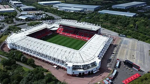 Britannia Stadium Landmark, Stoke-on-Trent21 km NW
-
River Blithe River, England15 km SE
-
River Churnet River, England15 km NE
-
Chasewater Lake, England19 km S
Sources & licences
Data last updated: