Stoke-on-Trent
Located in England, United Kingdom Coordinates: 53°00′00″ N 2°10′00″ W
- Population
- 259,965
- 260K
- Elevation
- 132 m
- above sea level
- Local time
- UTC+00:00
- Europe/London · UTC+00:00
- Places inside
- 81
- listed under Stoke-on-Trent
About Stoke-on-Trent
Stoke-on-Trent is a district. Location: England, United Kingdom. Population: 259,965.
In comparison
- 31 sights and natural places within 10 km Glebedale Park, Britannia Stadium
- Listed here: Neighbourhood: 54, Village: 15, Mountain: 5, Landmark: 3
Places in Stoke-on-Trent
81 places-
Stoke-on-Trent City258.4K
-
Longton Town27.2K
-
Trentham Village11.8K
-
Burslem Village6.9K
-
Tunstall Town6.2K
-
Abbey Hulton Neighbourhood
-
Adderley Green Neighbourhood
-
Baddeley Edge Neighbourhood
-
Baddeley Green Neighbourhood
-
Ball Green Neighbourhood
-
Bank Top Neighbourhood
-
Bemersley Green Village
-
Bentilee Neighbourhood
-
Berry Hill Neighbourhood
-
Birches Head Neighbourhood
-
Blurton Neighbourhood
-
Boothen Neighbourhood
-
Bradeley Neighbourhood
-
Britannia Stadium Landmark
-
Bucknall Village
-
Carmountside Neighbourhood
-
Chatterley Village
-
Chatterley Whitfield Hill Mountain
-
Chell Heath Neighbourhood
-
Cliff Vale Neighbourhood
-
Cobridge Village
-
Cobridge Hill Mountain
-
Cornhill Neighbourhood
-
Etruria Village
-
Fegg Hayes Neighbourhood
-
Fenton Village
-
Florence Neighbourhood
-
Ford Green Village
-
Gill Bank Mountain
-
Glebedale Park Mountain
-
Goldenhill Neighbourhood
-
Great Chell Neighbourhood
-
Hanford Neighbourhood
-
Hanley Neighbourhood
-
Heron Cross Neighbourhood
-
Hollybush Neighbourhood
-
Hulton Abbey, Stoke-on-Trent, GB Historic site
-
Joiner's Square Neighbourhood
-
Light Oaks Neighbourhood
-
Lightwood Neighbourhood
-
Little Chell Neighbourhood
-
Longport Village
-
Meir Neighbourhood
-
Meir Hay Neighbourhood
-
Middleport Village
-
Milton Village
-
Newfield Neighbourhood
-
Newstead Neighbourhood
-
Normacot Neighbourhood
-
Northwood Neighbourhood
-
Norton Green Neighbourhood
-
Norton-in-the-Moors Neighbourhood
-
Oakhill Neighbourhood
-
Oxford Neighbourhood
-
Packmoor Neighbourhood
Nearby attractions & nature
Everything nearby-
Park Hall Hill Mountain, Werrington4.3 km E
-
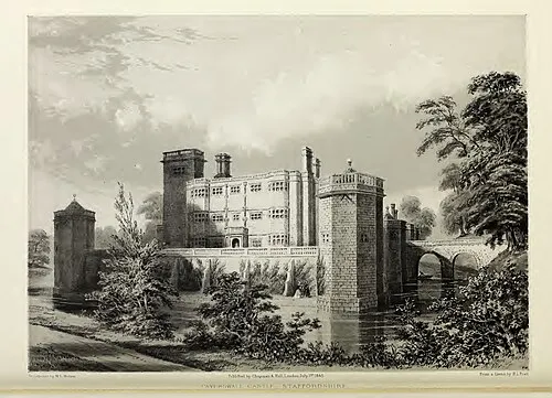 Caverswall Castle Historic site, Caverswall6.5 km E
-
Newcastle under Lyme Castle Historic site, Newcastle-under-Lyme District4.6 km W
-
Kingswood Bank Mountain, Swynnerton5.5 km SW
-
Swan Bank Historic site, Caverswall5.6 km E
-
Wetley Moor Mountain, Werrington5.8 km NE
Sources & licences
Data last updated: