Chatterley Whitfield Hill
Located in Stoke-on-Trent, England Coordinates: 53°04′25″ N 2°10′33″ W
- Elevation
- 209 m
- above sea level
- Local time
- UTC+00:00
- Europe/London · UTC+00:00
- Airports
- MAN Manchester Airport31 km
- LPL Liverpool John Lennon Airport54 km
About Chatterley Whitfield Hill
Chatterley Whitfield Hill is a mountain. Location: Stoke-on-Trent, England. Elevation: 209 m. The best months to visit are June–August. The nearest airport is Manchester Airport (31 km). Nearby sights include Bemersley Green Hill and Sneyd Hill.
Photos of Chatterley Whitfield Hill
-
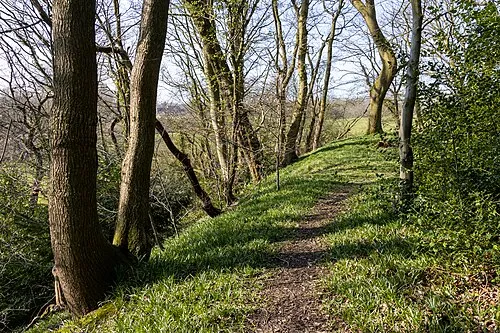
Biddulph Lea Forge Mike Peel · CC BY-SA 4.0 -

Vale Park User:Oldelpaso · CC BY-SA 3.0


Climate of Chatterley Whitfield Hill
Best months for sightseeingBest months for sightseeing: June–August.
This month · November
A cold month
Day 9° · Night 3° · Rain 78 mm
- Hottest month
- July (day 20°)
- Coldest month
- February (night 0°)
- Wettest month
- November (78 mm)
- Driest month
- February (52 mm)
Bars: average monthly low and high temperature. Below: precipitation. Monthly averages for 1970–2000 at about 18 km resolution, adjusted for elevation. Highlighted months are mild and relatively dry. Source: WorldClim 2.1 (CC BY 4.0).
Show values as a table
| Month | Jan | Feb | Mar | Apr | May | Jun | Jul | Aug | Sep | Oct | Nov | Dec |
|---|---|---|---|---|---|---|---|---|---|---|---|---|
| Average high (°C) | 6° | 6° | 8° | 11° | 15° | 17° | 20° | 19° | 16° | 13° | 9° | 7° |
| Average low (°C) | 1° | 0° | 2° | 3° | 6° | 9° | 11° | 11° | 9° | 6° | 3° | 2° |
| Precipitation (mm) | 71 | 52 | 61 | 53 | 56 | 67 | 55 | 72 | 66 | 74 | 78 | 74 |
How to get to Chatterley Whitfield Hill
The nearest airport is Manchester Airport (MAN), 31 km to the north as the crow flies. The nearest large city is Stoke-on-Trent, 8 km to the south.
Airports
- Manchester Airport (MAN) Manchester, Greater Manchester 31 kmnorth
- Liverpool John Lennon Airport (LPL) Liverpool 54 kmnorthwest
- East Midlands Airport (EMA) Nottingham, Leicestershire 63 kmsoutheast
Nearby large cities
- Stoke-on-Trent Population: 258.4K 8 kmsouth
- Newcastle-under-Lyme Population: 127.7K 9 kmsouthwest
- Stockport Population: 139.1K 37 kmnorth
- Warrington Population: 172.3K 45 kmnorthwest
- Manchester Population: 569K 46 kmnorth
Straight-line distances; road distances are longer. Airport data: OurAirports.
Day trips from Chatterley Whitfield Hill
Within 100 km: 808 historic and cultural sites, 1,392 natural sites, 165 lakes, rivers and coasts.
0–25 km127 places
- The Cloud Mountain 11 kmN
- Shining Tor Mountain 24 kmNE
- Gun Mountain 12 kmNE
- Old Man of Mow Mountain 5 kmNW
25–60 km593 places
- Horninglow island Island 47 kmSE
- Saint George's Island Island 45 kmN
- Brown's Island Island 50 kmSE
- Holme Nook Island 49 kmE
60–100 km1,645 places
- Thurstaston Beach Beach 71 kmNW
- Formby Beach Beach 82 kmNW
- Ainsdale Beach Beach 84 kmNW
- St Anne's Beach Beach 94 kmNW
Straight-line distances.
Nearest towns and villages
-
Tunstall Town, Stoke-on-Trent2.9 km SW
-
 Burslem Village, Stoke-on-Trent3.5 km SW
-
Whitfield Neighbourhood, Stoke-on-Trent0.4 km NE
-
Fegg Hayes Neighbourhood, Stoke-on-Trent0.6 km W
-
Oxford Neighbourhood, Stoke-on-Trent0.7 km W
-
Chell Heath Neighbourhood, Stoke-on-Trent0.8 km SW
Nearby attractions & nature
Everything nearby-
Bemersley Green Hill Mountain, Brown Edge1.7 km N
-
Sneyd Hill Mountain, Stoke-on-Trent3.3 km S
-
Vale Park Landmark, Stoke-on-Trent2.8 km SW
-
Gill Bank Mountain, Stoke-on-Trent3.5 km W
-
Cobridge Hill Mountain, Stoke-on-Trent4.1 km S
-
Ashenough Hill Mountain, Kidsgrove4.9 km W
-
Mow Cop - Trig Point Mountain, Odd Rode5.2 km NW
-
Old Man of Mow Mountain, Odd Rode5.3 km NW
Sources & licences
Data last updated: