
- Elevation
- 158 m
- above sea level
- Local time
- UTC+00:00
- Europe/London · UTC+00:00
- Airports
- MAN Manchester Airport36 km
- LPL Liverpool John Lennon Airport56 km
About Cobridge
Cobridge is a village. Location: Stoke-on-Trent, England. Elevation: 158 m.
Cobridge is an area of Stoke-on-Trent, in the City of Stoke-on-Trent district, in the county of Staffordshire, England. Cobridge was marked on the 1775 Yates map as 'Cow Bridge' and was recorded in Ward records (1843) as Cobridge Gate. Cobridge has a community centre, on Bursley Road. Cobridge once had a railway station on the Potteries Loop Line. Cobridge was the location of the Athletic Ground, now the site of a sheltered housing and nursing home complex.
Source: Wikipedia · CC BY-SA 4.0
Photos of Cobridge
-
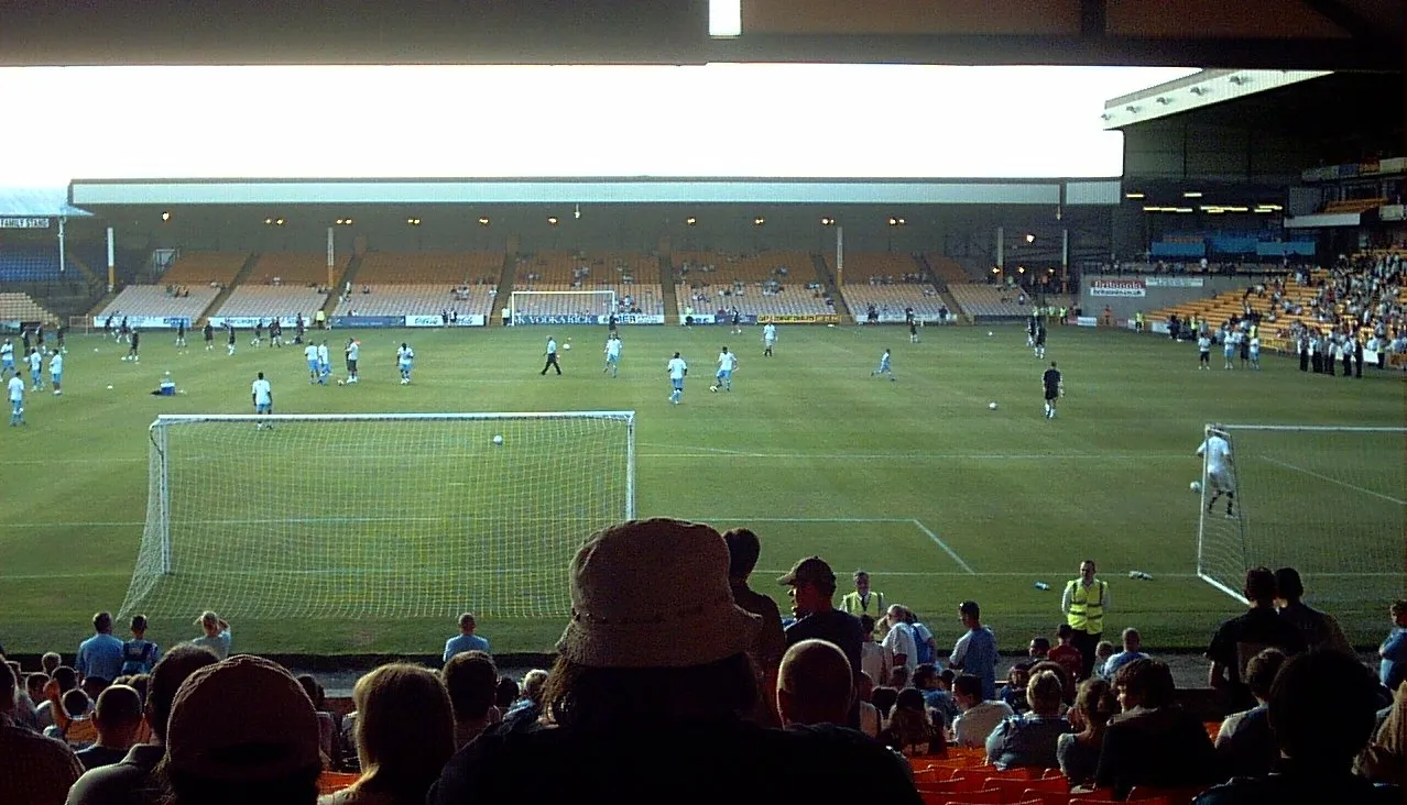
Vale Park User:Oldelpaso · CC BY-SA 3.0 -
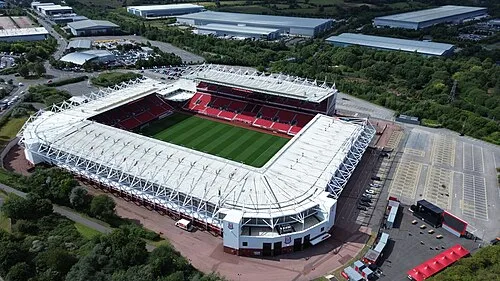
Britannia Stadium Gkbediako · CC BY-SA 4.0


Climate of Cobridge
Best months for sightseeingBest months for sightseeing: June–August.
This month · November
A cold month
Day 9° · Night 3° · Rain 78 mm
- Hottest month
- July (day 20°)
- Coldest month
- February (night 1°)
- Wettest month
- November (78 mm)
- Driest month
- February (52 mm)
Bars: average monthly low and high temperature. Below: precipitation. Monthly averages for 1970–2000 at about 18 km resolution, adjusted for elevation. Highlighted months are mild and relatively dry. Source: WorldClim 2.1 (CC BY 4.0).
Show values as a table
| Month | Jan | Feb | Mar | Apr | May | Jun | Jul | Aug | Sep | Oct | Nov | Dec |
|---|---|---|---|---|---|---|---|---|---|---|---|---|
| Average high (°C) | 6° | 6° | 9° | 11° | 15° | 18° | 20° | 20° | 17° | 13° | 9° | 7° |
| Average low (°C) | 1° | 1° | 2° | 4° | 7° | 9° | 12° | 11° | 9° | 6° | 3° | 2° |
| Precipitation (mm) | 71 | 52 | 61 | 53 | 56 | 67 | 55 | 72 | 66 | 74 | 78 | 74 |
How to get to Cobridge
The nearest airport is Manchester Airport (MAN), 36 km to the north as the crow flies. The nearest large city is Stoke-on-Trent, 3 km to the south.
Airports
- Manchester Airport (MAN) Manchester, Greater Manchester 36 kmnorth
- Liverpool John Lennon Airport (LPL) Liverpool 56 kmnorthwest
- East Midlands Airport (EMA) Nottingham, Leicestershire 62 kmeast
Nearby large cities
- Stoke-on-Trent Population: 258.4K 3 kmsouth
- Newcastle-under-Lyme Population: 127.7K 5 kmsouthwest
- Stockport Population: 139.1K 42 kmnorth
- Telford Population: 155.6K 43 kmsouthwest
- Burton-on-Trent Population: 122.2K 44 kmsoutheast
Straight-line distances; road distances are longer. Airport data: OurAirports.
Day trips from Cobridge
Within 100 km: 818 historic and cultural sites, 1,433 natural sites, 159 lakes, rivers and coasts.
0–25 km111 places
- The Cloud Mountain 15 kmN
- Gun Mountain 16 kmNE
- Old Man of Mow Mountain 9 kmN
- Shutlingsloe Mountain 23 kmNE
25–60 km618 places
- Horninglow island Island 46 kmSE
- Saint George's Island Island 49 kmN
- Brown's Island Island 47 kmSE
- Holme Nook Island 49 kmE
60–100 km1,681 places
- Thurstaston Beach Beach 72 kmNW
- Formby Beach Beach 85 kmNW
- Ainsdale Beach Beach 87 kmNW
- St Anne's Beach Beach 97 kmNW
Straight-line distances.
Nearby attractions & nature
Everything nearby-
Vale Park Landmark, Stoke-on-Trent1.9 km N
-
Cobridge Hill Mountain, Stoke-on-Trent1.1 km E
-
Sneyd Hill Mountain, Stoke-on-Trent1.3 km NE
-
Britannia Stadium Landmark, Stoke-on-Trent5.1 km S
-
Hulton Abbey, Stoke-on-Trent, GB Historic site, Stoke-on-Trent3.1 km E
-
Chatterley Whitfield Hill Mountain, Stoke-on-Trent4.5 km N
Other cities and towns in Stoke-on-Trent
-
 Longport Village, Stoke-on-Trent2.1 km NW
-
 Fenton Village, Stoke-on-Trent4.4 km SE
-
Etruria Village, Stoke-on-Trent1.3 km S
-
Northwood Neighbourhood, Stoke-on-Trent1.7 km E
-
Sneyd Green Neighbourhood, Stoke-on-Trent1.8 km NE
-
Birches Head Neighbourhood, Stoke-on-Trent2.1 km E
Sources & licences
Data last updated: · 2 independent sources