South Staffordshire District
Located in Staffordshire, England Coordinates: 52°37′32″ N 2°10′36″ W
- Population
- 111,180
- 111.2K
- Elevation
- 118 m
- above sea level
- Local time
- UTC+00:00
- Europe/London · UTC+00:00
- Places inside
- 29
- listed under South Staffordshire District
- Airports
- BHX Birmingham Airport35 km
- EMA East Midlands Airport62 km
About South Staffordshire District
South Staffordshire District is a municipality. Location: Staffordshire, England. Population: 111,180. Elevation: 118 m. The best months to visit are June–August. The nearest airport is Birmingham Airport (35 km). Nearby sights include Molineux Stadium and Tettenhall Wood.
Photos of South Staffordshire District
-
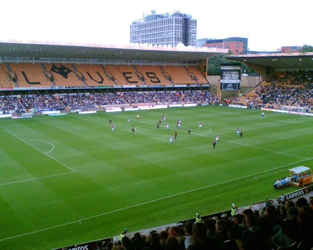
Molineux Stadium John Nickolls · CC BY-SA 2.0

Climate of South Staffordshire District
Best months for sightseeingBest months for sightseeing: June–August.
This month · November
A cold month
Day 9° · Night 3° · Rain 90 mm
- Hottest month
- July (day 20°)
- Coldest month
- February (night 1°)
- Wettest month
- December (91 mm)
- Driest month
- April (59 mm)
Bars: average monthly low and high temperature. Below: precipitation. Monthly averages for 1970–2000 at about 18 km resolution, adjusted for elevation. Highlighted months are mild and relatively dry. Source: WorldClim 2.1 (CC BY 4.0).
Show values as a table
| Month | Jan | Feb | Mar | Apr | May | Jun | Jul | Aug | Sep | Oct | Nov | Dec |
|---|---|---|---|---|---|---|---|---|---|---|---|---|
| Average high (°C) | 6° | 6° | 9° | 11° | 15° | 18° | 20° | 20° | 17° | 13° | 9° | 7° |
| Average low (°C) | 1° | 1° | 2° | 3° | 6° | 9° | 11° | 11° | 9° | 6° | 3° | 2° |
| Precipitation (mm) | 86 | 62 | 71 | 59 | 59 | 73 | 60 | 79 | 75 | 82 | 90 | 91 |
How to get to South Staffordshire District
The nearest airport is Birmingham Airport (BHX), 35 km to the southeast as the crow flies. The nearest large city is Wolverhampton, 6 km to the southeast.
Airports
- Birmingham Airport (BHX) Birmingham, West Midlands 35 kmsoutheast
- East Midlands Airport (EMA) Nottingham, Leicestershire 62 kmeast
- Manchester Airport (MAN) Manchester, Greater Manchester 81 kmnorth
Nearby large cities
- Wolverhampton Population: 263.7K 6 kmsoutheast
- Walsall Population: 172.1K 14 kmeast
- Dudley Population: 199.1K 15 kmsoutheast
- West Bromwich Population: 103.1K 17 kmsoutheast
- Telford Population: 155.6K 19 kmwest
Straight-line distances; road distances are longer. Airport data: OurAirports.
Day trips from South Staffordshire District
Within 100 km: 959 historic and cultural sites, 1,634 natural sites, 124 lakes, rivers and coasts.
0–25 km109 places
- Withymoor Island Island 17 kmSE
- Bromford Stop Island 18 kmSE
- Chasewater Lake 16 kmE
- Walton Hill Mountain 24 kmS
25–60 km662 places
- Horninglow island Island 43 kmNE
- Crescent Wood Island Island 37 kmSE
- The Island Island 55 kmSW
- Brown's Island Island 32 kmE
60–100 km1,946 places
- Alney Island Island 85 kmS
- Saint George's Island Island 94 kmN
- Glover's Island Island 61 kmS
- Barton Island Island 71 kmNE
Straight-line distances.
South Staffordshire District and similar cities
Side by side with cities of similar size in the same country: population, elevation and climate.
| Measure | South Staffordshire District | Chelmsford | Sutton Coldfield | Wakefield |
|---|---|---|---|---|
| Population | 111.2K | 111.5K | 109.9K | 109.8K |
| Elevation | 118 m | 33 m | 119 m | 50 m |
| Summer day (hottest month) | 20° | 22° | 21° | 21° |
| Winter night (coldest month) | 1° | 1° | 1° | 1° |
| Annual rainfall | 887 mm | 589 mm | 696 mm | 684 mm |
| Best months | Jun–Aug | Jun–Aug | Jun–Aug | Jun–Aug |
| Distance | — | 206 km | 25 km | 126 km |
Climate values are 1970–2000 monthly averages; straight-line distance.
Places in South Staffordshire District
29 placesCities & villages29
- Acton Trussell and Bednall · Village
- Bilbrook · Village
- Blymhill and Weston-under-Lizard · Village
- Bobbington · Village
- Brewood and Coven · Village
- Cheslyn Hay · Village
- Codsall · Village
- Coppenhall · Village
- Dunston · Village
- Enville · Village
- Essington · Village
- Featherstone · Village
- Great Wyrley · Village
- Hatherton · Village
- Hilton · Village
- Himley · Village
- Huntington · Village
- Kinver · Village
- Lapley, Stretton and Wheaton Aston · Village
- Lower Penn · Village
- Pattingham and Patshull · Village
- Penkridge · Village
- Perton · Village
- Saredon · Village
- Shareshill · Village
- Swindon · Village
- Teddesley Hay · Village
- Trysull and Seisdon · Village
- Wombourne · Village
Nearby attractions & nature
Everything nearby-
Molineux Stadium Landmark, Wolverhampton5 km SE
-
Tettenhall Wood Mountain, Wolverhampton4.3 km S
-
Wightwick Motte Historic site, Wolverhampton4.5 km S
-
Bushbury Hill Mountain, Wolverhampton4.8 km E
-
East Park Natural site, Wolverhampton7.4 km SE
-
White Oak Hill Mountain, Tong7.9 km NW
-
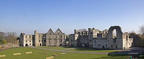 Dudley Castle Historic site, Dudley14 km SE
-
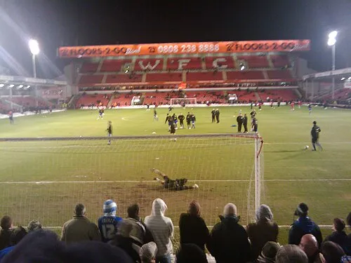 Bescot Stadium Landmark, Walsall14 km SE
Other cities and towns in Staffordshire
-
Codsall Town, Codsall1.7 km W
-
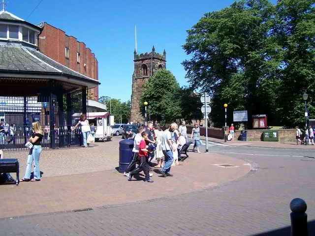 Cannock Town, Cannock Chase12 km NE
-
Cannock Chase Municipality, Staffordshire17 km NE
-
Featherstone Town, Featherstone6 km E
-
Stafford District Municipality, Staffordshire25 km N
-
Lichfield District Municipality, Staffordshire28 km E
Sources & licences
Data last updated: