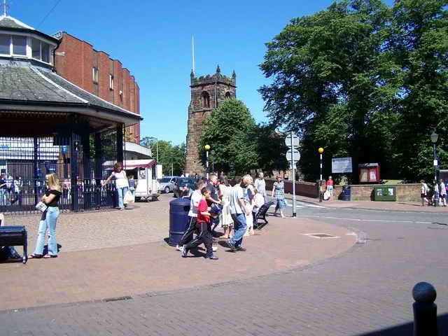
- Population
- 86,121
- 86.1K
- Elevation
- 154 m
- above sea level
- Local time
- UTC+00:00
- Europe/London · UTC+00:00
- Airports
- BHX Birmingham Airport33 km
- EMA East Midlands Airport50 km
About Cannock
Cannock is a town. Location: Cannock Chase, Staffordshire. Population: 86,121. Elevation: 154 m.
Cannock () is a town in the Cannock Chase district in the county Staffordshire, England. It had a population of 29,018. Cannock is not far from the towns Walsall, Burntwood, Stafford and Telford. The cities Lichfield and Wolverhampton are also nearby. Cannock lies to the north of the West Midlands conurbation on the M6, A34 and A5 roads and to the south of Hednesford and the Cannock Chase Area of Outstanding Natural Beauty. Cannock is served by a railway station on the Chase Line.
Source: Wikipedia · CC BY-SA 4.0
At a glance
- Area
- 9.2 km²
Source: Wikidata
Photos of Cannock
-

William Hook williamtm · CC0 -

Adam Evans UK · CC BY 3.0 -

Anthony Smith · CC BY-SA 2.0 -

Anonymous Unknown author · Public domain -

Geoff Pick · CC BY-SA 2.0


Travel notes for Cannock
From Wikivoyage
Cannock is the largest town within the Cannock Chase District in the county of Staffordshire in the West Midlands region of England.
Cannock lies to the north of the West Midlands conurbation on the M6, A34 and A5 roads, and to the south of Cannock Chase, an Area of Outstanding Natural Beauty (AONB). Cannock is served by a railway station on the Chase Line.
Get in+
By road:
Cannock is near the M6, M6 Toll, A5, and A460.
By train:
1 Cannock railway station. Cannock railway station is on the Chase Line operated by West Midlands Trains from Birmingham New Street to Rugeley. (updated Dec 2020)
Source: Wikivoyage · CC BY-SA 4.0 · abridged
Climate of Cannock
Best months for sightseeingBest months for sightseeing: June–August.
This month · November
A cold month
Day 9° · Night 3° · Rain 80 mm
- Hottest month
- July (day 20°)
- Coldest month
- February (night 0°)
- Wettest month
- November (80 mm)
- Driest month
- February (54 mm)
Bars: average monthly low and high temperature. Below: precipitation. Monthly averages for 1970–2000 at about 18 km resolution, adjusted for elevation. Highlighted months are mild and relatively dry. Source: WorldClim 2.1 (CC BY 4.0).
Show values as a table
| Month | Jan | Feb | Mar | Apr | May | Jun | Jul | Aug | Sep | Oct | Nov | Dec |
|---|---|---|---|---|---|---|---|---|---|---|---|---|
| Average high (°C) | 6° | 6° | 8° | 11° | 15° | 17° | 20° | 19° | 17° | 13° | 9° | 7° |
| Average low (°C) | 1° | 0° | 2° | 3° | 6° | 9° | 11° | 11° | 9° | 6° | 3° | 2° |
| Precipitation (mm) | 76 | 54 | 63 | 55 | 58 | 69 | 56 | 74 | 68 | 74 | 80 | 79 |
How to get to Cannock
The nearest airport is Birmingham Airport (BHX), 33 km to the southeast as the crow flies. The nearest large city is Walsall, 12 km to the south.
Airports
- Birmingham Airport (BHX) Birmingham, West Midlands 33 kmsoutheast
- East Midlands Airport (EMA) Nottingham, Leicestershire 50 kmeast
- Manchester Airport (MAN) Manchester, Greater Manchester 75 kmnorth
Nearby large cities
- Walsall Population: 172.1K 12 kmsouth
- Wolverhampton Population: 263.7K 13 kmsouthwest
- West Bromwich Population: 103.1K 19 kmsouth
- Sutton Coldfield Population: 109.9K 20 kmsoutheast
- Dudley Population: 199.1K 21 kmsouth
Straight-line distances; road distances are longer. Airport data: OurAirports.
Day trips from Cannock
Within 100 km: 897 historic and cultural sites, 1,424 natural sites, 124 lakes, rivers and coasts.
0–25 km89 places
- Brown's Island Island 21 kmE
- Withymoor Island Island 23 kmS
- Bromford Stop Island 20 kmS
- Chasewater Lake 6 kmSE
25–60 km597 places
- Horninglow island Island 31 kmNE
- Crescent Wood Island Island 34 kmSE
- Barton Island Island 59 kmNE
- Holme Nook Island 48 kmNE
60–100 km1,759 places
- Alney Island Island 93 kmS
- Newark Island Island 92 kmNE
- Saint George's Island Island 88 kmN
- Glover's Island Island 66 kmS
Straight-line distances.
Cannock and similar cities
Side by side with cities of similar size in the same country: population, elevation and climate.
| Measure | Cannock | Grimsby | South Shields | Londonderry |
|---|---|---|---|---|
| Population | 86.1K | 86.1K | 83.7K | 83.7K |
| Elevation | 154 m | 4 m | 12 m | 24 m |
| Summer day (hottest month) | 20° | 21° | 20° | 18° |
| Winter night (coldest month) | 0° | 1° | 2° | 3° |
| Annual rainfall | 806 mm | 626 mm | 673 mm | 1,561 mm |
| Best months | Jun–Aug | Jun–Sep | Jun–Sep | Jun–Aug |
| Distance | — | 163 km | 260 km | 432 km |
Climate values are 1970–2000 monthly averages; straight-line distance.
Nearby attractions & nature
Everything nearby-
Littleton Colliery Mountain, Huntington3 km N
-
Wimblebury Hill Mountain, Cannock Chase4.6 km E
-
Hednesford Hills Mountain, Hednesford4.2 km NE
-
Badger's Hills Mountain, Hednesford4.3 km N
-
Pye Green BT Tower Landmark, Hednesford4.3 km N
-
Rawnsley Hills Mountain, Brindley Heath5.4 km NE
-
Cannock Castle Ring Historic site, Cannock Wood6.9 km E
-
Radmore Abbey Historic site, Cannock Wood6.4 km E
Sources & licences
Data last updated: · 2 independent sources