- Elevation
- 5 m
- above sea level
- Local time
- UTC+00:00
- Europe/London · UTC+00:00
- Airports
- MME Teesside International Airport15 km
- NCL Newcastle International Airport57 km
About Haverton Hill
Haverton Hill is a village. Location: Billingham, Stockton-on-Tees. Elevation: 5 m.
Haverton Hill is an area within the borough of Stockton-on-Tees and ceremonial county of County Durham, England. Once considered a part of Billingham, Haverton Hill was once a thriving industrial community which has suffered significant depopulation since the 1960s as a result of pollution. It is situated to the north of the River Tees, near Billingham. The A1046 is the main road linking to Stockton and the A19 in the west and Port Clarence and the A178 in the east.
Source: Wikipedia · CC BY-SA 4.0
Photos of Haverton Hill
-
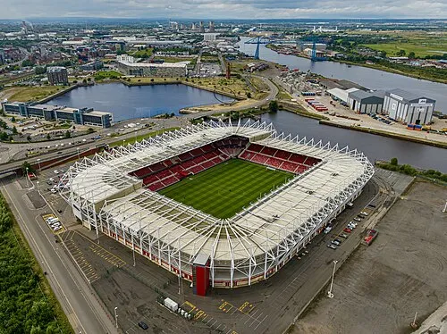
Riverside Stadium Arne Müseler · CC BY-SA 3.0 de -
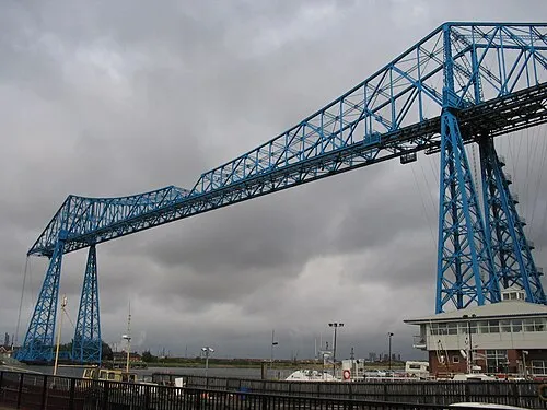
Middlesbrough Transporter Bridge Boerkevitz at Dutch Wikipedia · CC BY-SA 3.0


Climate of Haverton Hill
Best months for sightseeingBest months for sightseeing: June–August.
This month · November
A cold month
Day 10° · Night 4° · Rain 71 mm
- Hottest month
- July (day 20°)
- Coldest month
- January (night 1°)
- Wettest month
- November (71 mm)
- Driest month
- April (44 mm)
Bars: average monthly low and high temperature. Below: precipitation. Monthly averages for 1970–2000 at about 18 km resolution, adjusted for elevation. Highlighted months are mild and relatively dry. Source: WorldClim 2.1 (CC BY 4.0).
Show values as a table
| Month | Jan | Feb | Mar | Apr | May | Jun | Jul | Aug | Sep | Oct | Nov | Dec |
|---|---|---|---|---|---|---|---|---|---|---|---|---|
| Average high (°C) | 7° | 8° | 10° | 12° | 15° | 18° | 20° | 20° | 17° | 14° | 10° | 8° |
| Average low (°C) | 1° | 2° | 3° | 4° | 6° | 9° | 11° | 11° | 9° | 7° | 4° | 2° |
| Precipitation (mm) | 68 | 45 | 55 | 44 | 49 | 54 | 54 | 64 | 64 | 70 | 71 | 68 |
How to get to Haverton Hill
The nearest airport is Teesside International Airport (MME), 15 km to the southwest as the crow flies. For international flights: Newcastle International Airport (NCL) (57 km). The nearest large city is Middlesbrough, 3 km to the south.
Airports
- Teesside International Airport (MME) Darlington, Durham 15 kmsouthwest
- Newcastle International Airport (NCL) Newcastle upon Tyne, Tyne and Wear 57 kmnorthwest
- Leeds Bradford Airport (LBA) Leeds, West Yorkshire 86 kmsouth
Nearby large cities
- Middlesbrough Population: 142.7K 3 kmsouth
- Sunderland Population: 170.1K 35 kmnorth
- Newcastle upon Tyne Population: 300.1K 48 kmnorthwest
- York Population: 156.1K 72 kmsouth
- Leeds Population: 536.3K 91 kmsouth
Straight-line distances; road distances are longer. Airport data: OurAirports.
Day trips from Haverton Hill
Within 100 km: 587 historic and cultural sites, 768 natural sites, 160 lakes, rivers and coasts.
0–25 km87 places
- Seaton Carew Beach Beach 8 kmNE
- Redcar Beach Beach 11 kmE
- Roseberry Topping Mountain 14 kmSE
- Cleveland Hills Mountain 23 kmSE
25–60 km401 places
- Whitby Beach Beach 41 kmE
- The Island Island 48 kmSW
- Saint Mary’s Island Island 54 kmN
- The Island Island 57 kmS
60–100 km1,027 places
- Great Britain Island 83 kmSW
- Longhoughton Beach Beach 96 kmN
- North Beach Beach 89 kmSE
- Fraisethorpe Beach Beach 91 kmSE
Straight-line distances.
Nearby attractions & nature
Everything nearby-
Middlesbrough Transporter Bridge Landmark, Billingham1.9 km SE
-
Riverside Stadium Landmark, Middlesbrough2.9 km SE
-
Cowpen Bewley Low Grange Farm Landmark, Billingham3.2 km NW
-
Stockton Castle Historic site, Stockton-on-Tees5.9 km SW
-
Stockton-on-Tees Mediumwave Transmitter Landmark, Grindon6.8 km W
-
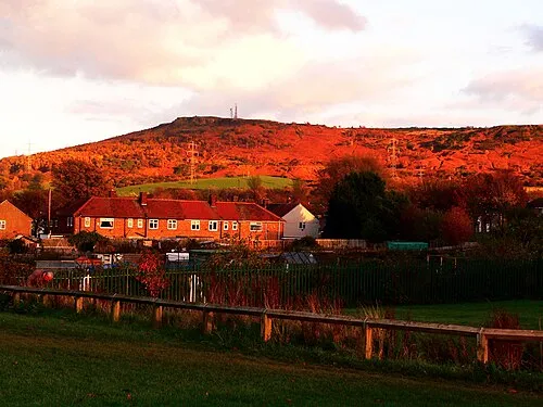 Eston Nab Mountain, Guisborough9.2 km SE
Sources & licences
Data last updated: · 2 independent sources