Church Aston
Located in Telford and Wrekin, England Coordinates: 52°45′28″ N 2°24′54″ W
- Elevation
- 68 m
- above sea level
- Local time
- UTC+00:00
- Europe/London · UTC+00:00
- Places inside
- 4
- listed under Church Aston
- Airports
- BHX Birmingham Airport56 km
- MAN Manchester Airport66 km
About Church Aston
Church Aston is a municipality. Location: Telford and Wrekin, England. Elevation: 68 m. The best months to visit are June–August. The nearest airport is Birmingham Airport (56 km). Nearby sights include Lilleshall Hill and Chetwynd Park.
Climate of Church Aston
Best months for sightseeingBest months for sightseeing: June–August.
This month · November
A cold month
Day 10° · Night 3° · Rain 71 mm
- Hottest month
- July (day 21°)
- Coldest month
- February (night 1°)
- Wettest month
- November (71 mm)
- Driest month
- February (47 mm)
Bars: average monthly low and high temperature. Below: precipitation. Monthly averages for 1970–2000 at about 18 km resolution, adjusted for elevation. Highlighted months are mild and relatively dry. Source: WorldClim 2.1 (CC BY 4.0).
Show values as a table
| Month | Jan | Feb | Mar | Apr | May | Jun | Jul | Aug | Sep | Oct | Nov | Dec |
|---|---|---|---|---|---|---|---|---|---|---|---|---|
| Average high (°C) | 7° | 7° | 9° | 12° | 16° | 19° | 21° | 21° | 17° | 14° | 10° | 8° |
| Average low (°C) | 1° | 1° | 2° | 3° | 6° | 9° | 11° | 11° | 9° | 6° | 3° | 2° |
| Precipitation (mm) | 66 | 47 | 57 | 49 | 52 | 63 | 48 | 69 | 61 | 62 | 71 | 71 |
How to get to Church Aston
The nearest airport is Birmingham Airport (BHX), 56 km to the southeast as the crow flies. The nearest large city is Telford, 9 km to the south.
Airports
- Birmingham Airport (BHX) Birmingham, West Midlands 56 kmsoutheast
- Manchester Airport (MAN) Manchester, Greater Manchester 66 kmnorth
- Liverpool John Lennon Airport (LPL) Liverpool 71 kmnorthwest
Nearby large cities
- Telford Population: 155.6K 9 kmsouth
- Wolverhampton Population: 263.7K 28 kmsoutheast
- Newcastle-under-Lyme Population: 127.7K 30 kmnortheast
- Stoke-on-Trent Population: 258.4K 31 kmnortheast
- Walsall Population: 172.1K 35 kmsoutheast
Straight-line distances; road distances are longer. Airport data: OurAirports.
Day trips from Church Aston
Within 100 km: 927 historic and cultural sites, 1,951 natural sites, 162 lakes, rivers and coasts.
0–25 km104 places
- Hawkstone lake Lake 19 kmNW
- Reservoir Lake 25 kmSW
- The Wrekin Mountain 13 kmSW
- The Wrekin Mountain 13 kmSW
25–60 km838 places
- Horninglow island Island 54 kmE
- Crescent Wood Island Island 59 kmSE
- The Island Island 59 kmS
- Brown's Island Island 47 kmE
60–100 km2,098 places
- Thurstaston Beach Beach 81 kmNW
- Hilbre Island Island 89 kmNW
- Saint George's Island Island 80 kmN
- The Island Island 99 kmN
Straight-line distances.
Places in Church Aston
4 placesCities & villages4
- Brockton · Village
- Church Aston · Neighbourhood
- Longford · Village
- Vauxhall · Neighbourhood
Nearby attractions & nature
Everything nearby-
Lilleshall Hill Mountain, Lilleshall and Donnington2.4 km S
-
Chetwynd Park Mountain, Chetwynd3.6 km NE
-
Puleston Hill Mountain, Chetwynd5.1 km N
-
Weston Jones Historic site, Norbury7.9 km NE
-
Redhill Mountain, Lilleshall and Donnington7 km S
-
Ketley Bank Mountain, Oakengates8.2 km S
-
New Bucks Head Landmark, Wellington8.9 km SW
-
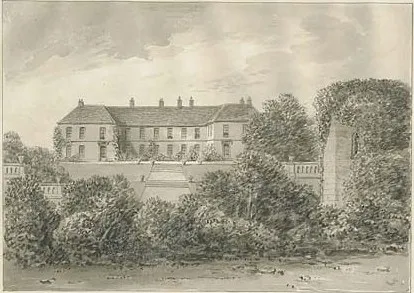 Eccleshall Castle Historic site, Eccleshall16 km NE
Other cities and towns in Telford and Wrekin
-
 Telford City, Lawley and Overdale9.3 km S
-
Lilleshall and Donnington Municipality, Telford and Wrekin3.8 km S
-
Chetwynd Municipality, Telford and Wrekin4.8 km N
-
Chetwynd Aston and Woodcote Municipality, Telford and Wrekin4.5 km E
-
Tibberton and Cherrington Municipality, Telford and Wrekin4.5 km W
-
Preston upon the Weald Moors Municipality, Telford and Wrekin5 km SW
Sources & licences
Data last updated: