- Elevation
- 25 m
- above sea level
- Local time
- UTC+00:00
- Europe/London · UTC+00:00
- Airports
- LCY London City Airport21 km
- SEN London Southend Airport25 km
About Orsett Heath
Orsett Heath is a village. Location: Thurrock, England. Elevation: 25 m.
Orsett Heath is a village in the unitary authority area of Thurrock, in the ceremonial county of Essex, England. It is located about twenty miles away from London. Nearby settlements include the towns of Tilbury and Grays and the villages of Orsett and Chadwell St Mary. For transport there is the A13 road, the A1089 road and the A1013 road nearby. The nearest railway station is Tilbury Town. At one time, Orsett Heath was probably part of a large swathe of heathland interspaced with woodland.
Read more on Wikipedia Text: Wikipedia contributors · CC BY-SA 4.0 · shortened
In comparison
- Nearest larger town: Chadwell St Mary, 1 km S
- 12 sights and natural places within 10 km Orsett, 380kV Thames Crossing, Tower South
Climate of Orsett Heath
Best months for sightseeingBest months for sightseeing: June–August.
Bars: average monthly low and high temperature. Below: precipitation. Monthly averages for 1970–2000 at about 18 km resolution, adjusted for elevation. Highlighted months are mild and relatively dry. Source: WorldClim 2.1 (CC BY 4.0).
Show values as a table
| Month | Jan | Feb | Mar | Apr | May | Jun | Jul | Aug | Sep | Oct | Nov | Dec |
|---|---|---|---|---|---|---|---|---|---|---|---|---|
| Average high (°C) | 7° | 8° | 10° | 13° | 16° | 20° | 22° | 22° | 19° | 15° | 10° | 8° |
| Average low (°C) | 2° | 2° | 3° | 4° | 7° | 10° | 12° | 12° | 10° | 7° | 4° | 3° |
| Precipitation (mm) | 64 | 39 | 47 | 43 | 44 | 51 | 41 | 48 | 57 | 59 | 64 | 61 |
Airports nearest to Orsett Heath
- London City Airport (LCY) London 21 km
- London Southend Airport (SEN) Southend-on-Sea, Essex 25 km
- London Stansted Airport (STN) London, Essex 44 km
Straight-line distance; airports with scheduled flights only. Source: OurAirports (public domain).
Nearby attractions & nature
Everything nearby-
Orsett Historic site, Thurrock2.4 km N
-
380kV Thames Crossing, Tower North Landmark, Thurrock5.8 km SW
-
380kV Thames Crossing, Tower South Landmark, Swanscombe and Greenhithe5.2 km SW
-
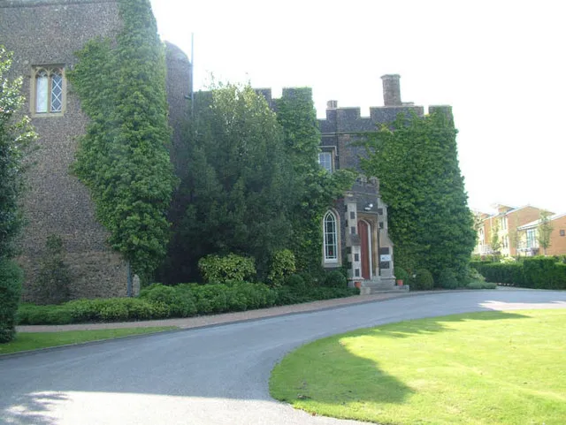 Stone Castle Historic site, Stone8 km SW
-
Sandy Lane Pit Mountain, Thurrock8.2 km W
-
Dartford Bridge Landmark, Thurrock7.7 km SW
Sources & licences
Data last updated: · 2 independent sources