St Johns
Located in Warwick, Warwick District Coordinates: 52°17′01″ N 1°34′50″ W
- Local time
- UTC+00:00
- Europe/London · UTC+00:00
- Elevation
- 53 m
- above sea level
About St Johns
St Johns is a museum. Location: Warwick, Warwick District.
In comparison
- 14 sights and natural places within 10 km Warwick Castle, River Leam
Airports nearest to St Johns
- Birmingham Airport (BHX) Birmingham, West Midlands 22 km
- East Midlands Airport (EMA) Nottingham, Leicestershire 63 km
- London Luton Airport (LTN) Luton, Luton 95 km
Straight-line distance; airports with scheduled flights only. Source: OurAirports (public domain).
Nearby attractions & nature
Everything nearby-
 Warwick Castle Historic site, Warwick0.5 km SW
-
River Leam River, England2.1 km E
-
Fulbrook Castle Historic site, Fulbrook5.6 km SW
-
Stoneleigh Abbey Historic site, Stoneleigh6.9 km NE
-
 Coventry Cathedral Attraction, Coventry15 km N
-
Kenilworth Castle Historic site, Kenilworth7.1 km N
-
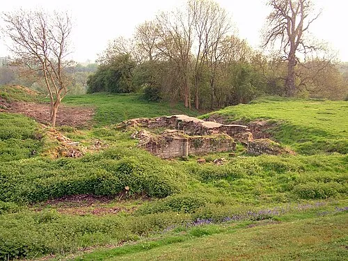 Baginton Castle Historic site, Baginton11 km NE
-
Pinley Priory Historic site, Rowington7.4 km W
Nearest towns and villages
-
Warwick City, Warwick District0.2 km W
-
Bridge End Neighbourhood, Warwick0.6 km S
-
Cliff Hill Neighbourhood, Warwick0.7 km N
-
Royal Leamington Spa Town, Royal Leamington Spa4.1 km E
Sources & licences
Data last updated: