Blisworth
Located in South Northamptonshire District, West Northamptonshire Coordinates: 52°10′21″ N 0°56′19″ W
- Elevation
- 111 m
- above sea level
- Local time
- UTC+00:00
- Europe/London · UTC+00:00
- Places inside
- 1
- listed under Blisworth
- Airports
- LTN London Luton Airport51 km
- BHX Birmingham Airport63 km
About Blisworth
Blisworth is a village. Location: South Northamptonshire District, West Northamptonshire. Elevation: 111 m. The best months to visit are June–August. The nearest airport is London Luton Airport (51 km). Nearby sights include Sewardsley Priory and Bury Mount.
Photos of Blisworth
-
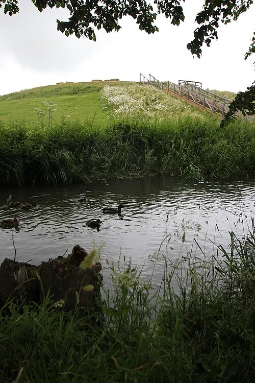
Bury Mount Cj1340 · CC BY-SA 3.0 -
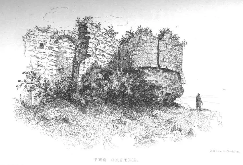
Northampton Castle C. H. Hartshorne · Public domain


Climate of Blisworth
Best months for sightseeingBest months for sightseeing: June–August.
This month · November
A cold month
Day 10° · Night 3° · Rain 55 mm
- Hottest month
- July (day 22°)
- Coldest month
- February (night 1°)
- Wettest month
- August (58 mm)
- Driest month
- February (38 mm)
Bars: average monthly low and high temperature. Below: precipitation. Monthly averages for 1970–2000 at about 18 km resolution, adjusted for elevation. Highlighted months are mild and relatively dry. Source: WorldClim 2.1 (CC BY 4.0).
Show values as a table
| Month | Jan | Feb | Mar | Apr | May | Jun | Jul | Aug | Sep | Oct | Nov | Dec |
|---|---|---|---|---|---|---|---|---|---|---|---|---|
| Average high (°C) | 7° | 7° | 10° | 12° | 16° | 19° | 22° | 21° | 18° | 14° | 10° | 7° |
| Average low (°C) | 1° | 1° | 2° | 3° | 6° | 9° | 11° | 11° | 9° | 6° | 3° | 2° |
| Precipitation (mm) | 55 | 38 | 48 | 45 | 49 | 55 | 51 | 58 | 55 | 53 | 55 | 57 |
How to get to Blisworth
The nearest airport is London Luton Airport (LTN), 51 km to the southeast as the crow flies. The nearest large city is Northampton, 9 km to the northeast.
Airports
- London Luton Airport (LTN) Luton, Luton 51 kmsoutheast
- Birmingham Airport (BHX) Birmingham, West Midlands 63 kmnorthwest
- East Midlands Airport (EMA) Nottingham, Leicestershire 78 kmnorth
Nearby large cities
- Northampton Population: 245.9K 9 kmnortheast
- Milton Keynes Population: 256.4K 19 kmsoutheast
- Bedford Population: 106.9K 33 kmeast
- Coventry Population: 345.3K 47 kmnorthwest
- Luton Population: 225.3K 48 kmsoutheast
Straight-line distances; road distances are longer. Airport data: OurAirports.
Day trips from Blisworth
Within 100 km: 902 historic and cultural sites, 549 natural sites, 260 lakes, rivers and coasts.
0–25 km85 places
- Heron Island Island 24 kmE
- Millholme Island Island 22 kmE
- Monkey Island Island 17 kmS
- Tongwell Lake Lake 18 kmSE
25–60 km448 places
- Rose Isle Island 55 kmS
- Lock Wood Island Island 59 kmS
- Fiddler's Elbow Island 55 kmS
- Isle of Rhea Island 50 kmSW
60–100 km1,178 places
- White Hart Lane Landmark 87 kmSE
- The Lynch Island 76 kmS
- Holm Island Island 87 kmS
- Sunbury Court Island 93 kmSE
Straight-line distances.
Places in Blisworth
1 placeBar: population relative to the most populous place in this list.
Nearby attractions & nature
Everything nearby-
Sewardsley Priory Historic site, Easton Neston2.6 km SW
-
Bury Mount Historic site, Towcester5.5 km SW
-
Wootton Historic site, Wootton4.4 km NE
-
Northampton Castle Historic site, Northampton7.7 km N
-
Alderton Ringwork Historic site, Alderton6.4 km S
-
Alderton Motte Historic site, Alderton6.4 km S
Sources & licences
Data last updated: