Chichester District
Located in West Sussex, England Coordinates: 50°55′00″ N 0°47′00″ W
- Population
- 118,175
- 118.2K
- Elevation
- 115 m
- above sea level
- Local time
- UTC+00:00
- Europe/London · UTC+00:00
- Places inside
- 68
- listed under Chichester District
- Airports
- SOU Southampton Airport40 km
- LGW London Gatwick Airport49 km
About Chichester District
Chichester District is a municipality. Location: West Sussex, England. Population: 118,175. Elevation: 115 m. The best months to visit are June–August. The nearest airport is Southampton Airport (40 km). Nearby sights include Butser Hill and Tote Copse Castle.
Photos of Chichester District
-
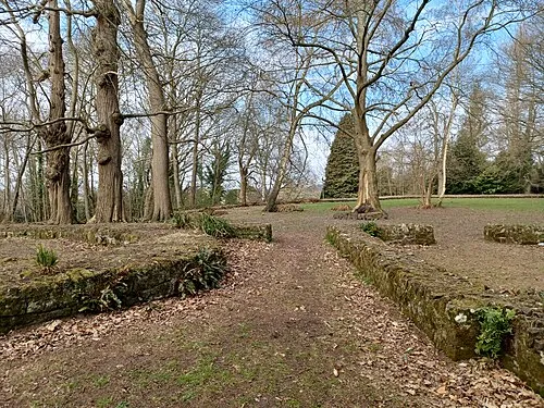
Midhurst Castle Simon Burchell · CC BY-SA 4.0 -
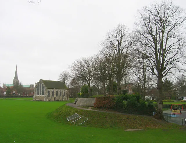
Chichester Castle Simon Carey · CC BY-SA 2.0


Climate of Chichester District
Best months for sightseeingBest months for sightseeing: June–August.
This month · November
A cold month
Day 10° · Night 4° · Rain 96 mm
- Hottest month
- July (day 21°)
- Coldest month
- February (night 1°)
- Wettest month
- January (99 mm)
- Driest month
- July (52 mm)
Bars: average monthly low and high temperature. Below: precipitation. Monthly averages for 1970–2000 at about 18 km resolution, adjusted for elevation. Highlighted months are mild and relatively dry. Source: WorldClim 2.1 (CC BY 4.0).
Show values as a table
| Month | Jan | Feb | Mar | Apr | May | Jun | Jul | Aug | Sep | Oct | Nov | Dec |
|---|---|---|---|---|---|---|---|---|---|---|---|---|
| Average high (°C) | 7° | 7° | 10° | 12° | 16° | 19° | 21° | 21° | 18° | 14° | 10° | 8° |
| Average low (°C) | 2° | 1° | 3° | 4° | 7° | 10° | 12° | 12° | 10° | 7° | 4° | 3° |
| Precipitation (mm) | 99 | 63 | 75 | 58 | 53 | 57 | 52 | 61 | 79 | 92 | 96 | 97 |
How to get to Chichester District
The nearest airport is Southampton Airport (SOU), 40 km to the west as the crow flies. For international flights: London Gatwick Airport (LGW) (49 km). The nearest large city is Portsmouth, 25 km to the southwest.
Airports
- Southampton Airport (SOU) Southampton 40 kmwest
- London Gatwick Airport (LGW) London 49 kmnortheast
- London Heathrow Airport (LHR) London 66 kmnorth
Nearby large cities
- Portsmouth Population: 208.1K 25 kmsouthwest
- Worthing Population: 113.9K 31 kmeast
- Southampton Population: 269.8K 44 kmwest
- Basingstoke Population: 107.6K 44 kmnorthwest
- Brighton Population: 283.9K 46 kmeast
Straight-line distances; road distances are longer. Airport data: OurAirports.
Day trips from Chichester District
Within 100 km: 615 historic and cultural sites, 649 natural sites, 254 lakes, rivers and coasts.
0–25 km136 places
- Portsea Island Natural site 24 kmSW
- Climping Beach Beach 20 kmSE
- Pagham Beach Beach 17 kmS
- Whale Island Island 25 kmSW
25–60 km402 places
- Isle of Wight Island 44 kmSW
- St Nicholas Church Shoreham Attraction 36 kmE
- The Marlipins Museum Museum 37 kmE
- Calshot Beach Beach 39 kmW
60–100 km980 places
- White Hart Lane Landmark 91 kmNE
- Brownsea Island Island 87 kmW
- Avon Beach Beach 70 kmW
- Studland Beach Beach 87 kmW
Straight-line distances.
Chichester District and similar cities
Side by side with cities of similar size in the same country: population, elevation and climate.
| Measure | Chichester District | Rotherham | Cheltenham | Burton-on-Trent |
|---|---|---|---|---|
| Population | 118.2K | 117.6K | 118.8K | 122.2K |
| Elevation | 115 m | 41 m | 60 m | 49 m |
| Summer day (hottest month) | 21° | 22° | 22° | 21° |
| Winter night (coldest month) | 1° | 1° | 1° | 1° |
| Annual rainfall | 882 mm | 817 mm | 800 mm | 678 mm |
| Best months | Jun–Aug | Jun–Aug | Jun–Aug | Jun–Aug |
| Distance | — | 282 km | 142 km | 219 km |
Climate values are 1970–2000 monthly averages; straight-line distance.
Places in Chichester District
68 placesBar: population relative to the most populous place in this list.
Cities & villages59
- Appledram · Village
- Barlavington · Village
- Bepton · Village
- Bignor · Village
- Birdham · Village
- Bosham · Village
- Boxgrove · Village
- Bury · Village
- Chichester · Village
- Chidham and Hambrook · Village
- Cocking · Village
- Compton · Village
- Donnington · Village
- Duncton · Village
- Earnley · Village
- Eartham · Village
- Easebourne · Village
- East Dean · Village
- East Lavington · Village
- East Wittering · Village
- Ebernoe · Village
- Elsted and Treyford · Village
- Fernhurst · Village
- Fishbourne · Village
- Fittleworth · Village
- Funtington · Village
- Graffham · Village
- Harting · Village
- Heyshott · Village
- Hunston · Village
- Kirdford · Village
- Lavant · Village
- Linch · Village
- Linchmere · Village
- Lodsworth · Village
- Loxwood · Village
- Lurgashall · Village
- Marden · Village
- Midhurst · Village
- Milland · Village
- Northchapel · Village
- North Mundham · Village
- Oving · Village
- Petworth · Village
- Plaistow · Village
- Rogate · Village
- Selsey · Village
- Sidlesham · Village
- Singleton · Village
- Southbourne · Village
- Stedham with Iping · Village
- Stopham · Village
- Stoughton · Village
- Sutton · Village
- Tangmere · Village
- Tillington · Village
- Trotton with Chithurst · Village
- Upwaltham · Village
- Westbourne · Village
Nearby attractions & nature
Everything nearby-
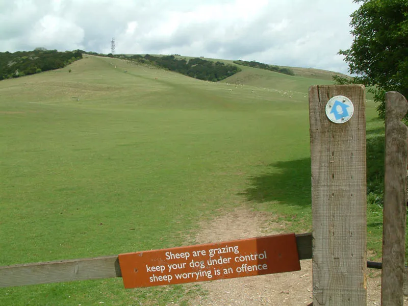 Butser Hill Mountain, Buriton15 km NW
-
Tote Copse Castle Historic site, Aldingbourne11 km SE
-
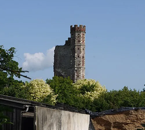 Warblington Castle Historic site, Havant District15 km SW
-
Nore Hill Mountain, Slindon10 km E
-
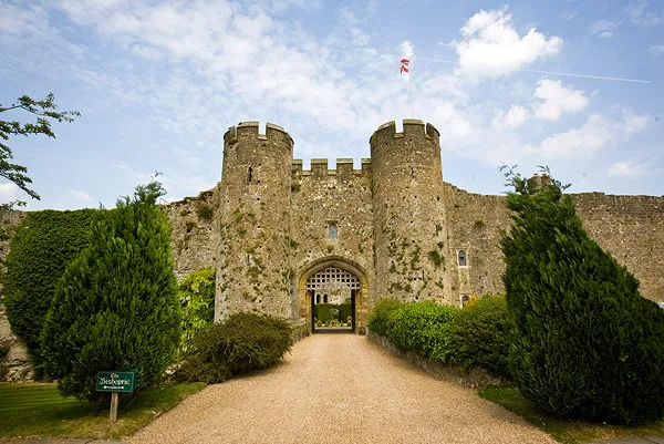 Amberley Castle Historic site, Amberley17 km E
-
Motleys Castle Historic site, Rowlands Castle13 km W
-
Clanfield Earthwork Historic site, Clanfield14 km W
-
Oakham Hill Mountain, Buriton12 km NW
Other cities and towns in West Sussex
-
Arun District Municipality, West Sussex18 km SE
-
Midhurst Town, Midhurst8.2 km N
-
Horsham District Municipality, West Sussex30 km E
-
Worthing District Municipality, West Sussex29 km E
-
Adur District Municipality, West Sussex33 km E
-
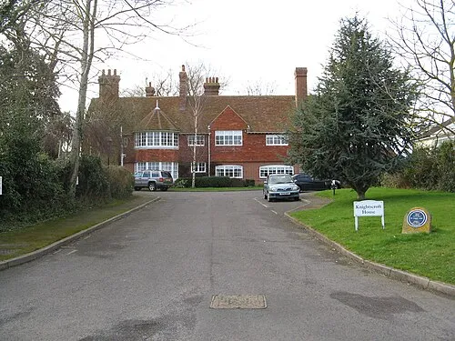 Rustington Town, Rustington23 km SE
Sources & licences
Data last updated: