
- Elevation
- 69 m
- above sea level
- Local time
- UTC+00:00
- Europe/London · UTC+00:00
- Airports
- LGW London Gatwick Airport3 km
- LHR London Heathrow Airport42 km
About Tinsley Green
Tinsley Green is a village. Location: Crawley District, West Sussex. Elevation: 69 m.
Tinsley Green is an area in the Borough of Crawley, one of seven local government districts in the English county of West Sussex. Originally a hamlet in the parish of Worth, it was absorbed by the New Town of Crawley in the 1940s and became part of the Pound Hill neighbourhood. As well as houses, farms and woodland, it became the site of the 1930s aerodrome at Gatwick—now London Gatwick Airport. The airport's first railway station was briefly known as Tinsley Green.
Source: Wikipedia · CC BY-SA 4.0
Photos of Tinsley Green
-

User:Hassocks5489 · CC0 -

User:Hassocks5489 · CC0 -

David Howard · CC BY-SA 2.0 -

James Kevin McMahon · CC BY-SA 4.0 -
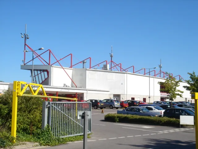
Broadfield Stadium Hassocks5489 at English Wikipedia · Public domain


Climate of Tinsley Green
Best months for sightseeingBest months for sightseeing: June–August.
This month · November
A cold month
Day 10° · Night 4° · Rain 85 mm
- Hottest month
- July (day 21°)
- Coldest month
- February (night 1°)
- Wettest month
- January (88 mm)
- Driest month
- July (43 mm)
Bars: average monthly low and high temperature. Below: precipitation. Monthly averages for 1970–2000 at about 18 km resolution, adjusted for elevation. Highlighted months are mild and relatively dry. Source: WorldClim 2.1 (CC BY 4.0).
Show values as a table
| Month | Jan | Feb | Mar | Apr | May | Jun | Jul | Aug | Sep | Oct | Nov | Dec |
|---|---|---|---|---|---|---|---|---|---|---|---|---|
| Average high (°C) | 7° | 7° | 10° | 12° | 16° | 19° | 21° | 21° | 18° | 15° | 10° | 8° |
| Average low (°C) | 1° | 1° | 3° | 4° | 7° | 10° | 12° | 12° | 10° | 7° | 4° | 2° |
| Precipitation (mm) | 88 | 56 | 61 | 52 | 50 | 58 | 43 | 54 | 67 | 81 | 85 | 87 |
How to get to Tinsley Green
The nearest airport is London Gatwick Airport (LGW), 3 km to the west as the crow flies. The nearest large city is Crawley, 4 km to the southwest.
Airports
- London Gatwick Airport (LGW) London 3 kmwest
- London Heathrow Airport (LHR) London 42 kmnorthwest
- London City Airport (LCY) London 43 kmnorth
Nearby large cities
- Crawley Population: 124K 4 kmsouthwest
- Sutton Population: 187.6K 23 kmnorth
- Croydon Population: 173.3K 27 kmnorth
- Woking Population: 103.9K 35 kmnorthwest
- Brighton Population: 283.9K 35 kmsouth
Straight-line distances; road distances are longer. Airport data: OurAirports.
Day trips from Tinsley Green
Within 100 km: 732 historic and cultural sites, 595 natural sites, 292 lakes, rivers and coasts.
0–25 km102 places
- Hawk Island Island 21 kmSE
- Sixteen Acre Island Island 19 kmE
- Two Bridges Island Island 19 kmE
- Ardingly Reservoir Lake 11 kmS
25–60 km858 places
- White Hart Lane Landmark 51 kmN
- Spotlites @ Kings Theatre Attraction 54 kmNE
- St Nicholas Church Shoreham Attraction 35 kmS
- The Marlipins Museum Museum 36 kmS
60–100 km659 places
- Portsea Island Natural site 75 kmSW
- Isle of Wight Island 96 kmSW
- Isle of Sheppey Island 74 kmNE
- Camber Sands Beach 70 kmE
Straight-line distances.
Nearby attractions & nature
Everything nearby-
Thunderfield Castle Historic site, Horley2.5 km N
-
Broadfield Stadium Landmark, Crawley District6.1 km SW
-
Hedgecourt Lake Lake, Felbridge5.7 km E
-
Gay House Hill Mountain, Outwood6.5 km NE
-
Duxhurst Mediumwave Transmitter Landmark, Salfords and Sidlow6.7 km NW
-
Selsfield Common Mountain, West Hoathly7.5 km SE
Other cities and towns in Crawley District
-
Shipley Bridge Village, Crawley District0.7 km NE
-
 Tilgate Village, Crawley District5.3 km SW
-
Burleys Wood Neighbourhood, Crawley District2.7 km S
-
Lowfield Heath Village, Crawley District2.8 km W
-
County Oak Neighbourhood, Crawley District3 km W
-
Worth Village, Crawley District3.6 km S
Sources & licences
Data last updated: · 2 independent sources