Marlborough Castle
Located in Marlborough, Wiltshire Coordinates: 51°24′58″ N 1°44′14″ W
- Local time
- UTC+00:00
- Europe/London · UTC+00:00
- Elevation
- 131 m
- above sea level
- Airports
- SOU Southampton Airport58 km
- BRS Bristol Airport68 km
About Marlborough Castle
Marlborough Castle is a historic site. Location: Marlborough, Wiltshire.
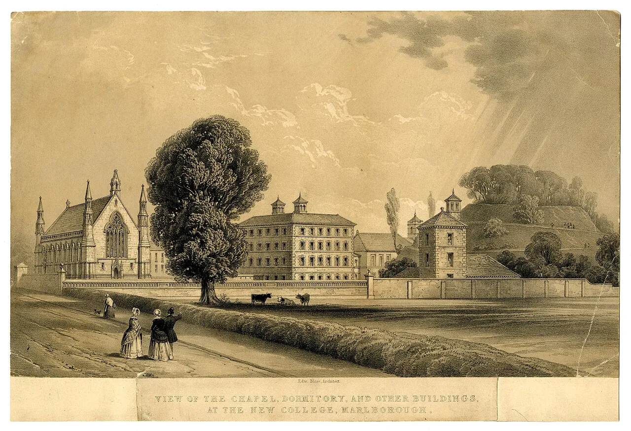
Marlborough Castle, locally known and recorded in historical documents as The Mound, was an 11th-century royal castle located in the civil parish of Marlborough. It is a market town in the English county of Wiltshire, on the Old Bath Road, the former main road from London to Bath (grid reference SU18376866). The barrow on which the fortification was built, perhaps the "barrow of Maerla", seems to be a prehistoric earthwork which formed the motte of the Norman Marlborough Castle.
Source: Wikipedia · CC BY-SA 4.0
At a glance
- Built
- 1067
Source: Wikidata
Climate of Marlborough Castle
Best months for sightseeingBest months for sightseeing: June–August.
This month · November
A cold month
Day 10° · Night 4° · Rain 74 mm
- Hottest month
- July (day 21°)
- Coldest month
- February (night 1°)
- Wettest month
- December (80 mm)
- Driest month
- April (47 mm)
Bars: average monthly low and high temperature. Below: precipitation. Monthly averages for 1970–2000 at about 18 km resolution, adjusted for elevation. Highlighted months are mild and relatively dry. Source: WorldClim 2.1 (CC BY 4.0).
Show values as a table
| Month | Jan | Feb | Mar | Apr | May | Jun | Jul | Aug | Sep | Oct | Nov | Dec |
|---|---|---|---|---|---|---|---|---|---|---|---|---|
| Average high (°C) | 7° | 7° | 9° | 12° | 16° | 19° | 21° | 21° | 18° | 14° | 10° | 8° |
| Average low (°C) | 2° | 1° | 3° | 4° | 7° | 10° | 12° | 12° | 10° | 7° | 4° | 3° |
| Precipitation (mm) | 77 | 53 | 60 | 47 | 53 | 58 | 47 | 58 | 67 | 69 | 74 | 80 |
How to get to Marlborough Castle
The nearest airport is Southampton Airport (SOU), 58 km to the southeast as the crow flies. For international flights: Bristol Airport (BRS) (68 km). The nearest large city is Swindon, 16 km to the north.
Airports
- Southampton Airport (SOU) Southampton 58 kmsoutheast
- Bristol Airport (BRS) Bristol 68 kmwest
- Bournemouth Airport (BOH) Bournemouth 71 kmsouth
Nearby large cities
- Swindon Population: 201.7K 16 kmnorth
- Bath Population: 101.6K 44 kmwest
- Basingstoke Population: 107.6K 48 kmeast
- Oxford Population: 162.1K 50 kmnortheast
- Reading Population: 318K 53 kmeast
Straight-line distances; road distances are longer. Airport data: OurAirports.
Day trips from Marlborough Castle
Within 100 km: 648 historic and cultural sites, 1,048 natural sites, 280 lakes, rivers and coasts.
0–25 km73 places
- Windmill Hill Mountain 10 kmW
- Whitehorse Hill Mountain 21 kmNE
- Lambourn Downs Mountain 19 kmNE
- Berkshire Downs Mountain 19 kmNE
25–60 km419 places
- The Lynch Island 59 kmE
- Andersey Island Island 42 kmNE
- Harnham Water Meadows Island 39 kmS
- Rose Isle Island 48 kmNE
60–100 km1,484 places
- Portsea Island Natural site 83 kmSE
- Isle of Wight Island 88 kmS
- Brownsea Island Island 82 kmS
- Avon Beach Beach 76 kmS
Straight-line distances.
Nearby attractions & nature
Everything nearby-
Ogbourne St Andrew Historic site, Ogbourne St. Andrew3.6 km N
-
Lewisham Castle Historic site, Aldbourne7.9 km NE
-
Martinsell Hill Mountain, Pewsey4.8 km S
-
Avebury Stones Historic site, Avebury8.2 km W
-
Savernake Forest Natural site, England5.2 km SE
-
Silbury Hill Historic site, Avebury8.4 km W
-
Coombe Down Mountain, Ogbourne St. Andrew5.9 km N
-
Wolf Hall Historic site, Burbage8.9 km SE
Nearest towns and villages
-
Marlborough Town, Marlborough0.7 km NE
-
 Mildenhall Village, Mildenhall2.8 km E
-
Manton Village, Marlborough1.3 km W
-
Clatford Village, Preshute2.3 km W
Sources & licences
Data last updated: · 2 independent sources