- Elevation
- 73 m
- above sea level
- Local time
- UTC+00:00
- Europe/London · UTC+00:00
- Airports
- BRS Bristol Airport48 km
- SOU Southampton Airport66 km
About Tanis
Tanis is a village. Location: Rowde, Wiltshire. Elevation: 73 m. The best months to visit are June–August. The nearest airport is Bristol Airport (48 km). Nearby sights include Devizes Castle and King's Play Hill.
Climate of Tanis
Best months for sightseeingBest months for sightseeing: June–August.
This month · November
A cold month
Day 10° · Night 4° · Rain 66 mm
- Hottest month
- July (day 21°)
- Coldest month
- February (night 2°)
- Wettest month
- December (73 mm)
- Driest month
- July (44 mm)
Bars: average monthly low and high temperature. Below: precipitation. Monthly averages for 1970–2000 at about 18 km resolution, adjusted for elevation. Highlighted months are mild and relatively dry. Source: WorldClim 2.1 (CC BY 4.0).
Show values as a table
| Month | Jan | Feb | Mar | Apr | May | Jun | Jul | Aug | Sep | Oct | Nov | Dec |
|---|---|---|---|---|---|---|---|---|---|---|---|---|
| Average high (°C) | 7° | 8° | 10° | 12° | 16° | 19° | 21° | 21° | 18° | 14° | 10° | 8° |
| Average low (°C) | 2° | 2° | 3° | 4° | 7° | 10° | 12° | 12° | 10° | 7° | 4° | 3° |
| Precipitation (mm) | 69 | 49 | 55 | 46 | 49 | 56 | 44 | 56 | 63 | 65 | 66 | 73 |
How to get to Tanis
The nearest airport is Bristol Airport (BRS), 48 km to the west as the crow flies. The nearest large city is Bath, 24 km to the west.
Airports
- Bristol Airport (BRS) Bristol 48 kmwest
- Southampton Airport (SOU) Southampton 66 kmsoutheast
- Bournemouth Airport (BOH) Bournemouth 66 kmsouth
Nearby large cities
- Bath Population: 101.6K 24 kmwest
- Swindon Population: 201.7K 27 kmnortheast
- Bristol Population: 479K 41 kmwest
- Gloucester Population: 132.4K 58 kmnorth
- Cheltenham Population: 118.8K 60 kmnorth
Straight-line distances; road distances are longer. Airport data: OurAirports.
Nearby attractions & nature
Everything nearby-
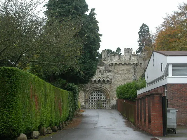 Devizes Castle Historic site, Devizes2.3 km SE
-
King's Play Hill Mountain, Heddington3.9 km NE
-
Roundway Hill Mountain, Bishops Cannings4 km NE
-
Potterne Field Mountain, Potterne4.4 km SE
-
Seend Hill Mountain, Seend5.1 km W
-
Etchilhampton Hill Mountain, Etchilhampton5.4 km SE
Sources & licences
Data last updated: