Hackpen Hill
Located in Winterbourne Bassett, Wiltshire Coordinates: 51°28′06″ N 1°48′57″ W
- Elevation
- 272 m
- above sea level
- Local time
- UTC+00:00
- Europe/London · UTC+00:00
- Airports
- BRS Bristol Airport63 km
- SOU Southampton Airport66 km
About Hackpen Hill
Hackpen Hill is a mountain. Location: Winterbourne Bassett, Wiltshire. Elevation: 272 m. The best months to visit are June–August. The nearest airport is Bristol Airport (63 km). Nearby sights include Barbury Down and Windmill Hill.
Photos of Hackpen Hill
-
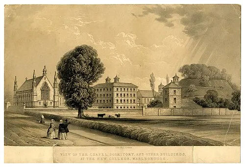
Marlborough Castle Wikimedia Commons · Public domain

Climate of Hackpen Hill
Best months for sightseeingBest months for sightseeing: June–August.
This month · November
A cold month
Day 9° · Night 3° · Rain 74 mm
- Hottest month
- July (day 20°)
- Coldest month
- February (night 0°)
- Wettest month
- December (80 mm)
- Driest month
- April (47 mm)
Bars: average monthly low and high temperature. Below: precipitation. Monthly averages for 1970–2000 at about 18 km resolution, adjusted for elevation. Highlighted months are mild and relatively dry. Source: WorldClim 2.1 (CC BY 4.0).
Show values as a table
| Month | Jan | Feb | Mar | Apr | May | Jun | Jul | Aug | Sep | Oct | Nov | Dec |
|---|---|---|---|---|---|---|---|---|---|---|---|---|
| Average high (°C) | 6° | 6° | 9° | 11° | 15° | 18° | 20° | 20° | 17° | 13° | 9° | 7° |
| Average low (°C) | 1° | 0° | 2° | 3° | 6° | 9° | 11° | 11° | 9° | 6° | 3° | 2° |
| Precipitation (mm) | 77 | 53 | 60 | 47 | 53 | 58 | 47 | 58 | 67 | 69 | 74 | 80 |
How to get to Hackpen Hill
The nearest airport is Bristol Airport (BRS), 63 km to the west as the crow flies. The nearest large city is Swindon, 10 km to the north.
Airports
- Bristol Airport (BRS) Bristol 63 kmwest
- Southampton Airport (SOU) Southampton 66 kmsoutheast
- Bournemouth Airport (BOH) Bournemouth 77 kmsouth
Nearby large cities
- Swindon Population: 201.7K 10 kmnorth
- Bath Population: 101.6K 39 kmwest
- Oxford Population: 162.1K 50 kmnortheast
- Cheltenham Population: 118.8K 51 kmnorth
- Gloucester Population: 132.4K 53 kmnorthwest
Straight-line distances; road distances are longer. Airport data: OurAirports.
Day trips from Hackpen Hill
Within 100 km: 685 historic and cultural sites, 1,060 natural sites, 264 lakes, rivers and coasts.
0–25 km73 places
- Friday Island Island 24 kmNW
- Windmill Hill Mountain 5 kmSW
- Whitehorse Hill Mountain 21 kmNE
- Lambourn Downs Mountain 21 kmE
25–60 km458 places
- Alney Island Island 53 kmNW
- Andersey Island Island 43 kmNE
- Harnham Water Meadows Island 45 kmS
- Rose Isle Island 49 kmNE
60–100 km1,478 places
- Portsea Island Natural site 91 kmSE
- Isle of Wight Island 95 kmSE
- Brownsea Island Island 87 kmS
- Avon Beach Beach 82 kmS
Straight-line distances.
Nearest towns and villages
-
Broad Hinton Village, Broad Hinton3.2 km NW
-
Winterbourne Bassett Village, Winterbourne Bassett2.6 km W
-
Wroughton Town, Wroughton6.4 km N
-
Berwick Bassett Village, Berwick Bassett3.1 km W
-
Broad Hinton Municipality, Wiltshire3.2 km NW
-
Uffcott Village, Broad Hinton3.3 km N
Nearby attractions & nature
Everything nearby-
Barbury Down Mountain, Ogbourne St. Andrew3.1 km NE
-
Windmill Hill Mountain, Avebury5.2 km SW
-
Coombe Down Mountain, Ogbourne St. Andrew5.3 km E
-
Clyffe Pypard Hill Mountain, Clyffe Pypard5.8 km W
-
Waden Hill Mountain, Avebury5.9 km SW
-
Silbury Hill Mountain, Avebury6.5 km SW
-
Burderop Wood Natural site, England8.6 km NE
-
Cherhill Down Mountain, Calne Without9.4 km SW
Sources & licences
Data last updated: