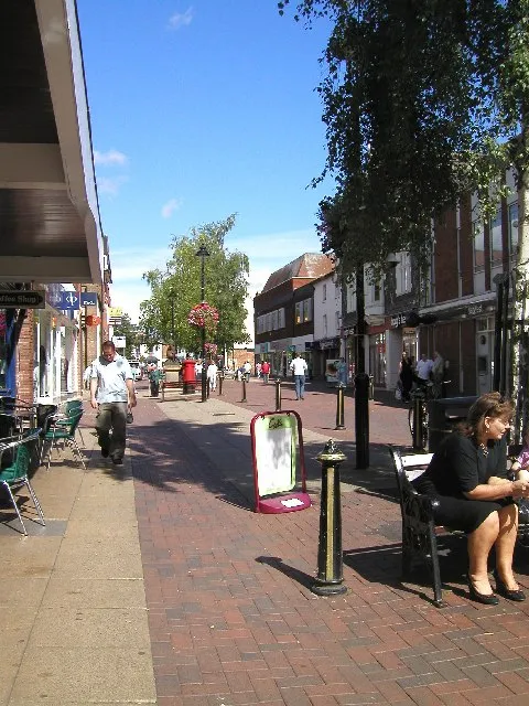
- Population
- 34,755
- 34.8K
- Elevation
- 90 m
- above sea level
- Local time
- UTC+00:00
- Europe/London · UTC+00:00
- Airports
- BHX Birmingham Airport25 km
- EMA East Midlands Airport74 km
About Bromsgrove
Bromsgrove is a town. Location: Bromsgrove District, Worcestershire. Population: 34,755. Elevation: 90 m.
Bromsgrove is a town in Worcestershire, England, about 16 miles (26 km) north-east of Worcester and 13 miles (21 km) south-west of Birmingham city centre. It had a population of 34,755 in at the 2021 census. It gives its name to the wider Bromsgrove District, of which it is the largest town and administrative centre. In the Middle Ages, it was a small market town, primarily producing cloth through the early modern period. In the eighteenth and nineteenth centuries, it became a major centre for nail making.
Source: Wikipedia · CC BY-SA 4.0
Photos of Bromsgrove
-

Graham Mitchell · CC BY 2.0 -

PicturePrince · CC BY-SA 4.0 -

Peter Whatley · CC BY-SA 2.0 -

Richard Law · CC BY-SA 2.0 -

Oliver Mills · CC BY-SA 2.0


Travel notes for Bromsgrove
From Wikivoyage
Bromsgrove is a dormitory town in Worcestershire. Bromsgrove is not much of a tourist destination, but it hosts a well regarded annual music festival.
Understand+
Bromsgrove was a market town, with a long history of water mills, nail making and a railway wagon works. It is best known now for Bromsgrove School, a private residential school, and for being the town where the poet AE Houseman and his radical brother and sister lived. His house and some connected sites can be seen, and a statue has been placed on the pedestrianised high street.
Bromsgrove was also the home to a group of artists and craftsmen working at the Bromsgrove Guild, who created a number of famous works, including the Liver Birds and parts of Buckingham Palace's gates. Some of their work can be found in local churches.
It is close to major motorway junctions, so it has some large hotels. It is also close to some better known leisure spots, such as the Lickey Hills.
Get in+
By train:
1 Bromsgrove station, New Road, B60 2LX (approximately 1 mile from the town centre). One of the two southern termini Birmingham's Cross City Line services, the other being Redditch.Trains run every 20 minutes (hourly on Sundays) all-stops to Birmingham New Street station, then on the northern terminus of the line either at Litchfield or Four Oaks. From New Street, connections can be made to/from Birmingham International station (for Birmingham Airport and the NEC), or other rail routes across the UK. A single fare is around £6.50, and journey time is about half an hour.There are also a handful of trains per day to Nottingham and Cardiff. Car parking, complete with EV charging, as well as cycle parking is available on site, but few buses serve the station. If you aren't cycling or walking, it's recommended to have a taxi booked in advance to meet you, as they rarely wait at the station (most passengers are commuters who either drive themselves, or get picked up).
By car:
Bromsgrove is located at the intersection between the M5 and M42 motorways, and is well signposted. The main A38 runs through the town.
There is plenty of car parking, although few places are free of charge.
Source: Wikivoyage · CC BY-SA 4.0 · abridged
Climate of Bromsgrove
Best months for sightseeingBest months for sightseeing: June–August.
This month · November
A wet month
Day 10° · Night 4° · Rain 112 mm
- Hottest month
- July (day 20°)
- Coldest month
- February (night 1°)
- Wettest month
- December (113 mm)
- Driest month
- May (68 mm)
Bars: average monthly low and high temperature. Below: precipitation. Monthly averages for 1970–2000 at about 18 km resolution, adjusted for elevation. Highlighted months are mild and relatively dry. Source: WorldClim 2.1 (CC BY 4.0).
Show values as a table
| Month | Jan | Feb | Mar | Apr | May | Jun | Jul | Aug | Sep | Oct | Nov | Dec |
|---|---|---|---|---|---|---|---|---|---|---|---|---|
| Average high (°C) | 7° | 7° | 9° | 12° | 16° | 18° | 20° | 20° | 17° | 13° | 10° | 8° |
| Average low (°C) | 1° | 1° | 3° | 4° | 6° | 9° | 11° | 11° | 9° | 7° | 4° | 2° |
| Precipitation (mm) | 108 | 77 | 88 | 70 | 68 | 83 | 72 | 89 | 91 | 102 | 112 | 113 |
How to get to Bromsgrove
The nearest airport is Birmingham Airport (BHX), 25 km to the northeast as the crow flies. The nearest large city is Dudley, 18 km to the north.
Airports
- Birmingham Airport (BHX) Birmingham, West Midlands 25 kmnortheast
- East Midlands Airport (EMA) Nottingham, Leicestershire 74 kmnortheast
- Manchester Airport (MAN) Manchester, Greater Manchester 114 kmnorth
Nearby large cities
- Dudley Population: 199.1K 18 kmnorth
- Birmingham Population: 1.2M 20 kmnortheast
- Worcester Population: 101.7K 20 kmsouthwest
- West Bromwich Population: 103.1K 21 kmnorth
- Solihull Population: 126.6K 21 kmnortheast
Straight-line distances; road distances are longer. Airport data: OurAirports.
Day trips from Bromsgrove
Within 100 km: 982 historic and cultural sites, 1,409 natural sites, 120 lakes, rivers and coasts.
0–25 km120 places
- Bevere Island Island 17 kmSW
- Withymoor Island Island 17 kmN
- Bromford Stop Island 19 kmN
- Walton Hill Mountain 9 kmN
25–60 km640 places
- Alney Island Island 54 kmS
- Glover's Island Island 27 kmS
- Crescent Wood Island Island 27 kmNE
- The Island Island 46 kmW
60–100 km1,751 places
- Andersey Island Island 92 kmSE
- Horninglow island Island 60 kmNE
- Rose Isle Island 89 kmSE
- Lock Wood Island Island 93 kmSE
Straight-line distances.
Nearby attractions & nature
Everything nearby-
Ashborough Hill Mountain, Bromsgrove District2 km NE
-
Caspidge Hill Mountain, Bromsgrove District2.2 km E
-
Droitwich Longwave Transmitter, Mast North Landmark, Dodderhill5.4 km SW
-
Chapman's Hill Mountain, Bromsgrove District7.1 km N
-
Droitwich Longwave Transmitter, Mast South Landmark, Dodderhill5.6 km SW
-
Beacon Hill Mountain, Lickey and Blackwell5.8 km NE
-
Piper's Hill Mountain, Dodderhill5.8 km S
-
Rednal Hill Mountain, Cofton Hackett6.5 km NE
Sources & licences
Data last updated: · 2 independent sources