Clifton upon Teme
Located in Malvern Hills District, Worcestershire Coordinates: 52°14′54″ N 2°24′40″ W
- Elevation
- 187 m
- above sea level
- Local time
- UTC+00:00
- Europe/London · UTC+00:00
- Places inside
- 2
- listed under Clifton upon Teme
- Airports
- BHX Birmingham Airport51 km
- EMA East Midlands Airport98 km
About Clifton upon Teme
Clifton upon Teme is a village. Location: Malvern Hills District, Worcestershire. Elevation: 187 m. The best months to visit are June–August. The nearest airport is Birmingham Airport (51 km). Nearby sights include Tedney Hill and Rodge Hill.
Photos of Clifton upon Teme
-
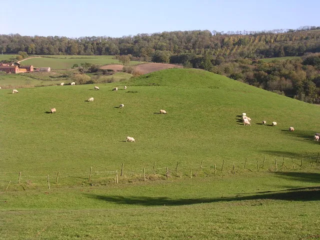
Homme Castle Richard Greenwood · CC BY-SA 2.0

Climate of Clifton upon Teme
Best months for sightseeingBest months for sightseeing: June–August.
This month · November
A cold month
Day 9° · Night 3° · Rain 90 mm
- Hottest month
- July (day 20°)
- Coldest month
- February (night 0°)
- Wettest month
- December (96 mm)
- Driest month
- July (58 mm)
Bars: average monthly low and high temperature. Below: precipitation. Monthly averages for 1970–2000 at about 18 km resolution, adjusted for elevation. Highlighted months are mild and relatively dry. Source: WorldClim 2.1 (CC BY 4.0).
Show values as a table
| Month | Jan | Feb | Mar | Apr | May | Jun | Jul | Aug | Sep | Oct | Nov | Dec |
|---|---|---|---|---|---|---|---|---|---|---|---|---|
| Average high (°C) | 6° | 6° | 8° | 11° | 15° | 17° | 20° | 19° | 17° | 13° | 9° | 7° |
| Average low (°C) | 1° | 0° | 2° | 3° | 6° | 8° | 10° | 10° | 8° | 6° | 3° | 1° |
| Precipitation (mm) | 93 | 65 | 74 | 60 | 59 | 71 | 58 | 75 | 80 | 85 | 90 | 96 |
How to get to Clifton upon Teme
The nearest airport is Birmingham Airport (BHX), 51 km to the northeast as the crow flies. The nearest large city is Worcester, 15 km to the southeast.
Airports
- Birmingham Airport (BHX) Birmingham, West Midlands 51 kmnortheast
- East Midlands Airport (EMA) Nottingham, Leicestershire 98 kmnortheast
- Bristol Airport (BRS) Bristol 99 kmsouth
Nearby large cities
- Worcester Population: 101.7K 15 kmsoutheast
- Dudley Population: 199.1K 36 kmnortheast
- West Bromwich Population: 103.1K 41 kmnortheast
- Wolverhampton Population: 263.7K 42 kmnortheast
- Birmingham Population: 1.2M 43 kmnortheast
Straight-line distances; road distances are longer. Airport data: OurAirports.
Day trips from Clifton upon Teme
Within 100 km: 1,000 historic and cultural sites, 1,839 natural sites, 131 lakes, rivers and coasts.
0–25 km145 places
- The Island Island 21 kmW
- Bevere Island Island 12 kmE
- Worcestershire Beacon Mountain 17 kmS
- Titterstone Clee Hill Mountain 21 kmNW
25–60 km966 places
- Alney Island Island 44 kmS
- Glover's Island Island 35 kmSE
- Crescent Wood Island Island 52 kmNE
- Withymoor Island Island 35 kmNE
60–100 km1,859 places
- Horninglow island Island 82 kmNE
- Rose Isle Island 100 kmSE
- Isle of Rhea Island 96 kmSE
- Fiddler's Island Island 95 kmSE
Straight-line distances.
Places in Clifton upon Teme
2 placesClifton upon Teme
Population: 695
-
Nearby attractions & nature
Everything nearby-
Tedney Hill Mountain, Whitbourne2.5 km S
-
Rodge Hill Mountain, Martley3 km NE
-
Berrow Hill Mountain, Martley3.6 km SE
-
Woodbury Hill Mountain, Great Witley4.2 km NE
-
Ankerdine Hill Mountain, Doddenham5 km S
-
Walsgrove Hill Mountain, Shelsley Beauchamp5.1 km NE
Sources & licences
Data last updated: