Glengormley
Located in Antrim and Newtownabbey, Northern Ireland Coordinates: 54°40′53″ N 5°58′04″ W
- Population
- 21,027
- 21K
- Elevation
- 213 m
- above sea level
- Local time
- UTC+00:00
- Europe/London · UTC+00:00
- Airports
- BHD George Best Belfast City Airport9 km
- BFS Belfast International Airport16 km
About Glengormley
Glengormley is a village. Location: Antrim and Newtownabbey, Northern Ireland. Population: 21,027. Elevation: 213 m.
Glengormley (from Irish Gleann Ghormlaithe, meaning 'Gormlaith's valley') is a townland (of 215 acres) and electoral ward in County Antrim, Northern Ireland. Glengormley is within the urban area of Newtownabbey bordering Belfast, and is located in the Antrim and Newtownabbey Borough Council area. It is also situated in the civil parish of Carnmoney and the historic barony of Belfast Lower.
Source: Wikipedia · CC BY-SA 4.0
Photos of Glengormley
-
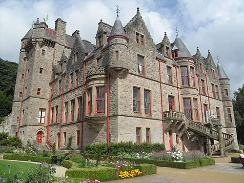
Belfast Castle Trevor Caruth · CC BY-SA 3.0

Climate of Glengormley
Best months for sightseeingBest months for sightseeing: June–August.
This month · November
A wet month
Day 8° · Night 3° · Rain 101 mm
- Hottest month
- July (day 18°)
- Coldest month
- January (night 1°)
- Wettest month
- January (106 mm)
- Driest month
- May (61 mm)
Bars: average monthly low and high temperature. Below: precipitation. Monthly averages for 1970–2000 at about 18 km resolution, adjusted for elevation. Highlighted months are mild and relatively dry. Source: WorldClim 2.1 (CC BY 4.0).
Show values as a table
| Month | Jan | Feb | Mar | Apr | May | Jun | Jul | Aug | Sep | Oct | Nov | Dec |
|---|---|---|---|---|---|---|---|---|---|---|---|---|
| Average high (°C) | 6° | 6° | 8° | 11° | 14° | 17° | 18° | 18° | 15° | 12° | 8° | 6° |
| Average low (°C) | 1° | 1° | 2° | 3° | 6° | 8° | 10° | 10° | 8° | 6° | 3° | 1° |
| Precipitation (mm) | 106 | 75 | 85 | 66 | 61 | 65 | 73 | 86 | 93 | 106 | 101 | 101 |
How to get to Glengormley
The nearest airport is George Best Belfast City Airport (BHD), 9 km to the southeast as the crow flies. For international flights: Belfast International Airport (BFS) (16 km). The nearest large city is Belfast, 10 km to the south.
Airports
- George Best Belfast City Airport (BHD) Belfast 9 kmsoutheast
- Belfast International Airport (BFS) Belfast 16 kmwest
- Campbeltown Airport (CAL) Campbeltown 86 kmnorth
Nearby large cities
- Belfast Population: 348K 10 kmsouth
- Dublin Population: 1M 151 kmsouth
- Glasgow Population: 626.4K 171 kmnortheast
- Blackpool Population: 145K 213 kmsoutheast
- Edinburgh Population: 515K 226 kmnortheast
Straight-line distances; road distances are longer. Airport data: OurAirports.
Day trips from Glengormley
Within 100 km: 83 historic and cultural sites, 603 natural sites, 345 lakes, rivers and coasts.
0–25 km72 places
- Rams Island Island 24 kmSW
- Portmore Lough Lake 24 kmSW
- Lough Mourne Lake 12 kmNE
- Monlough Lake 22 kmS
25–60 km190 places
- West Maiden Island 31 kmNE
- Reedy Flat Island 38 kmSW
- Reagh Island Island 28 kmSE
- Lighthouse Island Island 29 kmE
60–100 km769 places
- Portstewart Beach Beach 73 kmNW
- Benone Beach Beach 80 kmNW
- Portstewart Strand Beach 75 kmNW
- The Skerries Island 74 kmNW
Straight-line distances.
Nearby attractions & nature
Everything nearby-
Carnmoney Hill Mountain, Antrim and Newtownabbey2.1 km E
-
Belfast Castle Historic site, Belfast4.6 km S
-
Collinward Mountain, Antrim and Newtownabbey3.2 km S
-
Cave Hill Mountain, Belfast3.9 km S
-
Carn Hill Mountain, Mid and East Antrim6.7 km NE
-
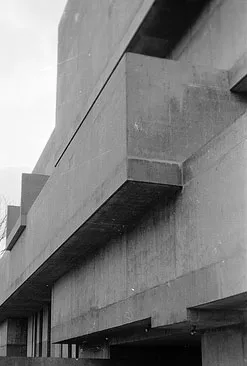 Ulster Museum Museum, Belfast11 km S
Other cities and towns in Antrim and Newtownabbey
-
 Whiteabbey Village, Antrim and Newtownabbey4.7 km E
-
Templepatrick Village, Antrim and Newtownabbey7.4 km W
-
Hyde Park Village, Antrim and Newtownabbey2.6 km SW
-
Doagh Village, Antrim and Newtownabbey11 km NW
-
The Trench Village, Antrim and Newtownabbey3.6 km SW
-
Whitehouse Village, Antrim and Newtownabbey4.8 km SE
Sources & licences
Data last updated: · 2 independent sources