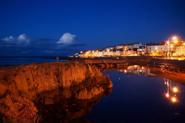
- Population
- 61,011
- 61K
- Elevation
- 19 m
- above sea level
- Local time
- UTC+00:00
- Europe/London · UTC+00:00
- Airports
- BHD George Best Belfast City Airport14 km
- BFS Belfast International Airport35 km
About Bangor
Bangor is a city. Location: Ards and North Down, Northern Ireland. Population: 61,011. Elevation: 19 m.
Bangor ( BANG-gər; from Irish Beannchar [ˈbʲaːn̪ˠəxəɾˠ]) is a seaside city and civil parish in County Down, Northern Ireland, on the southern side of Belfast Lough. It is within the Belfast metropolitan area and is 13 miles (22 km) east of Belfast city centre, to which it is linked by the A2 road and the Belfast–Bangor railway line. The population was 64,596 at the 2021 census. Bangor Abbey was an important and influential monastery founded in the 6th century by Saint Comgall.
Source: Wikipedia · CC BY-SA 4.0
Photos of Bangor
-

Eric Jones · CC BY-SA 2.0 -

Rossographer · CC BY-SA 2.0 -
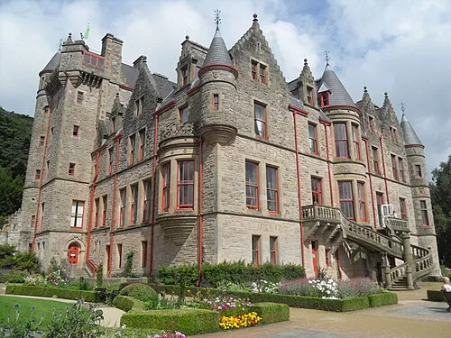
Belfast Castle Trevor Caruth · CC BY-SA 3.0 -
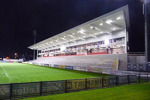
Kingspan Stadium Aaronsc at English Wikipedia · Public domain -
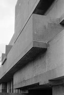
Ulster Museum Robert Nash · CC BY 2.5


Travel notes for Bangor
From Wikivoyage
Bangor is a town on the south shore of Belfast Lough, in County Down. It was a holiday resort from the mid-19th to the mid-20th century but is now chiefly a commuter town for Belfast. In 2021 it had a population of 64,000.
Understand+
Bangor in Irish is Beannchor, a horned or peaked curve, referring to the shape of its bay. In the 6th and 7th centuries its monastery rivalled Armagh as the religious and cultural centre of Ireland, but Viking raids finished it off, and its Norman revival under St Malachy was never so important. It remained a small place until the Ulster Plantations of the 17th century, when it grew as a port. Over the next 200 years a major linen industry developed across Ireland, however Bangor's speciality was cotton, with steam-driven mills lining the sea front. But as the scale of production processes grew, Bangor couldn't compete with the Lancashire mill towns and this industry faded. The railway arrived in 1865 and the town morphed into a seaside resort and commuter town for Belfast, acquiring its Victorian architecture.
It remained a tourist resort into the 1960s, but its cool climate and bracing sea temperatures were no match for the Med. "The Troubles" then set in: there were murderous bomb attacks in Bangor but the town escaped more lightly than most, though it suffered from the blight that descended on Belfast. Conversely, it benefited from the revival following the Good Friday Agreement of 1998. The six counties of Northern Ireland are no longer units of governance; since 2015 Bangor has been the administrative centre of Ards and North Down Borough, so local government is a significant local employer.
Visitor information is based in the old market house at 77 Main St, open M-Sa 9:30AM-5PM.
Get in+
Most long-distance routes are via Belfast. One exception is George Best City Airport: you walk or take the free shuttle bus to Sydenham station for the Bangor train, and don't travel via the city.
By road from Belfast follow A2.
Trains from Belfast Grand Central run every 20 min and take 40 min via City Hospital, Botanic (for Queen's University), Lanyon Place, Titanic, Sydenham (for City Airport), Holywood, Marino, Cultra (for Transport and Folk Museums), Seahill, Helen's Bay (for Crawfordsburn), Carnalea and Bangor West.
1 Bangor railway station is on Abbey St. It has a staffed ticket office and machines, and step-free access to the platforms.
Ulsterbus 1 & 2 run from Belfast Laganside, taking 50 min via Lanyon Place, Holywood, Cultra, Kilcooley and Crawfordsburn; they don't serve Belfast Grand Central. They're hourly M-Sa but only four on Sunday. Bangor Buscentre is south side of the railway station.
Source: Wikivoyage · CC BY-SA 4.0 · abridged
Twin towns and sister cities of Bangor
- Virginia Beach· United States
- Bregenz· Austria
Source: Wikidata. Only places with a page on this site are shown.
Climate of Bangor
Best months for sightseeingBest months for sightseeing: June–August.
This month · November
A cold month
Day 9° · Night 3° · Rain 79 mm
- Hottest month
- July (day 20°)
- Coldest month
- January (night 1°)
- Wettest month
- October (86 mm)
- Driest month
- May (55 mm)
Bars: average monthly low and high temperature. Below: precipitation. Monthly averages for 1970–2000 at about 18 km resolution, adjusted for elevation. Highlighted months are mild and relatively dry. Source: WorldClim 2.1 (CC BY 4.0).
Show values as a table
| Month | Jan | Feb | Mar | Apr | May | Jun | Jul | Aug | Sep | Oct | Nov | Dec |
|---|---|---|---|---|---|---|---|---|---|---|---|---|
| Average high (°C) | 6° | 7° | 10° | 12° | 16° | 18° | 20° | 19° | 17° | 13° | 9° | 7° |
| Average low (°C) | 1° | 1° | 2° | 4° | 6° | 9° | 12° | 11° | 9° | 6° | 3° | 2° |
| Precipitation (mm) | 85 | 60 | 66 | 58 | 55 | 60 | 64 | 77 | 79 | 86 | 79 | 81 |
How to get to Bangor
The nearest airport is George Best Belfast City Airport (BHD), 14 km to the west as the crow flies. For international flights: Belfast International Airport (BFS) (35 km). The nearest large city is Belfast, 18 km to the southwest.
Airports
- George Best Belfast City Airport (BHD) Belfast 14 kmwest
- Belfast International Airport (BFS) Belfast 35 kmwest
- Campbeltown Airport (CAL) Campbeltown 86 kmnorth
Nearby large cities
- Belfast Population: 348K 18 kmsouthwest
- Dublin Population: 1M 153 kmsouth
- Glasgow Population: 626.4K 161 kmnortheast
- Blackpool Population: 145K 195 kmsoutheast
- Edinburgh Population: 515K 213 kmnortheast
Straight-line distances; road distances are longer. Airport data: OurAirports.
Day trips from Bangor
Within 100 km: 67 historic and cultural sites, 707 natural sites, 297 lakes, rivers and coasts.
0–25 km62 places
- Reagh Island Island 17 kmS
- Lighthouse Island Island 10 kmNE
- Copeland Island Island 9 kmE
- Burial Island Island 24 kmSE
25–60 km244 places
- West Maiden Island 30 kmN
- Reedy Flat Island 55 kmW
- Rams Island Island 42 kmW
- Guns Island Island 42 kmS
60–100 km765 places
- Portstewart Beach Beach 89 kmNW
- Benone Beach Beach 96 kmNW
- Portstewart Strand Beach 90 kmNW
- The Skerries Island 88 kmNW
Straight-line distances.
Bangor and similar cities
Side by side with cities of similar size in the same country: population, elevation and climate.
| Measure | Bangor | Bury | Widnes | Hereford |
|---|---|---|---|---|
| Population | 61K | 61K | 61.5K | 60.4K |
| Elevation | 19 m | 93 m | 13 m | 61 m |
| Summer day (hottest month) | 20° | 20° | 20° | 22° |
| Winter night (coldest month) | 1° | 2° | 2° | 1° |
| Annual rainfall | 850 mm | 1,054 mm | 823 mm | 707 mm |
| Best months | Jun–Aug | Jun–Aug | Jun–Aug | Jun–Aug |
| Distance | — | 250 km | 241 km | 350 km |
Climate values are 1970–2000 monthly averages; straight-line distance.
Nearby attractions & nature
Everything nearby-
Bangor Bay Natural site, Ards and North Down0.8 km N
-
Ballyholme Bay Natural site, Ards and North Down2 km NE
-
Scrabo Hill Mountain, Ards and North Down9.5 km S
-
Helens Tower Landmark, Ards and North Down5.8 km SW
-
Helen's Bay Natural site, Northern Ireland4.5 km W
-
Mahee Island Island, Ards and North Down18 km S
-
Cairngaver Mountain, Ards and North Down7.2 km SW
-
Mew Island Island, Northern Ireland11 km E
Other cities and towns in Ards and North Down
-
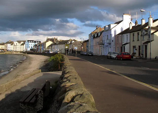 Donaghadee Town, Ards and North Down8.8 km E
-
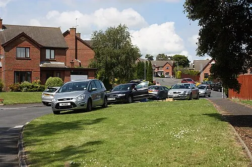 Comber Town, Ards and North Down13 km S
Sources & licences
Data last updated: · 2 independent sources