Newtownards
Local name: Baile Nua na hArda
Located in Ards and North Down, Northern Ireland Coordinates: 54°35′32″ N 5°41′27″ W
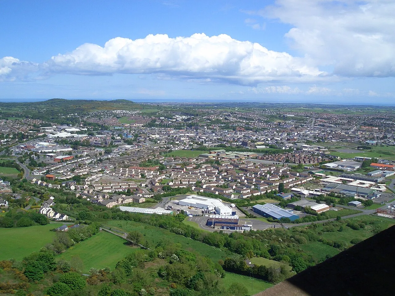
- Population
- 29,363
- 29.4K
- Elevation
- 9 m
- above sea level
- Local time
- UTC+00:00
- Europe/London · UTC+00:00
- Airports
- BHD George Best Belfast City Airport12 km
- BFS Belfast International Airport35 km
About Newtownards
Newtownards is a city. Location: Ards and North Down, Northern Ireland. Population: 29,363. Elevation: 9 m.
Newtownards (), is a town in County Down, Northern Ireland. It lies at the most northern tip of Strangford Lough, 10 miles (16 km) east of Belfast, on the Ards Peninsula. It is in the civil parish of Newtownards and the historic baronies of Ards Lower and Castlereagh Lower. Newtownards is in the Ards and North Down Borough. The population was 29,677 in the 2021 Census.
Source: Wikipedia · CC BY-SA 4.0
Photos of Newtownards
-

Rossographer · CC BY-SA 2.0 -

Eric Jones · CC BY-SA 2.0 -

Eric Jones · CC BY-SA 2.0 -
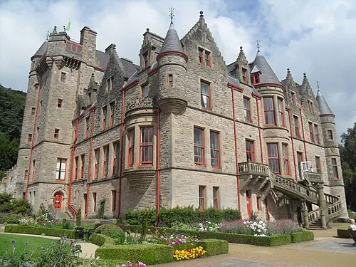
Belfast Castle Trevor Caruth · CC BY-SA 3.0 -
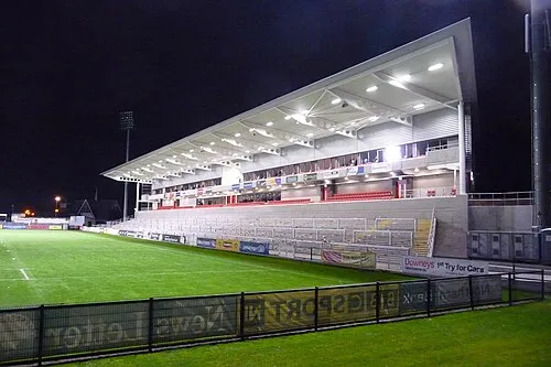
Kingspan Stadium Aaronsc at English Wikipedia · Public domain


Travel notes for Newtownards
From Wikivoyage
Newtownards is a town at the head of Strangford Lough, historically in County Down, with a population in 2021 of 29,600. The counties of Northern Ireland are no longer units of governance so since 2015 the town has been part of Ards and North Down "super-district". It has few sights of its own, but the area around the lough is dotted with natural and historic attractions. This page therefore covers the entire Ards Peninsula down to Portaferry, and the northern half of the lough. For the southwest shore of the lough see Downpatrick and Strangford.
Understand+
"New" means from 1226 AD, when the Normans founded the "New Town of Blathewic". The old town was built from 540 AD around Movilla Abbey but was torched and razed in the 1570s, by Irish clans trying to keep out the English. What they got instead was the Scots, especially from Ayrshire, who settled in large numbers during the 17th century Plantations. At the dawn of the industrial age, places called "new town" were springing up all over, so this one became specified as Newtownards. It was a large market town but growth was hampered by lack of a port — the lough was too shallow — so goods had to be lugged to and from Donaghadee. But in 1860 the railway connected it to Belfast and the population increased rapidly, sharing the ups and downs of Northern Ireland's economic heartland.
The challenge for Newtownards ever since is to be more than just a commuter town for Belfast. Its industries were never traditional smoke-stack, and the Council sees its future in niche areas of agri-business, engineering, and IT such as cyber-security. But many industrial lots lie vacant, and its principal employment sector of services and hospitality has been hard hit.
Get in+
By road from Belfast follow A20.
Ulsterbus 5 runs from Belfast Laganside, taking 40 min via Dundonald. It's every hour or so M-Sa, but with only four on Sunday.
Bus 7 also runs hourly from Laganside, taking 40 min, and continues to Donaghadee, Millisle and Ballywalter.
Bus 6 runs every 30 min from Bangor, taking 20 min.
Bus 9 / 10 runs M-Sa hourly from Newtownards down the Ards Peninsula via Mount Stewart House and Grey Abbey to Portaferry, for ferries to Strangford. (Some buses start from Laganside.) There's only four on Sunday.
1 Newtownards Bus Station is central on Regent St.
Source: Wikivoyage · CC BY-SA 4.0 · abridged
Climate of Newtownards
Best months for sightseeingBest months for sightseeing: June–August.
This month · November
A cold month
Day 9° · Night 3° · Rain 79 mm
- Hottest month
- July (day 20°)
- Coldest month
- January (night 1°)
- Wettest month
- October (86 mm)
- Driest month
- May (55 mm)
Bars: average monthly low and high temperature. Below: precipitation. Monthly averages for 1970–2000 at about 18 km resolution, adjusted for elevation. Highlighted months are mild and relatively dry. Source: WorldClim 2.1 (CC BY 4.0).
Show values as a table
| Month | Jan | Feb | Mar | Apr | May | Jun | Jul | Aug | Sep | Oct | Nov | Dec |
|---|---|---|---|---|---|---|---|---|---|---|---|---|
| Average high (°C) | 7° | 7° | 10° | 13° | 16° | 18° | 20° | 19° | 17° | 13° | 9° | 7° |
| Average low (°C) | 1° | 1° | 3° | 4° | 7° | 10° | 12° | 11° | 9° | 7° | 3° | 2° |
| Precipitation (mm) | 85 | 60 | 66 | 58 | 55 | 60 | 64 | 77 | 79 | 86 | 79 | 81 |
How to get to Newtownards
The nearest airport is George Best Belfast City Airport (BHD), 12 km to the west as the crow flies. For international flights: Belfast International Airport (BFS) (35 km). The nearest large city is Belfast, 15 km to the west.
Airports
- George Best Belfast City Airport (BHD) Belfast 12 kmwest
- Belfast International Airport (BFS) Belfast 35 kmwest
- Isle of Man Airport (IOM) Castletown, Rushen 90 kmsoutheast
Nearby large cities
- Belfast Population: 348K 15 kmwest
- Dublin Population: 1M 145 kmsouth
- Glasgow Population: 626.4K 169 kmnortheast
- Blackpool Population: 145K 193 kmsoutheast
- Preston Population: 313.3K 216 kmsoutheast
Straight-line distances; road distances are longer. Airport data: OurAirports.
Day trips from Newtownards
Within 100 km: 65 historic and cultural sites, 631 natural sites, 297 lakes, rivers and coasts.
0–25 km62 places
- Reagh Island Island 10 kmS
- Lighthouse Island Island 16 kmNE
- Copeland Island Island 14 kmNE
- Burial Island Island 20 kmSE
25–60 km245 places
- West Maiden Island 38 kmN
- Reedy Flat Island 52 kmW
- Rams Island Island 40 kmW
- Guns Island Island 34 kmS
60–100 km686 places
- Portstewart Beach Beach 93 kmNW
- Benone Beach Beach 99 kmNW
- Portstewart Strand Beach 94 kmNW
- The Skerries Island 93 kmNW
Straight-line distances.
Nearby attractions & nature
Everything nearby-
Scrabo Hill Mountain, Ards and North Down2.1 km SW
-
Helens Tower Landmark, Ards and North Down3.2 km NW
-
Cairngaver Mountain, Ards and North Down4.6 km NW
-
Mahee Island Island, Ards and North Down11 km S
-
Castle Espie Wetland Centre Natural site, Ards and North Down7 km S
-
Ballykeel Mountain, Ards and North Down8.4 km NW
-
Bangor Bay Natural site, Ards and North Down8.4 km N
-
Stormont Castle Historic site, Ards and North Down9.6 km W
Sources & licences
Data last updated: · 2 independent sources