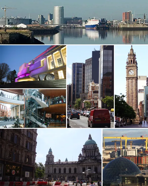
- Population
- 348,005
- 348K
- Elevation
- 7 m
- above sea level
- Local time
- UTC+00:00
- Europe/London · UTC+00:00
- Airports
- BHD George Best Belfast City Airport4 km
- BFS Belfast International Airport20 km
About Belfast
Belfast is a city. Location: Belfast, Northern Ireland. Population: 348,005. Elevation: 7 m.
Belfast ( BEL-fast, , -fahst; from Irish: Béal Feirste [bʲeːlˠ ˈfʲɛɾˠ(ə)ʃtʲə]) is the capital, largest city and main port of Northern Ireland. It stands on the banks of the river Lagan, and is connected to the open sea through Belfast Lough and the North Channel. The city is the most populous in Northern Ireland and the second-largest, after Dublin, on the island of Ireland, with a recorded population in 2021 of 345,418 and of 704,406 for the greater metropolitan area.
Source: Wikipedia · CC BY-SA 4.0
Photos of Belfast
-

William Murphy · CC BY-SA 3.0 -

thejackrustles · CC BY-SA 2.0 -

Rossographer · CC BY-SA 2.0 -

Marathon · CC BY-SA 2.0 -

Joseph Mischyshyn · CC BY-SA 2.0


Travel notes for Belfast
From Wikivoyage
Belfast (Irish: Béal Feirste) is the capital and largest city of Northern Ireland. Most of it historically lay in County Antrim west of the River Lagan, with about a third on the east bank in County Down, but it's always been governed as a separate metropolis, with a population in 2024 of about 671,000. It's had a troubled history but is nowadays safe to visit and has the best-developed visitor facilities in Northern Ireland. And its situation means that Belfast can confidently claim to be the most fascinating city in both the United Kingdom and on the island of Ireland.
Understand+
This noble city is named for a mud bank and is built upon sludge. The lower River Lagan is tidal and receives a dozen small tributaries (nowadays culverted) which drop their silt, forming banks of sand and mud. The lowest point at which you could ford the river at low tide is where the Lagan road bridge now crosses, and in Irish this is Béal Feirste, "river-mouth of the sand-bank ford". The tributary joining at that point, the Farset, is likewise named for the mud bank, not vice versa. And besides the man-made channels and culverts, a great volume of water seeps through the alluvial silt on both sides of the Lagan. It's a slimy, thixotropic impediment to building — clay dug out of a trench quickly feels homesick and slides back in — and a deterrent to high-rise; but Paris grew up on similar foundations.
Pre-industrial Belfast was a small provincial place. It grew rapidly in the 18th century with the linen trade, and in the 19th with smokestack industry, especially ship-building along the estuary. It sucked in labour, including Catholics moving off the land. In 1921 Ireland was divided: Dublin and the Republic fell behind economically, while Belfast found itself the capital city of Northern Ireland and, after the Depression, busily tooling up to fight the Second World War.
Get in+
By plane:
George Best Belfast City:
1 George Best Belfast City Airport (BHD IATA), Sydenham BT3 9JH (2 miles east of city centre), ☏ +44 28 9093 9093. This airport is close to the city centre. Most flights come from the rest of the UK, mainly by Aer Lingus which has a base here. Other destinations include London Heathrow (British Airways), Amsterdam (KLM), and Frankfurt (Lufthansa) all with global connections. Loganair fly from Aberdeen and Inverness. (updated Jan 2026)
Ground transport:
Bus 600 runs every 30 min from the airport to Queens Square, Victoria Square, Wellington Place and Grand Central Station. It runs 6AM-10PM daily, taking less than 15 min, adult single fare is £2.30 in 2026.
Taxis might cost £15 to most parts of the city, but check at the outset whether the fare you're quoted includes the £2.50 airport supplement, or the taxi driver may try to add it on when you arrive.
Train: Sydenham railway station is just southwest of the terminal and there's a free shuttle bus. Walk to the 600 bus stop and press the buzzer to call the shuttle. There's a footbridge over the busy dual carriageway to the railway halt, not ideal if you have lots of luggage. Sydenham is on the railway from Belfast via Holywood to Bangor on the coast, with trains 6AM - midnight every 20 min (hourly on Sundays). The adult fare in 2026 is £2.20 to the city and £5.70 to Bangor. So you can ride it to city centre for a trivial saving over the bus, but the main advantage is to reach southside locations (such as Botanic, for Queens University) for a single flat fare.
Belfast International Airport:
Source: Wikivoyage · CC BY-SA 4.0 · abridged
Twin towns and sister cities of Belfast
- Guadalajara· Mexico
Source: Wikidata. Only places with a page on this site are shown.
Climate of Belfast
Best months for sightseeingBest months for sightseeing: June–August.
This month · November
A cold month
Day 10° · Night 4° · Rain 82 mm
- Hottest month
- July (day 20°)
- Coldest month
- January (night 1°)
- Wettest month
- October (90 mm)
- Driest month
- May (57 mm)
Bars: average monthly low and high temperature. Below: precipitation. Monthly averages for 1970–2000 at about 18 km resolution, adjusted for elevation. Highlighted months are mild and relatively dry. Source: WorldClim 2.1 (CC BY 4.0).
Show values as a table
| Month | Jan | Feb | Mar | Apr | May | Jun | Jul | Aug | Sep | Oct | Nov | Dec |
|---|---|---|---|---|---|---|---|---|---|---|---|---|
| Average high (°C) | 7° | 8° | 10° | 13° | 16° | 19° | 20° | 20° | 17° | 13° | 10° | 7° |
| Average low (°C) | 1° | 2° | 3° | 4° | 7° | 10° | 12° | 11° | 9° | 7° | 4° | 2° |
| Precipitation (mm) | 88 | 62 | 71 | 60 | 57 | 61 | 64 | 79 | 82 | 90 | 82 | 84 |
How to get to Belfast
The nearest airport is George Best Belfast City Airport (BHD), 4 km to the northeast as the crow flies. For international flights: Belfast International Airport (BFS) (20 km). The nearest large city is Dublin, 142 km to the south.
Airports
- George Best Belfast City Airport (BHD) Belfast 4 kmnortheast
- Belfast International Airport (BFS) Belfast 20 kmwest
- City of Derry Airport (LDY) Derry, Derry and Strabane 94 kmnorthwest
Nearby large cities
- Dublin Population: 1M 142 kmsouth
- Glasgow Population: 626.4K 177 kmnortheast
- Blackpool Population: 145K 207 kmsoutheast
- Preston Population: 313.3K 230 kmsoutheast
- Edinburgh Population: 515K 230 kmnortheast
Straight-line distances; road distances are longer. Airport data: OurAirports.
Day trips from Belfast
Within 100 km: 67 historic and cultural sites, 558 natural sites, 340 lakes, rivers and coasts.
0–25 km60 places
- Reagh Island Island 21 kmSE
- Rams Island Island 25 kmW
- Strangford Lough Lake 24 kmSE
- Portmore Lough Lake 23 kmW
25–60 km185 places
- West Maiden Island 39 kmN
- Reedy Flat Island 37 kmW
- Lighthouse Island Island 28 kmNE
- Guns Island Island 42 kmSE
60–100 km720 places
- Portstewart Beach Beach 82 kmNW
- Benone Beach Beach 88 kmNW
- Portstewart Strand Beach 84 kmNW
- The Skerries Island 83 kmNW
Straight-line distances.
Belfast and similar cities
Side by side with cities of similar size in the same country: population, elevation and climate.
| Measure | Belfast | Coventry | Bradford | Leicester |
|---|---|---|---|---|
| Population | 348K | 345.3K | 366.2K | 368.6K |
| Elevation | 7 m | 89 m | 110 m | 65 m |
| Summer day (hottest month) | 20° | 21° | 20° | 22° |
| Winter night (coldest month) | 1° | 1° | 1° | 1° |
| Annual rainfall | 880 mm | 673 mm | 898 mm | 645 mm |
| Best months | Jun–Aug | Jun–Aug | Jun–Aug | Jun–Aug |
| Distance | — | 381 km | 287 km | 385 km |
Climate values are 1970–2000 monthly averages; straight-line distance.
Nearby attractions & nature
Everything nearby-
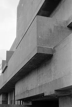 Ulster Museum Museum, Belfast1.8 km S
-
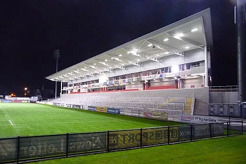 Kingspan Stadium Landmark, Belfast2.6 km SE
-
Titanic Belfast Museum, Belfast1.4 km NE
-
Botanic Gardens Park Natural site, Belfast1.7 km S
-
Titanic Studio Museum, Belfast2.1 km NE
-
ULIDIA PLAYING FIELDS Landmark, Belfast2.3 km S
-
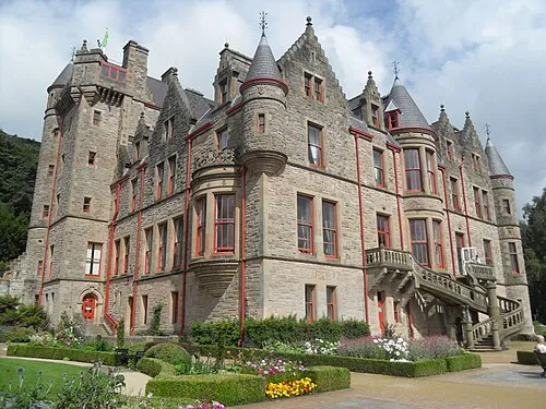 Belfast Castle Historic site, Belfast5.2 km N
-
St Columba's Church Attraction, Belfast4.2 km E
Sources & licences
Data last updated: · 2 independent sources