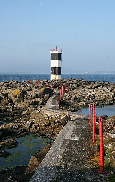
Rue Point Lighthouse
Located in Causeway Coast and Glens, Northern Ireland Coordinates: 55°15′31″ N 6°11′28″ W
- Local time
- UTC+00:00
- Europe/London · UTC+00:00
- Elevation
- 0 m
- above sea level
- Airports
- CAL Campbeltown Airport38 km
- ILY Islay Airport47 km
About Rue Point Lighthouse
Rue Point Lighthouse is a landmark. Location: Causeway Coast and Glens, Northern Ireland. The best months to visit are June–August. The nearest airport is Campbeltown Airport (38 km). Nearby sights include Ushet Lough and Ally Lough.
At a glance
- Built
- 1921
- Heritage designation
- Grade B1 listed building
Source: Wikidata
Photos of Rue Point Lighthouse
-

Gunther Tschuch · CC BY-SA 4.0 -

Robert Ashby · CC BY-SA 2.0 -

Victuallers · CC BY-SA 4.0 -

Victuallers · CC BY-SA 4.0 -

PaulT · CC BY-SA 4.0


Climate of Rue Point Lighthouse
Best months for sightseeingBest months for sightseeing: June–August.
This month · November
A wet month
Day 10° · Night 5° · Rain 126 mm
- Hottest month
- July (day 18°)
- Coldest month
- February (night 3°)
- Wettest month
- January (132 mm)
- Driest month
- May (55 mm)
Bars: average monthly low and high temperature. Below: precipitation. Monthly averages for 1970–2000 at about 18 km resolution, adjusted for elevation. Highlighted months are mild and relatively dry. Source: WorldClim 2.1 (CC BY 4.0).
Show values as a table
| Month | Jan | Feb | Mar | Apr | May | Jun | Jul | Aug | Sep | Oct | Nov | Dec |
|---|---|---|---|---|---|---|---|---|---|---|---|---|
| Average high (°C) | 8° | 8° | 9° | 11° | 14° | 16° | 18° | 18° | 16° | 13° | 10° | 9° |
| Average low (°C) | 3° | 3° | 4° | 5° | 7° | 10° | 12° | 12° | 10° | 8° | 5° | 4° |
| Precipitation (mm) | 132 | 92 | 100 | 67 | 55 | 62 | 74 | 87 | 103 | 124 | 126 | 123 |
How to get to Rue Point Lighthouse
The nearest airport is Campbeltown Airport (CAL), 38 km to the northeast as the crow flies. The nearest large city is Belfast, 76 km to the south.
Airports
- Campbeltown Airport (CAL) Campbeltown 38 kmnortheast
- Islay Airport (ILY) Isle of Islay, Argyll and Bute 47 kmnorth
- City of Derry Airport (LDY) Derry, Derry and Strabane 66 kmwest
Nearby large cities
- Belfast Population: 348K 76 kmsouth
- Glasgow Population: 626.4K 139 kmnortheast
- Edinburgh Population: 515K 204 kmnortheast
- Dublin Population: 1M 214 kmsouth
- Dundee Population: 148.2K 242 kmnortheast
Straight-line distances; road distances are longer. Airport data: OurAirports.
Day trips from Rue Point Lighthouse
Within 100 km: 85 historic and cultural sites, 1,100 natural sites, 496 lakes, rivers and coasts.
0–25 km61 places
- Sheep Island Island 10 kmW
- Rathlin Island Island 5 kmN
- Ushet Lough Lake 1 kmN
- Ally Lough Lake 2 kmN
25–60 km360 places
- Portstewart Beach Beach 36 kmW
- Benone Beach Beach 45 kmW
- Portstewart Strand Beach 38 kmW
- West Maiden Island 47 kmSE
60–100 km1,260 places
- Isle of Arran Island 71 kmNE
- Great Cumbrae Island Island 98 kmNE
- Colonsay Island 90 kmN
- Hunterston Sands Beach 97 kmNE
Straight-line distances.
Nearby attractions & nature
Everything nearby-
Ushet Lough Lake, Causeway Coast and Glens1.2 km N
-
Ally Lough Lake, Causeway Coast and Glens1.8 km N
-
Kinkeel Lough Lake, Causeway Coast and Glens2.3 km N
-
Illancarragh Bay Natural site, United Kingdom1.8 km NE
-
Doon Bay Natural site, United Kingdom1.4 km NE
-
Craigmacagan Lough Lake, Causeway Coast and Glens2.5 km N
-
Bruces Castle Historic site, Causeway Coast and Glens4.5 km N
-
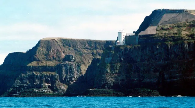 Rathlin Island Lighthouse Landmark, Causeway Coast and Glens7.4 km NW
Nearest towns and villages
-
Ballycastle Town, Causeway Coast and Glens6.9 km SW
-
Ballypatrick Village, Causeway Coast and Glens9 km S
-
Ballyvoy Village, Causeway Coast and Glens6.6 km S
-
Ballintoy Harbour Village, Causeway Coast and Glens11 km W
More sights in Causeway Coast and Glens
-
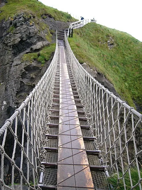 Carrick-a-Rede Rope Bridge Landmark, Causeway Coast and Glens9.2 km W
-
Altacarry Head Lighthouse Landmark, Causeway Coast and Glens4.9 km N
-
Bonamargy Abbey Historic site, Causeway Coast and Glens8.5 km S
-
Gobban Saers Castle Historic site, Causeway Coast and Glens8.8 km S
-
Layd Church Historic site, Causeway Coast and Glens21 km SE
-
Dunluce Castle Historic site, Causeway Coast and Glens25 km W
Sources & licences
Data last updated: · 2 independent sources