Letterlogher
Located in Derry City and Strabane, Northern Ireland Coordinates: 54°54′39″ N 7°04′57″ W
- Elevation
- 249 m
- above sea level
- Local time
- UTC+00:00
- Europe/London · UTC+00:00
- Airports
- LDY City of Derry Airport16 km
- BFS Belfast International Airport62 km
About Letterlogher
Letterlogher is a mountain. Location: Derry City and Strabane, Northern Ireland. Elevation: 249 m. The best months to visit are July. The nearest airport is City of Derry Airport (16 km). Nearby sights include Mullaghmeash Hill and Straid Hill.
Climate of Letterlogher
Best months for sightseeingBest months for sightseeing: July.
This month · November
A wet month
Day 9° · Night 4° · Rain 173 mm
- Hottest month
- July (day 17°)
- Coldest month
- January (night 2°)
- Wettest month
- November (173 mm)
- Driest month
- May (89 mm)
Bars: average monthly low and high temperature. Below: precipitation. Monthly averages for 1970–2000 at about 18 km resolution, adjusted for elevation. Highlighted months are mild and relatively dry. Source: WorldClim 2.1 (CC BY 4.0).
Show values as a table
| Month | Jan | Feb | Mar | Apr | May | Jun | Jul | Aug | Sep | Oct | Nov | Dec |
|---|---|---|---|---|---|---|---|---|---|---|---|---|
| Average high (°C) | 6° | 7° | 8° | 10° | 13° | 15° | 17° | 17° | 15° | 12° | 9° | 7° |
| Average low (°C) | 2° | 2° | 2° | 4° | 6° | 9° | 11° | 10° | 9° | 6° | 4° | 2° |
| Precipitation (mm) | 160 | 120 | 127 | 96 | 89 | 96 | 103 | 126 | 141 | 165 | 173 | 172 |
Other places to visit in this season: July
How to get to Letterlogher
The nearest airport is City of Derry Airport (LDY), 16 km to the north as the crow flies. For international flights: Belfast International Airport (BFS) (62 km). The nearest large city is Belfast, 82 km to the southeast.
Airports
- City of Derry Airport (LDY) Derry, Derry and Strabane 16 kmnorth
- Belfast International Airport (BFS) Belfast 62 kmsoutheast
- Donegal Airport (CFN) Donegal 82 kmwest
Nearby large cities
- Belfast Population: 348K 82 kmsoutheast
- Dublin Population: 1M 184 kmsouth
- Glasgow Population: 626.4K 208 kmnortheast
- Limerick Population: 102.3K 270 kmsouthwest
- Edinburgh Population: 515K 272 kmnortheast
Straight-line distances; road distances are longer. Airport data: OurAirports.
Day trips from Letterlogher
Within 100 km: 89 historic and cultural sites, 754 natural sites, 744 lakes, rivers and coasts.
0–25 km97 places
- Island More Island 25 kmW
- White Mountain Mountain 16 kmE
- Sperrin Mountains Mountain 12 kmS
- Slievemore Mountain 20 kmSW
25–60 km434 places
- Island Roy Island 55 kmNW
- Portstewart Beach Beach 37 kmNE
- Benone Beach Beach 32 kmNE
- Portstewart Strand Beach 35 kmNE
60–100 km1,056 places
- West Maiden Island 86 kmE
- Texa Island Island 98 kmNE
- Rathlin Island Island 70 kmNE
- Rams Island Island 62 kmSE
Straight-line distances.
Nearest towns and villages
-
Claudy Village, Derry City and Strabane4.5 km W
-
Feeny Village, Causeway Coast and Glens5.2 km SE
-
Killaloo Village, Derry City and Strabane6.5 km W
-
Altmover Village, Causeway Coast and Glens5.8 km NE
-
Dreen Village, Derry City and Strabane7.1 km S
-
Dungiven Village, Causeway Coast and Glens11 km E
Nearby attractions & nature
Everything nearby-
Mullaghmeash Hill Mountain, Causeway Coast and Glens3.4 km E
-
Straid Hill Mountain, Derry City and Strabane3.7 km S
-
Slieveboy Mountain, Derry City and Strabane5.2 km SW
-
Loughermore Mountain, Derry City and Strabane8.2 km N
-
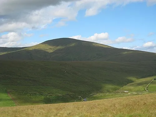 Sawel Mountain Mountain, Derry City and Strabane11 km S
-
Mullach Aise Mountain, Causeway Coast and Glens7.5 km SE
-
Cnoc Dubhaise Mountain, Derry City and Strabane7.8 km SW
-
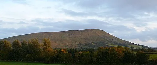 Benbradagh Mountain, Causeway Coast and Glens14 km E
Sources & licences
Data last updated: