Londonderry
Located in Derry City and Strabane, Northern Ireland Coordinates: 54°59′53″ N 7°18′34″ W
- Population
- 83,652
- 83.7K
- Elevation
- 24 m
- above sea level
- Local time
- UTC+00:00
- Europe/London · UTC+00:00
- Airports
- LDY City of Derry Airport11 km
- CFN Donegal Airport66 km
About Londonderry
Londonderry is a city. Location: Derry City and Strabane, Northern Ireland. Population: 83,652. Elevation: 24 m. The best months to visit are June–August. The nearest airport is City of Derry Airport (11 km). Nearby sights include The Peace Bridge and Guildhall.
Photos of Londonderry
-
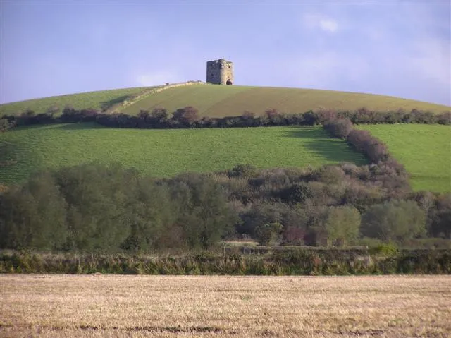
Burt Castle Kenneth Allen · CC BY-SA 2.0

Climate of Londonderry
Best months for sightseeingBest months for sightseeing: June–August.
This month · November
A wet month
Day 10° · Night 5° · Rain 176 mm
- Hottest month
- July (day 18°)
- Coldest month
- January (night 3°)
- Wettest month
- November (176 mm)
- Driest month
- May (87 mm)
Bars: average monthly low and high temperature. Below: precipitation. Monthly averages for 1970–2000 at about 18 km resolution, adjusted for elevation. Highlighted months are mild and relatively dry. Source: WorldClim 2.1 (CC BY 4.0).
Show values as a table
| Month | Jan | Feb | Mar | Apr | May | Jun | Jul | Aug | Sep | Oct | Nov | Dec |
|---|---|---|---|---|---|---|---|---|---|---|---|---|
| Average high (°C) | 8° | 8° | 10° | 12° | 14° | 16° | 18° | 18° | 16° | 13° | 10° | 8° |
| Average low (°C) | 3° | 3° | 4° | 5° | 7° | 10° | 12° | 12° | 10° | 8° | 5° | 4° |
| Precipitation (mm) | 157 | 116 | 124 | 93 | 87 | 96 | 104 | 126 | 143 | 165 | 176 | 174 |
How to get to Londonderry
The nearest airport is City of Derry Airport (LDY), 11 km to the northeast as the crow flies. For international flights: Belfast International Airport (BFS) (80 km). The nearest large city is Belfast, 100 km to the southeast.
Airports
- City of Derry Airport (LDY) Derry, Derry and Strabane 11 kmnortheast
- Donegal Airport (CFN) Donegal 66 kmwest
- Belfast International Airport (BFS) Belfast 80 kmsoutheast
Nearby large cities
- Belfast Population: 348K 100 kmsoutheast
- Dublin Population: 1M 198 kmsouth
- Glasgow Population: 626.4K 216 kmnortheast
- Limerick Population: 102.3K 274 kmsouth
- Edinburgh Population: 515K 281 kmnortheast
Straight-line distances; road distances are longer. Airport data: OurAirports.
Day trips from Londonderry
Within 100 km: 76 historic and cultural sites, 732 natural sites, 650 lakes, rivers and coasts.
0–25 km129 places
- Lisfannon Beach Beach 15 kmNW
- Island More Island 18 kmSW
- Port Lough Lake 10 kmW
- Mintiaghs Lough Lake 24 kmN
25–60 km568 places
- Island Roy Island 37 kmNW
- Portstewart Beach Beach 42 kmNE
- Benone Beach Beach 34 kmNE
- Portstewart Strand Beach 40 kmNE
60–100 km761 places
- Sheep Island Island 67 kmNE
- Reedy Flat Island 75 kmSE
- Rathlin Island Island 78 kmNE
- Rams Island Island 79 kmSE
Straight-line distances.
Londonderry and similar cities
Side by side with cities of similar size in the same country: population, elevation and climate.
| Measure | Londonderry | South Shields | Weston-super-Mare | Halifax |
|---|---|---|---|---|
| Population | 83.7K | 83.7K | 82.9K | 82.6K |
| Elevation | 24 m | 12 m | 13 m | 150 m |
| Summer day (hottest month) | 18° | 20° | 21° | 20° |
| Winter night (coldest month) | 3° | 2° | 2° | 1° |
| Annual rainfall | 1,561 mm | 673 mm | 901 mm | 1,157 mm |
| Best months | Jun–Aug | Jun–Sep | Jun–Aug | Jun–Aug |
| Distance | — | 376 km | 499 km | 382 km |
Climate values are 1970–2000 monthly averages; straight-line distance.
Nearby attractions & nature
Everything nearby-
The Peace Bridge Landmark, Derry City and Strabane0.5 km W
-
Guildhall Landmark, Derry City and Strabane0.6 km W
-
Shipquay Street Historic site, Derry City and Strabane0.8 km W
-
Walker's Monument and the Apprentice Boy's Memorial Hall Historic site, Derry City and Strabane1 km W
-
St Columb's cathedral Attraction, Derry City and Strabane1 km SW
-
Museum of free derry Museum, Derry City and Strabane1.1 km W
-
Bishops Gate Derry City Walls Historic site, Derry City and Strabane1.1 km SW
-
Free derry corner Landmark, Derry City and Strabane1.1 km W
Sources & licences
Data last updated: