Carrickfergus
Located in Mid and East Antrim, Northern Ireland Coordinates: 54°42′57″ N 5°48′21″ W
- Population
- 29,208
- 29.2K
- Elevation
- 7 m
- above sea level
- Local time
- UTC+00:00
- Europe/London · UTC+00:00
- Airports
- BHD George Best Belfast City Airport12 km
- BFS Belfast International Airport27 km
About Carrickfergus
Carrickfergus is a city. Location: Mid and East Antrim, Northern Ireland. Population: 29,208. Elevation: 7 m.
Carrickfergus (from Irish Carraig Fhearghais [ˌkaɾˠəc ˈaɾˠəgəʃ, ˌkaɾˠəɟ ˈaɾˠiːʃ], meaning "Fergus' rock") is a historic coastal town in County Antrim, Northern Ireland. It sits on the north shore of Belfast Lough, 11 miles (18 km) from Belfast. The town had a population of 28,141 at the 2021 census. It is County Antrim's oldest town and one of the oldest towns in Ireland as a whole.
Source: Wikipedia · CC BY-SA 4.0
At a glance
- Area
- 12.2 km²
Source: Wikidata
Photos of Carrickfergus
-

United Kingdom Hydrographic Office · Public domain -

Ardfern · CC BY-SA 3.0 -

Robert Ashby · CC BY-SA 2.0 -

Darrin Antrobus · CC BY-SA 2.0 -
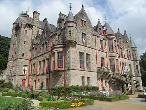
Belfast Castle Trevor Caruth · CC BY-SA 3.0


Travel notes for Carrickfergus
From Wikivoyage
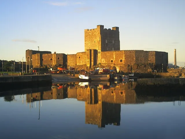
Carrickfergus is a town 12 miles northeast of Belfast, historically in County Antrim, with a population in 2021 of 28,000. Its main attraction is the sturdy 12th-century Norman castle.
Understand+
Carraig Fhearghais means "The rock of Fergus" - Fergus the Great (430-501 AD) was King of Dál Riata and it's said his ship hit a rock here. It became a substantial walled town in the Norman period, acquiring its fine castle. It long pre-dates Belfast, which only outgrew it in the 18th and 19th centuries as metal-bashing industries developed, and ships needed deeper harbours. Until then, Carrickfergus was the place you had to capture to land your troops in Ulster, and the English, Scots and Irish took turns doing so. King William of Orange landed here to campaign against James II / VII, and in 1760 the town was even seized for a few days by French privateers.
The counties of Northern Ireland are no longer units of government, so since 2015 the town has been part of Mid and East Antrim District. It's often abbreviated to "Carrick" but that's a common place name in Ireland, so always specify "Carrickfergus" when organising transport. It's nowadays a commuter town for Belfast, and its fortunes have ebbed and flowed with those of industry and civil stability in Northern Ireland.
Get in+
See Belfast for long-distance travel from Great Britain and the Republic of Ireland.
Trains run every 30 min from Belfast (several stations) via Whiteabbey (for Newtownabbey), taking 35 min to Carrickfergus. Most trains continue to Larne.
1 Carrickfergus railway station is north side of town centre. Trains also stop at Clipperstown a quarter of a mile west, and at Downshire half a mile east towards Larne.
Ulsterbus 563a-f runs hourly M-Sa from Belfast Laganside bus station via High St, Ulster University, Yorkgate, Skegonell, Greencastle, Whiteabbey and Greenisland, taking 40 min to Carrickfergus and continuing up Larne Road to Kilroot.
By road from Belfast follow M2 onto M5 then A2 the Shore Road.
There's free parking at Harbour Car Park next to the castle.
Source: Wikivoyage · CC BY-SA 4.0 · abridged
Twin towns and sister cities of Carrickfergus
- Portsmouth· United States
Source: Wikidata. Only places with a page on this site are shown.
Climate of Carrickfergus
Best months for sightseeingBest months for sightseeing: June–August.
This month · November
A cold month
Day 9° · Night 4° · Rain 89 mm
- Hottest month
- July (day 19°)
- Coldest month
- January (night 2°)
- Wettest month
- January (94 mm)
- Driest month
- May (54 mm)
Bars: average monthly low and high temperature. Below: precipitation. Monthly averages for 1970–2000 at about 18 km resolution, adjusted for elevation. Highlighted months are mild and relatively dry. Source: WorldClim 2.1 (CC BY 4.0).
Show values as a table
| Month | Jan | Feb | Mar | Apr | May | Jun | Jul | Aug | Sep | Oct | Nov | Dec |
|---|---|---|---|---|---|---|---|---|---|---|---|---|
| Average high (°C) | 7° | 7° | 10° | 12° | 15° | 18° | 19° | 19° | 16° | 13° | 9° | 7° |
| Average low (°C) | 2° | 2° | 3° | 4° | 7° | 9° | 11° | 11° | 9° | 7° | 4° | 2° |
| Precipitation (mm) | 94 | 67 | 72 | 58 | 54 | 59 | 67 | 78 | 83 | 94 | 89 | 89 |
How to get to Carrickfergus
The nearest airport is George Best Belfast City Airport (BHD), 12 km to the south as the crow flies. For international flights: Belfast International Airport (BFS) (27 km). The nearest large city is Belfast, 15 km to the southwest.
Airports
- George Best Belfast City Airport (BHD) Belfast 12 kmsouth
- Belfast International Airport (BFS) Belfast 27 kmwest
- Campbeltown Airport (CAL) Campbeltown 81 kmnorth
Nearby large cities
- Belfast Population: 348K 15 kmsouthwest
- Dublin Population: 1M 157 kmsouth
- Glasgow Population: 626.4K 161 kmnortheast
- Blackpool Population: 145K 206 kmsoutheast
- Edinburgh Population: 515K 215 kmnortheast
Straight-line distances; road distances are longer. Airport data: OurAirports.
Day trips from Carrickfergus
Within 100 km: 68 historic and cultural sites, 697 natural sites, 297 lakes, rivers and coasts.
0–25 km69 places
- West Maiden Island 24 kmN
- Lighthouse Island Island 18 kmE
- East Maiden Island 24 kmN
- Copeland Island Island 18 kmE
25–60 km227 places
- Reedy Flat Island 49 kmSW
- Reagh Island Island 25 kmSE
- Rams Island Island 35 kmSW
- Guns Island Island 50 kmS
60–100 km766 places
- Portstewart Beach Beach 78 kmNW
- Benone Beach Beach 85 kmNW
- Portstewart Strand Beach 80 kmNW
- The Skerries Island 77 kmNW
Straight-line distances.
Nearby attractions & nature
Everything nearby-
Carrickfergus Castle Historic site, Mid and East Antrim0.8 km E
-
Lough Mourne Lake, Northern Ireland3.9 km N
-
Slimero Mountain, Mid and East Antrim6.7 km N
-
Carn Hill Mountain, Mid and East Antrim7 km W
-
Belfast Lough Natural site, Northern Ireland4.8 km E
-
Belfast Castle Historic site, Belfast12 km SW
-
Helen's Bay Natural site, Northern Ireland6.5 km SE
-
Castle Chichester Historic site, Mid and East Antrim8 km NE
Other cities and towns in Mid and East Antrim
Sources & licences
Data last updated: · 2 independent sources