Mourne Mountains
Local name: Beanna Boirche
Located in Northern Ireland, United Kingdom Coordinates: 54°10′00″ N 6°05′00″ W
- Elevation
- 364 m
- above sea level
- Local time
- UTC+00:00
- Europe/London · UTC+00:00
- Airports
- BHD George Best Belfast City Airport52 km
- BFS Belfast International Airport55 km
About Mourne Mountains
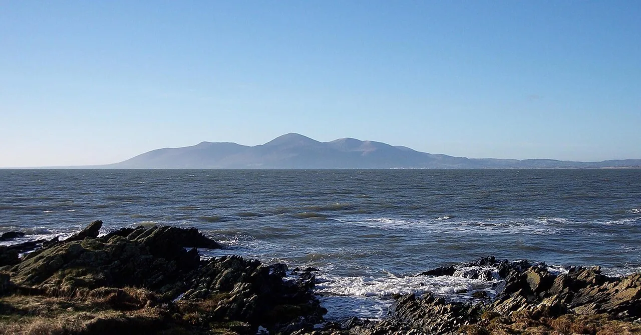
Mourne Mountains is a mountain. Location: Northern Ireland, United Kingdom. Elevation: 364 m.
The Mourne Mountains ( MORN; Irish: Beanna Boirche), also called the Mournes or the Mountains of Mourne, are a predominantly granite mountain range in County Down in the south-east of Northern Ireland. They include the highest mountain in all of Ulster, Slieve Donard at 850 m (2,790 ft). The Mournes are designated an Area of Outstanding Natural Beauty and it has been proposed to make the area Northern Ireland's first national park.
Source: Wikipedia · CC BY-SA 4.0
At a glance
- Heritage designation
- National Landscape
Source: Wikidata
Photos of Mourne Mountains
-

Conall · CC BY 2.0 -

Eric Jones · CC BY-SA 2.0 -

Eric Jones · CC BY-SA 2.0


Climate of Mourne Mountains
Best months for sightseeingBest months for sightseeing: June–August.
This month · November
A wet month
Day 7° · Night 1° · Rain 132 mm
- Hottest month
- July (day 18°)
- Coldest month
- January (night -1°)
- Wettest month
- January (144 mm)
- Driest month
- May (77 mm)
Bars: average monthly low and high temperature. Below: precipitation. Monthly averages for 1970–2000 at about 18 km resolution, adjusted for elevation. Highlighted months are mild and relatively dry. Source: WorldClim 2.1 (CC BY 4.0).
Show values as a table
| Month | Jan | Feb | Mar | Apr | May | Jun | Jul | Aug | Sep | Oct | Nov | Dec |
|---|---|---|---|---|---|---|---|---|---|---|---|---|
| Average high (°C) | 5° | 5° | 8° | 10° | 14° | 16° | 18° | 17° | 15° | 11° | 7° | 5° |
| Average low (°C) | -1° | -1° | 1° | 2° | 4° | 7° | 9° | 9° | 7° | 4° | 1° | 0° |
| Precipitation (mm) | 144 | 106 | 119 | 85 | 77 | 84 | 83 | 108 | 111 | 134 | 132 | 136 |
How to get to Mourne Mountains
The nearest airport is George Best Belfast City Airport (BHD), 52 km to the north as the crow flies. For international flights: Belfast International Airport (BFS) (55 km). The nearest large city is Belfast, 49 km to the north.
Airports
- George Best Belfast City Airport (BHD) Belfast 52 kmnorth
- Belfast International Airport (BFS) Belfast 55 kmnorth
- Dublin Airport (DUB) Dublin 83 kmsouth
Nearby large cities
- Belfast Population: 348K 49 kmnorth
- Dublin Population: 1M 93 kmsouth
- Blackpool Population: 145K 203 kmeast
- Birkenhead Population: 325.3K 220 kmeast
- Liverpool Population: 496.8K 221 kmeast
Straight-line distances; road distances are longer. Airport data: OurAirports.
Day trips from Mourne Mountains
Within 100 km: 186 historic and cultural sites, 366 natural sites, 419 lakes, rivers and coasts.
0–25 km99 places
- Silent Valley Reservoir Lake 7 kmSE
- Lough Shark Lake 25 kmNW
- Lough Shannagh Lake 4 kmE
- Lough Island Reavy Lake 9 kmNE
25–60 km196 places
- Reedy Flat Island 47 kmNW
- Reagh Island Island 47 kmNE
- Rams Island Island 49 kmN
- Guns Island Island 38 kmE
60–100 km676 places
- Rockabill Island 64 kmS
- Pollboy Bridge Landmark 69 kmSW
- Sandymount Strand Beach 93 kmS
- Portmarnock Beach Beach 84 kmS
Straight-line distances.
Nearest towns and villages
-
Hilltown Village, Newry Mourne and Down4.9 km NW
-
Bannvale Village, Newry Mourne and Down4.9 km NW
-
 Rostrevor Village, Newry Mourne and Down11 km SW
-
Rathfriland Village, Armagh City Banbridge and Craigavon11 km NW
-
Square Village, Newry Mourne and Down6.5 km NE
-
Kilcoo Village, Newry Mourne and Down6.5 km NE
Nearby attractions & nature
Everything nearby-
Cock Mountain Mountain, Newry Mourne and Down0.9 km N
-
Pigeon Rock North Mountain, Newry Mourne and Down1.2 km SE
-
Wee Slievemoughan Mountain, Newry Mourne and Down1.4 km SW
-
Sliabh Meascain Mountain, Newry Mourne and Down1.5 km NE
-
Pigeon Rock South Mountain, Newry Mourne and Down1.9 km SE
-
Slievemoughanmore Mountain, Newry Mourne and Down1.9 km S
-
Rocky Mountain Mountain, Newry Mourne and Down1.9 km W
-
Sheep Hill Mountain, Newry Mourne and Down2.9 km W
Sources & licences
Data last updated: · 2 independent sources