Listooder
Local name: Lios an tSúdaire
Located in Newry Mourne and Down, Northern Ireland Coordinates: 54°24′00″ N 5°49′00″ W

- Population
- 31
- 31
- Elevation
- 39 m
- above sea level
- Local time
- UTC+00:00
- Europe/London · UTC+00:00
- Airports
- BHD George Best Belfast City Airport25 km
- BFS Belfast International Airport39 km
About Listooder
Listooder is a village. Location: Newry Mourne and Down, Northern Ireland. Population: 31. Elevation: 39 m.
Listooder is a hamlet and townland situated outside Crossgar towards both Ballynahinch and Saintfield in County Down, Northern Ireland. Listooder derives its name from the Irish word Lios an tSúdaire meaning "fort of the leather tanner" or "ring-fort". From the mid 19th century, the hamlet was known as The Cock, while the townland which centres around the fort was called Listooder. The hamlet has a small working farm, a missionary hall, an Orange Lodge, and a Non-Subscribing Presbyterian church.
Source: Wikipedia · CC BY-SA 4.0
Photos of Listooder
-

Cbowsie at English Wikipedia · CC BY-SA 3.0 -

Cbowsie · CC BY-SA 4.0 -

Cbowsie · CC BY-SA 4.0


Climate of Listooder
Best months for sightseeingBest months for sightseeing: June–August.
This month · November
A cold month
Day 9° · Night 2° · Rain 76 mm
- Hottest month
- July (day 20°)
- Coldest month
- January (night 0°)
- Wettest month
- January (84 mm)
- Driest month
- May (54 mm)
Bars: average monthly low and high temperature. Below: precipitation. Monthly averages for 1970–2000 at about 18 km resolution, adjusted for elevation. Highlighted months are mild and relatively dry. Source: WorldClim 2.1 (CC BY 4.0).
Show values as a table
| Month | Jan | Feb | Mar | Apr | May | Jun | Jul | Aug | Sep | Oct | Nov | Dec |
|---|---|---|---|---|---|---|---|---|---|---|---|---|
| Average high (°C) | 6° | 7° | 10° | 12° | 16° | 18° | 20° | 19° | 17° | 13° | 9° | 6° |
| Average low (°C) | 0° | 1° | 2° | 4° | 6° | 9° | 11° | 11° | 8° | 6° | 2° | 1° |
| Precipitation (mm) | 84 | 60 | 65 | 58 | 54 | 60 | 60 | 76 | 75 | 84 | 76 | 81 |
How to get to Listooder
The nearest airport is George Best Belfast City Airport (BHD), 25 km to the north as the crow flies. For international flights: Belfast International Airport (BFS) (39 km). The nearest large city is Belfast, 23 km to the north.
Airports
- George Best Belfast City Airport (BHD) Belfast 25 kmnorth
- Belfast International Airport (BFS) Belfast 39 kmnorthwest
- Isle of Man Airport (IOM) Castletown, Rushen 85 kmsoutheast
Nearby large cities
- Belfast Population: 348K 23 kmnorth
- Dublin Population: 1M 122 kmsouth
- Glasgow Population: 626.4K 191 kmnortheast
- Blackpool Population: 145K 192 kmeast
- Birkenhead Population: 325.3K 216 kmsoutheast
Straight-line distances; road distances are longer. Airport data: OurAirports.
Day trips from Listooder
Within 100 km: 72 historic and cultural sites, 445 natural sites, 308 lakes, rivers and coasts.
0–25 km62 places
- Reagh Island Island 16 kmNE
- Guns Island Island 21 kmSE
- Castle Island Island 10 kmSE
- Gores Island Island 11 kmE
25–60 km173 places
- West Maiden Island 59 kmN
- Reedy Flat Island 45 kmW
- Rams Island Island 38 kmNW
- Lighthouse Island Island 38 kmNE
60–100 km590 places
- Rockabill Island 90 kmS
- Sanda Island Island 99 kmN
- Isle of Lochnaw Island 73 kmNE
- Kid Islands Island 90 kmNE
Straight-line distances.
Nearby attractions & nature
Everything nearby-
Rowallane Natural site, Newry Mourne and Down5.7 km N
-
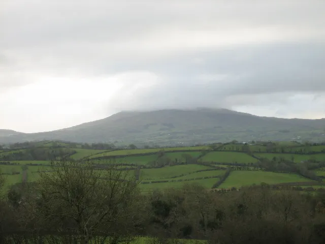 Slieve Croob Mountain, Newry Mourne and Down12 km SW
-
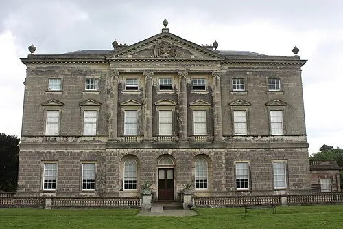 Castle Ward Historic site, Newry Mourne and Down16 km E
-
Castle Island Island, Newry Mourne and Down10 km SE
-
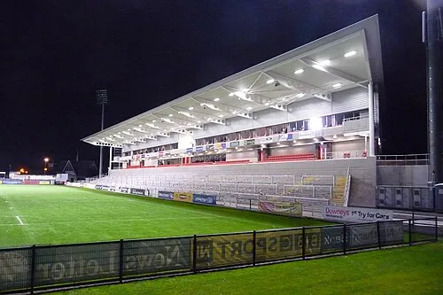 Kingspan Stadium Landmark, Belfast20 km N
-
Sliabh an Uisce Mountain, Newry Mourne and Down12 km SW
Sources & licences
Data last updated: · 2 independent sources