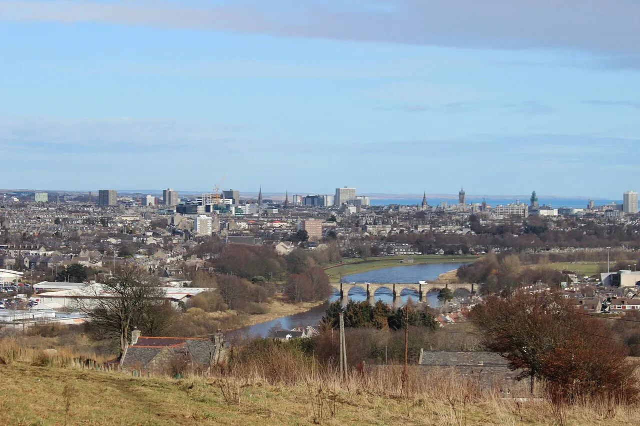
- Population
- 198,590
- 198.6K
- Elevation
- 13 m
- above sea level
- Local time
- UTC+00:00
- Europe/London · UTC+00:00
- Airports
- ABZ Aberdeen International Airport9 km
- DND Dundee Airport96 km
About Aberdeen
Aberdeen is a city. Location: Aberdeen City, Scotland. Population: 198,590. Elevation: 13 m.
Aberdeen is a port city in North East Scotland, and is the third most populous Scottish city. Historically, Aberdeen was within the historic county of Aberdeenshire, but is now separate from the council area of Aberdeenshire. Aberdeen City Council is one of Scotland's 32 local authorities (commonly referred to as councils).
Source: Wikipedia · CC BY-SA 4.0
Photos of Aberdeen
-

Paul Rysz paulrysz · CC0 -

Jim Osley · CC BY-SA 2.0 -

Jim Osley · CC BY-SA 2.0 -

Tom Parnell from Scottish Borders, Scotland · CC BY-SA 2.0 -

Tom Parnell from Scottish Borders, Scotland · CC BY-SA 2.0


Travel notes for Aberdeen
From Wikivoyage
Aberdeen (Scottish Gaelic: Obar Dheathain, Scots: Aiberdeen) is the third-largest city in Scotland, United Kingdom, with a population of almost 200,000 (2018). It is a harbour city on Scotland's north-east coast, approximately 120 miles (190 km) north of Edinburgh and 400 miles (650 km) north of London, where the Rivers Dee and Don meet the North Sea. It is an important sea port, regional centre, and the hub of the North Sea oil industry.
Although remote by UK standards, this is no backwater; Aberdeen is a prosperous and cosmopolitan city (partly due to North Sea oil) and is characterised by its grand and ornate architecture. Most buildings are constructed out of granite quarried in and around the city, and as a result, Aberdeen is often referred to as The Granite City. It is also known for its many outstanding parks, gardens and floral displays throughout the city, and for its long, sandy beach. Aberdeen boasts the title of Oil Capital of Europe and has been voted in several polls as the happiest place in Britain, with a 2006 poll citing access to large areas of greenery and community spirit. It has won the Britain in Bloom competition 10 times.
Understand+
Aberdeen is set in fertile lowlands and is the natural regional centre, becoming a city in 1179 when two villages grew into each other. Old Aberdeen is north, by the mouth of the River Don, and home to the University since 1495. New Aberdeen developed from 1136 two miles south near the mouth of the River Dee: this has a much better harbour and became the city centre. It was bashed about in conflicts until 1745, but then followed a long spell of peace and prosperity. Aberdeen was rebuilt in its signature grey granite along the broad axis of Union Street east-west, which intersects the historic coast road then at Castlegate turns north along King Street. So grand and confident were these buildings, they bankrupted the city in 1817, probably a civic first. Aberdeen recovered through its traditional industries based on farming, fishing, knitware and paper, but by the late 20th century these were in decline. The city was out on a limb, a long way from markets, materials and labour... and then they struck oil.
In the 1960s the North Sea was shown to have commercially exciting reserves of gas to the south and oil to the north, and the quirks of international frontiers awarded Britain the lion's share. This transformed UK politics and the economy, nowhere more so than in Aberdeen. The oilfields lay many miles offshore, but in a relatively shallow sea, and technology advanced to exploit them. Oil was brought ashore at Sullom Voe in Shetland and at Grangemouth on the Firth of Forth. It never came through Aberdeen: the city's role was as a support base for the oil platforms, and centre of industrial innovation as the quest for new fields moved into deeper darker waters. The skies were busy with the chatter of helicopters ferrying workers to and from the rigs. The city was a boom town and property prices soared.
Get in+
By plane:
There are flights to Aberdeen from Amsterdam, Bergen, Burgas, Copenhagen, Dublin, Esbjerg, Gdansk, Geneva, Groningen, Haugesund, Paris CDG, Riga, Oslo, and Stavanger, plus seasonal flights to the Mediterranean.
There's a wide range of UK flights, as Aberdeen is far to reach by rail or road. These include London Heathrow (with BA), London Gatwick and Luton (with easyJet), Belfast, Birmingham, Bristol, Cardiff, Durham, Humberside, Kirkwall on Orkney, Leeds, Manchester, Norwich, Newcastle, Southampton, Stornoway on Lewis, Sumburgh on Shetland, and Wick.
Aberdeen is also a hub for transfers to the weird sounding destinations of Apache, Hurricane, Ineos, and Nexen. These are the names of oil and gas rigs out in the North Sea, served by helicopter from here.
1 Aberdeen International Airport (ABZ IATA) is at Dyce, 7 miles (11 km) northwest from city centre. There are car rental desks here but their stock is limited, best book in advance.
Between airport and city centre, take the bus. Jet 727 is a big blue Stagecoach bus, running every 10-30 min to the main bus station in Union Square, next to the railway station and ferry terminal. It runs daily between 3AM and midnight, taking 30 min. In early 2025, a single ticket costs £3.70 and a return (good for 28 days) costs £6.50. The former direct buses to Stonehaven, Montrose and Peterhead have been axed.
Dyce has a railway station, but it's wrong side of the runway from the terminal, a 45-min walk with no public transport. You could take a taxi there: you'd only do this to pick up a northbound train without going into city centre. The Aberdeen to Inverness trains stop at Dyce, Inverurie, Insch, Huntly, Keith, Forres and Nairn.
A taxi to town costs about £25, and to Dyce £15.
By train:
Wikivoyage has a guide to Rail travel in Great Britain.
Source: Wikivoyage · CC BY-SA 4.0 · abridged
Twin towns and sister cities of Aberdeen
- Houston· United States
- Baku City· Azerbaijan
Source: Wikidata. Only places with a page on this site are shown.
Population of Aberdeen over time
| 1891 | 121,623 | |
|---|---|---|
| 1901 | 153,503 | |
| 1911 | 163,891 | |
| 1921 | 158,963 | |
| 1931 | 167,258 | |
| 1951 | 182,729 | |
| 1961 | 185,390 | |
| 1971 | 182,075 | |
| 1981 | 199,770 | |
| 2001 | 212,125 | |
| 2005 | 202,370 | |
| 2016 | 200,680 |
Censuses and official estimates; source: Wikidata.
Climate of Aberdeen
Best months for sightseeingBest months for sightseeing: June–August.
This month · November
A cold month
Day 8° · Night 2° · Rain 81 mm
- Hottest month
- July (day 19°)
- Coldest month
- January (night -1°)
- Wettest month
- October (82 mm)
- Driest month
- April (52 mm)
Bars: average monthly low and high temperature. Below: precipitation. Monthly averages for 1970–2000 at about 18 km resolution, adjusted for elevation. Highlighted months are mild and relatively dry. Source: WorldClim 2.1 (CC BY 4.0).
Show values as a table
| Month | Jan | Feb | Mar | Apr | May | Jun | Jul | Aug | Sep | Oct | Nov | Dec |
|---|---|---|---|---|---|---|---|---|---|---|---|---|
| Average high (°C) | 5° | 6° | 9° | 11° | 14° | 17° | 19° | 19° | 16° | 12° | 8° | 6° |
| Average low (°C) | -1° | 0° | 2° | 3° | 6° | 8° | 10° | 10° | 8° | 5° | 2° | 0° |
| Precipitation (mm) | 79 | 54 | 58 | 52 | 54 | 55 | 61 | 65 | 71 | 82 | 81 | 74 |
How to get to Aberdeen
The nearest airport is Aberdeen International Airport (ABZ), 9 km to the northwest as the crow flies. The nearest large city is Dundee, 92 km to the southwest.
Airports
- Aberdeen International Airport (ABZ) Aberdeen 9 kmnorthwest
- Dundee Airport (DND) Dundee 96 kmsouthwest
- Inverness Airport (INV) Inverness, Highland 125 kmwest
Nearby large cities
- Dundee Population: 148.2K 92 kmsouthwest
- Edinburgh Population: 515K 149 kmsouthwest
- Glasgow Population: 626.4K 195 kmsouthwest
- Newcastle upon Tyne Population: 300.1K 244 kmsouth
- Sunderland Population: 170.1K 253 kmsouth
Straight-line distances; road distances are longer. Airport data: OurAirports.
Day trips from Aberdeen
Within 100 km: 63 historic and cultural sites, 1,363 natural sites, 233 lakes, rivers and coasts.
0–25 km138 places
- Balbithan Island Island 18 kmNW
- Newburgh Seals Beach Beach 20 kmN
- Aberdeen Beach Beach 2 kmNE
- Inch Geck Island 23 kmN
25–60 km492 places
- Keith Inch Island 45 kmNE
- The Donnons Island 34 kmNE
- Dundonnie Island 40 kmNE
- Logg Island Island 51 kmNW
60–100 km1,029 places
- Findlays Seat Mountain 81 kmNW
- Lossiemouth East Beach Beach 96 kmNW
- Sunnyside Beach Beach 74 kmNW
- Island of Dundurcas Island 79 kmNW
Straight-line distances.
Aberdeen and similar cities
Side by side with cities of similar size in the same country: population, elevation and climate.
| Measure | Aberdeen | Dudley | Swindon | Portsmouth |
|---|---|---|---|---|
| Population | 198.6K | 199.1K | 201.7K | 208.1K |
| Elevation | 13 m | 161 m | 113 m | 6 m |
| Summer day (hottest month) | 19° | 20° | 21° | 22° |
| Winter night (coldest month) | -1° | 1° | 1° | 2° |
| Annual rainfall | 786 mm | 1,073 mm | 683 mm | 805 mm |
| Best months | Jun–Aug | Jun–Aug | Jun–Aug | Jun–Aug |
| Distance | — | 517 km | 622 km | 709 km |
Climate values are 1970–2000 monthly averages; straight-line distance.
Nearby attractions & nature
Everything nearby-
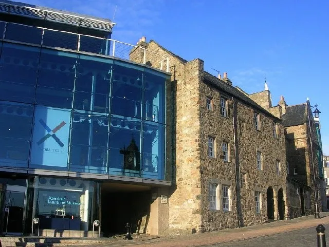 Aberdeen Maritime Museum Museum, Aberdeen City0.4 km NE
-
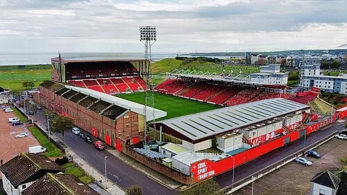 Pittodrie Stadium Landmark, Aberdeen City1.8 km N
-
Torry Mountain, Aberdeen City1.4 km SE
-
Aberdeen Beach Beach, Aberdeen City1.7 km NE
-
River Dee River, Aberdeen City0.7 km S
-
Aberdeen Bay Natural site, Aberdeen City2 km E
-
Girdle Ness Natural site, Aberdeen City3.2 km E
-
Greg Ness Natural site, Aberdeen City3.4 km SE
Sources & licences
Data last updated: · 2 independent sources