- Elevation
- 732 m
- above sea level
- Local time
- UTC+00:00
- Europe/London · UTC+00:00
- Airports
- INV Inverness Airport66 km
- DND Dundee Airport71 km
About Meall an t-Slugain
Meall an t-Slugain is a mountain. Location: Aberdeenshire, Scotland. Elevation: 732 m. The best months to visit are July. The nearest airport is Inverness Airport (66 km). Nearby sights include Carn na Craoibhe Seileich and Creag an Dail Mhor.
Photos of Meall an t-Slugain
-
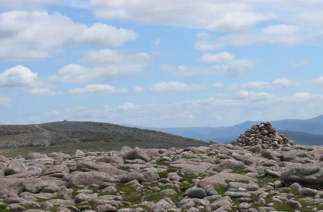
Beinn Bhreac Stuart Meek · CC BY-SA 2.0 -
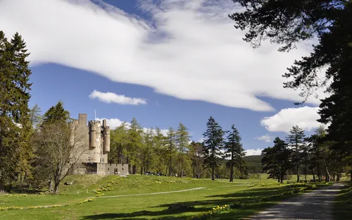
Braemar Castle Paul Hermans · CC BY-SA 3.0


Climate of Meall an t-Slugain
Best months for sightseeingBest months for sightseeing: July.
This month · November
A wet month
Day 4° · Night -1° · Rain 139 mm
- Hottest month
- July (day 16°)
- Coldest month
- February (night -4°)
- Wettest month
- January (169 mm)
- Driest month
- July (77 mm)
Bars: average monthly low and high temperature. Below: precipitation. Monthly averages for 1970–2000 at about 18 km resolution, adjusted for elevation. Highlighted months are mild and relatively dry. Source: WorldClim 2.1 (CC BY 4.0).
Show values as a table
| Month | Jan | Feb | Mar | Apr | May | Jun | Jul | Aug | Sep | Oct | Nov | Dec |
|---|---|---|---|---|---|---|---|---|---|---|---|---|
| Average high (°C) | 2° | 2° | 4° | 7° | 11° | 14° | 16° | 15° | 12° | 8° | 4° | 3° |
| Average low (°C) | -3° | -4° | -2° | -1° | 2° | 5° | 7° | 7° | 5° | 2° | -1° | -3° |
| Precipitation (mm) | 169 | 110 | 121 | 81 | 82 | 78 | 77 | 92 | 120 | 149 | 139 | 140 |
Other places to visit in this season: July
How to get to Meall an t-Slugain
The nearest airport is Inverness Airport (INV), 66 km to the northwest as the crow flies. For international flights: Aberdeen International Airport (ABZ) (77 km). The nearest large city is Dundee, 70 km to the southeast.
Airports
- Inverness Airport (INV) Inverness, Highland 66 kmnorthwest
- Dundee Airport (DND) Dundee 71 kmsouth
- Aberdeen International Airport (ABZ) Aberdeen 77 kmeast
Nearby large cities
- Dundee Population: 148.2K 70 kmsoutheast
- Aberdeen Population: 198.6K 82 kmeast
- Edinburgh Population: 515K 123 kmsouth
- Glasgow Population: 626.4K 141 kmsouth
- Newcastle upon Tyne Population: 300.1K 257 kmsoutheast
Straight-line distances; road distances are longer. Airport data: OurAirports.
Day trips from Meall an t-Slugain
Within 100 km: 93 historic and cultural sites, 3,401 natural sites, 622 lakes, rivers and coasts.
0–25 km460 places
- Loch Vrotachan Lake 17 kmS
- Loch Tilt Lake 20 kmSW
- Loch Muick Lake 21 kmSE
- Loch Morlich Lake 21 kmNW
25–60 km1,511 places
- Findlays Seat Mountain 60 kmN
- Island of Dundurcas Island 57 kmN
- Eilean nan Clach Island 52 kmNW
- Isle of Moy Island 52 kmNW
60–100 km2,145 places
- Balbithan Island Island 70 kmE
- Lossiemouth East Beach Beach 76 kmN
- Sunnyside Beach Beach 82 kmNE
- Newburgh Seals Beach Beach 93 kmE
Straight-line distances.
Nearest towns and villages
-
Braemar Village, Aberdeenshire4.9 km SE
-
Auchendryne Neighbourhood, Aberdeenshire4.8 km SE
-
Corriemulzie Village, Aberdeenshire6.8 km S
-
Muir Village, Aberdeenshire8.9 km SW
-
Inverey Village, Aberdeenshire9.4 km S
-
Newbigging Village, Aberdeenshire11 km S
Nearby attractions & nature
Everything nearby-
Carn na Craoibhe Seileich Mountain, Aberdeenshire0.9 km N
-
Creag an Dail Mhor Mountain, Aberdeenshire2.5 km N
-
Carn Fiaclach Mountain, Aberdeenshire2.6 km NW
-
Creag a' Chleirich Mountain, Aberdeenshire2.8 km SE
-
Little Craigandal Mountain, Aberdeenshire3.9 km NE
-
Carn Elrig Mor Mountain, Aberdeenshire3.4 km SW
-
Carn Eas Mountain, Aberdeenshire3.5 km N
-
Creag an Dail Bheag Mountain, Aberdeenshire3.9 km NE
More nature in United Kingdom
-
Beinn Bhreac Mountain, Aberdeenshire6.9 km W
-
Little Elrick Mountain, Aberdeenshire3.9 km E
-
A' Chioch Mountain, Aberdeenshire4.1 km NW
-
Carn Liath Mountain, Aberdeenshire4.3 km NE
-
Ben Avon Mountain, Aberdeenshire4.3 km N
-
Beinn a' Bhuird South Top Mountain, Aberdeenshire4.5 km NW
Sources & licences
Data last updated: