- Elevation
- 740 m
- above sea level
- Local time
- UTC+00:00
- Europe/London · UTC+00:00
- Airports
- DND Dundee Airport42 km
- ABZ Aberdeen International Airport81 km
About Badandun Hill
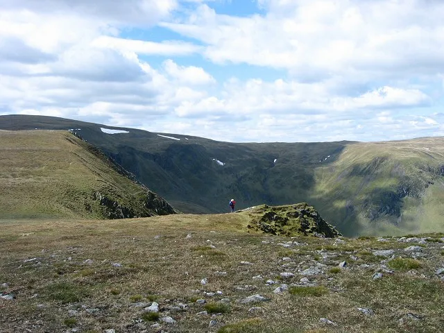
Badandun Hill is a mountain. Location: Angus, Scotland. Elevation: 740 m. The best months to visit are July. The nearest airport is Dundee Airport (42 km). Nearby sights include Craig Lair and Fore Brae.
Climate of Badandun Hill
Best months for sightseeingBest months for sightseeing: July.
This month · November
A cold month
Day 4° · Night -2° · Rain 99 mm
- Hottest month
- July (day 15°)
- Coldest month
- January (night -4°)
- Wettest month
- January (125 mm)
- Driest month
- April (61 mm)
Bars: average monthly low and high temperature. Below: precipitation. Monthly averages for 1970–2000 at about 18 km resolution, adjusted for elevation. Highlighted months are mild and relatively dry. Source: WorldClim 2.1 (CC BY 4.0).
Show values as a table
| Month | Jan | Feb | Mar | Apr | May | Jun | Jul | Aug | Sep | Oct | Nov | Dec |
|---|---|---|---|---|---|---|---|---|---|---|---|---|
| Average high (°C) | 2° | 2° | 4° | 7° | 10° | 13° | 15° | 15° | 11° | 8° | 4° | 3° |
| Average low (°C) | -4° | -4° | -3° | -1° | 1° | 4° | 6° | 6° | 4° | 1° | -2° | -3° |
| Precipitation (mm) | 125 | 79 | 86 | 61 | 67 | 64 | 63 | 72 | 91 | 112 | 99 | 102 |
Other places to visit in this season: July
How to get to Badandun Hill
The nearest airport is Dundee Airport (DND), 42 km to the southeast as the crow flies. For international flights: Aberdeen International Airport (ABZ) (81 km). The nearest large city is Dundee, 41 km to the southeast.
Airports
- Dundee Airport (DND) Dundee 42 kmsoutheast
- Aberdeen International Airport (ABZ) Aberdeen 81 kmnortheast
- Edinburgh Airport (EDI) Ingliston, Edinburgh 94 kmsouth
Nearby large cities
- Dundee Population: 148.2K 41 kmsoutheast
- Aberdeen Population: 198.6K 83 kmnortheast
- Edinburgh Population: 515K 94 kmsouth
- Glasgow Population: 626.4K 119 kmsouthwest
- Newcastle upon Tyne Population: 300.1K 229 kmsoutheast
Straight-line distances; road distances are longer. Airport data: OurAirports.
Day trips from Badandun Hill
Within 100 km: 141 historic and cultural sites, 3,251 natural sites, 627 lakes, rivers and coasts.
0–25 km426 places
- Stanners Island Island 21 kmSE
- Loch Wharral Lake 16 kmE
- Loch Vrotachan Lake 14 kmNW
- Loch Valigan Lake 23 kmW
25–60 km1,374 places
- Mugdrum Island Island 50 kmS
- Moncreiffe Island Island 46 kmS
- Isle of Spar Island 49 kmSW
- Eilean nan Ubh Island 47 kmSW
60–100 km2,219 places
- Balbithan Island Island 77 kmNE
- Findlays Seat Mountain 86 kmN
- Newburgh Seals Beach Beach 98 kmNE
- Aberdeen Beach Beach 84 kmNE
Straight-line distances.
Nearest towns and villages
-
Little Forter Village, Angus3.4 km SW
-
Forter Village, Angus3.7 km SW
-
Meikle Forter Village, Angus4.1 km SW
-
Folda Village, Angus4.6 km S
-
Inverharity Village, Angus5.2 km S
-
Hole Village, Angus6.9 km SE
Nearby attractions & nature
Everything nearby-
Craig Lair Mountain, Angus1.9 km NE
-
Fore Brae Mountain, Angus1.9 km N
-
Bodnasparet Mountain, Angus2.2 km NE
-
Creagan Caise Hill Mountain, Angus2.8 km W
-
Mid Hill Mountain, Angus3.3 km N
-
Bada na Goibhre Mountain, Angus3.3 km E
-
Auchintaple Loch Lake, Angus3.3 km S
-
Carn an Fhidhleir Mountain, Angus4.1 km SW
More nature in United Kingdom
-
Glen Damff Natural site, Angus5.2 km E
-
Glen Brighty Natural site, Angus6.1 km NW
-
 Monega Hill Mountain, Angus8 km N
-
Craigie Thieves Mountain, Angus4.2 km NE
-
Monamenach Mountain, Angus4.2 km NW
-
Cairn Doos Mountain, Angus4.3 km NW
Sources & licences
Data last updated: