Barr a' Ghlaoigh Mor
Located in Argyll and Bute, Scotland Coordinates: 56°22′57″ N 5°09′05″ W
- Elevation
- 193 m
- above sea level
- Local time
- UTC+00:00
- Europe/London · UTC+00:00
- Airports
- GLA Glasgow Airport72 km
- ILY Islay Airport104 km
About Barr a' Ghlaoigh Mor
Barr a' Ghlaoigh Mor is a mountain. Location: Argyll and Bute, Scotland. Elevation: 193 m. The best months to visit are July. The nearest airport is Glasgow Airport (72 km). Nearby sights include Creag Thulach and Meall an Fhithich.
Photos of Barr a' Ghlaoigh Mor
-
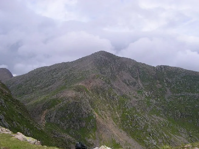
Ben Cruachan The original uploader was Grinner at English Wikipedia · CC BY-SA 3.0 -
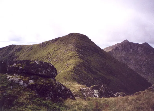
Stob Diamh bill copland · CC BY-SA 2.0 -
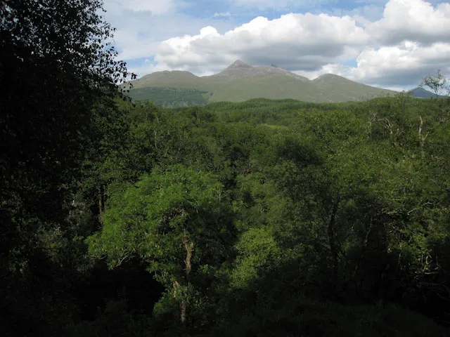
Glen Nant Hugh Venables · CC BY-SA 2.0


Climate of Barr a' Ghlaoigh Mor
Best months for sightseeingBest months for sightseeing: July.
This month · November
A wet month
Day 8° · Night 3° · Rain 213 mm
- Hottest month
- July (day 17°)
- Coldest month
- February (night 1°)
- Wettest month
- January (230 mm)
- Driest month
- May (96 mm)
Bars: average monthly low and high temperature. Below: precipitation. Monthly averages for 1970–2000 at about 18 km resolution, adjusted for elevation. Highlighted months are mild and relatively dry. Source: WorldClim 2.1 (CC BY 4.0).
Show values as a table
| Month | Jan | Feb | Mar | Apr | May | Jun | Jul | Aug | Sep | Oct | Nov | Dec |
|---|---|---|---|---|---|---|---|---|---|---|---|---|
| Average high (°C) | 6° | 6° | 7° | 10° | 14° | 16° | 17° | 17° | 14° | 11° | 8° | 6° |
| Average low (°C) | 1° | 1° | 2° | 3° | 6° | 9° | 11° | 11° | 9° | 6° | 3° | 2° |
| Precipitation (mm) | 230 | 150 | 171 | 105 | 96 | 98 | 115 | 137 | 185 | 211 | 213 | 216 |
Other places to visit in this season: July
How to get to Barr a' Ghlaoigh Mor
The nearest airport is Glasgow Airport (GLA), 72 km to the southeast as the crow flies. The nearest large city is Glasgow, 80 km to the southeast.
Airports
- Glasgow Airport (GLA) Glasgow 72 kmsoutheast
- Islay Airport (ILY) Isle of Islay, Argyll and Bute 104 kmsouthwest
- Glasgow Prestwick Airport (PIK) Prestwick, South Ayrshire 104 kmsouth
Nearby large cities
- Glasgow Population: 626.4K 80 kmsoutheast
- Edinburgh Population: 515K 131 kmeast
- Dundee Population: 148.2K 135 kmeast
- Aberdeen Population: 198.6K 205 kmnortheast
- Belfast Population: 348K 205 kmsouth
Straight-line distances; road distances are longer. Airport data: OurAirports.
Day trips from Barr a' Ghlaoigh Mor
Within 100 km: 106 historic and cultural sites, 4,000 natural sites, 1,393 lakes, rivers and coasts.
0–25 km540 places
- Eriska Island 23 kmNW
- Inishail Island 5 kmSE
- Fraoch Eilean Island 6 kmE
- Eilean Dubh Island 25 kmNW
25–60 km1,981 places
- Scarba Island 41 kmSW
- Oronsay Island 57 kmNW
- Cala Island 50 kmSW
- Torsa Island Island 32 kmSW
60–100 km2,978 places
- Isle of Arran Island 87 kmS
- Great Cumbrae Island Island 70 kmS
- Colonsay Island 75 kmSW
- Eigg Island 85 kmNW
Straight-line distances.
Nearest towns and villages
-
Kilchrenan Village, Argyll and Bute3.3 km SW
-
Ardanaiseig Village, Argyll and Bute3.3 km E
-
Hayfield Village, Argyll and Bute4.2 km SE
-
Ardbrecknish Village, Argyll and Bute4.7 km S
-
Bridge of Awe Village, Argyll and Bute4.8 km NW
-
Portsonachan Village, Argyll and Bute4.9 km S
Nearby attractions & nature
Everything nearby-
Creag Thulach Mountain, Argyll and Bute1.1 km E
-
Meall an Fhithich Mountain, Argyll and Bute1.2 km N
-
Cnoc Dubh Loch Mountain, Argyll and Bute1.4 km W
-
Eilean Tighe Bhàin Island, Argyll and Bute1.4 km SW
-
Cnoc Lomain Mountain, Argyll and Bute1.8 km SW
-
Creag an Aonaich Mountain, Argyll and Bute2.2 km N
-
Cnoc Lochan a' Bhealaich Mountain, Argyll and Bute2.4 km NW
-
Loch Tromlee Lake, Argyll and Bute2 km SW
More nature in United Kingdom
-
Ben Cruachan Mountain, Argyll and Bute5 km N
-
Glen Nant Natural site, Argyll and Bute4.5 km NW
-
Stob Diamh Mountain, Argyll and Bute6.5 km NE
-
Caisteal Suidhe Cheannaidh Mountain, Argyll and Bute2.9 km SW
-
Cruach Achadh na Craoibhe Mountain, Argyll and Bute3.3 km W
-
Creag Bhainneach Mountain, Argyll and Bute3.5 km NW
Sources & licences
Data last updated: