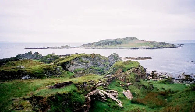
- Elevation
- 18 m
- above sea level
- Local time
- UTC+00:00
- Europe/London · UTC+00:00
- Airports
- ILY Islay Airport20 km
- CAL Campbeltown Airport44 km
About Brosdale Island
Brosdale Island is an island. Location: Argyll and Bute, Scotland.
Brosdale Island is an uninhabited island in the council area of Argyll and Bute, Scotland. It is 1.25 miles from Jura House on Jura. It is about 1/4 of a mile long and 1/4 of a mile wide. The earliest comprehensive written list of Hebridean island names was undertaken in the 16th century by Donald Monro in his 16th century Description of the Western Isles of Scotland. Brosdale is not mentioned by name although there is a laconic entry referring to a Hasil Iyle "which in the Erish is callit Ellan-na-Crawiche". R.
Source: Wikipedia · CC BY-SA 4.0
Photos of Brosdale Island
-
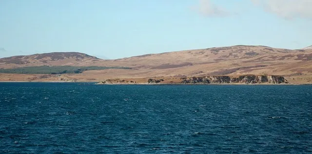
Am Fraoch Eilean Mary and Angus Hogg · CC BY-SA 2.0

Climate of Brosdale Island
Best months for sightseeingBest months for sightseeing: June–August.
This month · November
A wet month
Day 10° · Night 6° · Rain 171 mm
- Hottest month
- July (day 18°)
- Coldest month
- February (night 4°)
- Wettest month
- January (188 mm)
- Driest month
- May (71 mm)
Bars: average monthly low and high temperature. Below: precipitation. Monthly averages for 1970–2000 at about 18 km resolution, adjusted for elevation. Highlighted months are mild and relatively dry. Source: WorldClim 2.1 (CC BY 4.0).
Show values as a table
| Month | Jan | Feb | Mar | Apr | May | Jun | Jul | Aug | Sep | Oct | Nov | Dec |
|---|---|---|---|---|---|---|---|---|---|---|---|---|
| Average high (°C) | 8° | 8° | 9° | 11° | 14° | 16° | 18° | 18° | 16° | 13° | 10° | 8° |
| Average low (°C) | 4° | 4° | 4° | 5° | 8° | 10° | 12° | 12° | 10° | 8° | 6° | 4° |
| Precipitation (mm) | 188 | 112 | 144 | 89 | 71 | 80 | 101 | 119 | 152 | 171 | 171 | 168 |
How to get to Brosdale Island
The nearest airport is Islay Airport (ILY), 20 km to the southwest as the crow flies. For international flights: Glasgow Prestwick Airport (PIK) (95 km). The nearest large city is Glasgow, 109 km to the east.
Airports
- Islay Airport (ILY) Isle of Islay, Argyll and Bute 20 kmsouthwest
- Campbeltown Airport (CAL) Campbeltown 44 kmsoutheast
- Glasgow Prestwick Airport (PIK) Prestwick, South Ayrshire 95 kmeast
Nearby large cities
- Glasgow Population: 626.4K 109 kmeast
- Belfast Population: 348K 133 kmsouth
- Edinburgh Population: 515K 176 kmeast
- Dundee Population: 148.2K 202 kmnortheast
- Dublin Population: 1M 274 kmsouth
Straight-line distances; road distances are longer. Airport data: OurAirports.
Day trips from Brosdale Island
Within 100 km: 77 historic and cultural sites, 1,840 natural sites, 989 lakes, rivers and coasts.
0–25 km318 places
- Texa Island Island 22 kmSW
- Eilean Mór Island 22 kmNE
- Jura Island 24 kmN
- Islay Island 13 kmW
25–60 km916 places
- Isle of Arran Island 51 kmSE
- Colonsay Island 34 kmNW
- Kiloran Beach Beach 37 kmN
- Scarba Island 47 kmN
60–100 km1,672 places
- Great Cumbrae Island Island 67 kmE
- Ayr Beach Beach 93 kmSE
- Troon Beach Beach 88 kmE
- Hunterston Sands Beach 69 kmE
Straight-line distances.
Nearest towns and villages
-
Ardfin Village, Argyll and Bute2.1 km NW
-
Craighouse Village, Argyll and Bute5.5 km NE
-
 Keils Village, Argyll and Bute6.6 km N
-
Ardtalla Village, Argyll and Bute8.4 km S
-
Feolin Ferry Village, Argyll and Bute8.9 km NW
-
Isle of Jura Village, Argyll and Bute13 km N
Nearby attractions & nature
Everything nearby-
Aonach Cumhang Mountain, Argyll and Bute1.2 km NE
-
Am Fraoch Eilean Island, Argyll and Bute2.9 km W
-
Am Plòth Island, Argyll and Bute2.7 km W
-
Brat Bheinn Mountain, Argyll and Bute3.9 km N
-
Crackaig Hill Mountain, Argyll and Bute4.1 km NE
-
Cnoc Reamhar Mountain, Argyll and Bute4.4 km NW
-
McArthurs Head Natural site, Scotland3.6 km SW
-
Dubh Bheinn Mountain, Argyll and Bute6 km N
Sources & licences
Data last updated: · 2 independent sources