- Elevation
- 813 m
- above sea level
- Local time
- UTC+00:00
- Europe/London · UTC+00:00
- Airports
- GLA Glasgow Airport44 km
- PIK Glasgow Prestwick Airport81 km
About Cruach nam Miseag
Cruach nam Miseag is a mountain. Location: Argyll and Bute, Scotland. Elevation: 813 m. The nearest airport is Glasgow Airport (44 km). Nearby sights include Beinn Narnain and Creag Tharsuinn.
Photos of Cruach nam Miseag
-
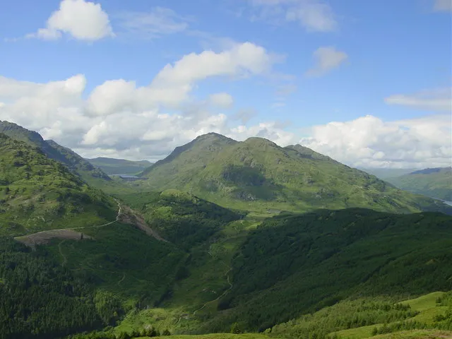
Ben Vorlich Alan White · CC BY-SA 2.0 -
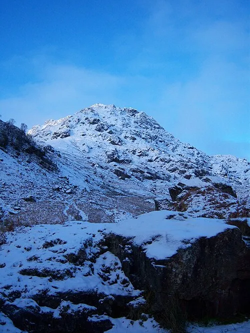
Ben Vane Graham Lewis · CC BY 2.0 -
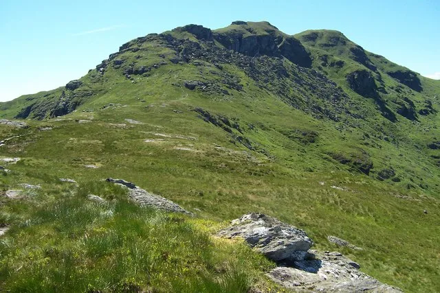
Ben Donich Gordon Wilson · CC BY-SA 2.0 -
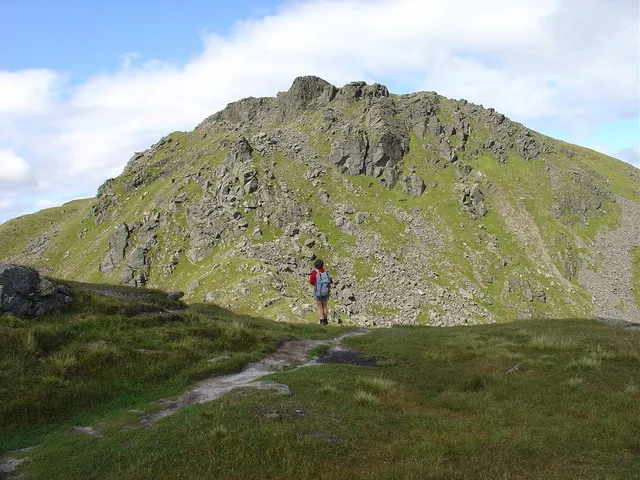
Beinn Narnain Alan White · CC BY-SA 2.0


Climate of Cruach nam Miseag
This month · November
A wet month
Day 4° · Night -1° · Rain 228 mm
- Hottest month
- July (day 13°)
- Coldest month
- January (night -3°)
- Wettest month
- January (258 mm)
- Driest month
- June (105 mm)
Bars: average monthly low and high temperature. Below: precipitation. Monthly averages for 1970–2000 at about 18 km resolution, adjusted for elevation. Highlighted months are mild and relatively dry. Source: WorldClim 2.1 (CC BY 4.0).
Show values as a table
| Month | Jan | Feb | Mar | Apr | May | Jun | Jul | Aug | Sep | Oct | Nov | Dec |
|---|---|---|---|---|---|---|---|---|---|---|---|---|
| Average high (°C) | 2° | 2° | 3° | 6° | 9° | 11° | 13° | 13° | 10° | 7° | 4° | 2° |
| Average low (°C) | -3° | -3° | -2° | -1° | 2° | 4° | 6° | 6° | 5° | 2° | -1° | -3° |
| Precipitation (mm) | 258 | 168 | 185 | 111 | 111 | 105 | 120 | 145 | 198 | 231 | 228 | 233 |
How to get to Cruach nam Miseag
The nearest airport is Glasgow Airport (GLA), 44 km to the southeast as the crow flies. The nearest large city is Glasgow, 51 km to the southeast.
Airports
- Glasgow Airport (GLA) Glasgow 44 kmsoutheast
- Glasgow Prestwick Airport (PIK) Prestwick, South Ayrshire 81 kmsouth
- Edinburgh Airport (EDI) Ingliston, Edinburgh 93 kmeast
Nearby large cities
- Glasgow Population: 626.4K 51 kmsoutheast
- Edinburgh Population: 515K 103 kmeast
- Dundee Population: 148.2K 115 kmeast
- Aberdeen Population: 198.6K 194 kmnortheast
- Belfast Population: 348K 195 kmsouth
Straight-line distances; road distances are longer. Airport data: OurAirports.
Day trips from Cruach nam Miseag
Within 100 km: 139 historic and cultural sites, 3,837 natural sites, 1,324 lakes, rivers and coasts.
0–25 km451 places
- Inishail Island 25 kmNW
- Inchlonaig Island 17 kmSE
- Inchcailloch Island 21 kmSE
- Fraoch Eilean Island 25 kmNW
25–60 km1,942 places
- Great Cumbrae Island Island 51 kmS
- Hunterston Sands Beach 55 kmS
- Scarba Island 58 kmW
- Eriska Island 52 kmNW
60–100 km2,907 places
- Isle of Arran Island 75 kmSW
- Colonsay Island 91 kmW
- Ayr Beach Beach 85 kmS
- Troon Beach Beach 76 kmS
Straight-line distances.
Nearest towns and villages
-
Succoth Village, Argyll and Bute2.3 km SE
-
Arrochar Village, Argyll and Bute3.3 km SE
-
Ardgartan Village, Argyll and Bute3.4 km S
-
Tarbet Village, Argyll and Bute4.5 km SE
-
Inveruglas Village, Argyll and Bute5.3 km NE
-
Inversnaid Village, Stirling6.6 km NE
Nearby attractions & nature
Everything nearby-
Beinn Narnain Mountain, Argyll and Bute0.6 km NW
-
Creag Tharsuinn Mountain, Argyll and Bute1 km N
-
An t-Sron Mountain, Argyll and Bute1.4 km SW
-
The Cobbler North Peak Mountain, Argyll and Bute1.5 km W
-
A' Chrois Mountain, Argyll and Bute1.8 km NE
-
Ben Arthur Mountain, Argyll and Bute1.8 km W
-
Ben Vane Mountain, Argyll and Bute3.5 km N
-
Glen Loin Natural site, Argyll and Bute3 km E
More nature in United Kingdom
-
Ben Vorlich Mountain, Argyll and Bute6.4 km N
-
Ben Donich Mountain, Argyll and Bute6.1 km W
-
Beinn Ime Mountain, Argyll and Bute3 km NW
-
Dubh Chnoc Mountain, Argyll and Bute3.5 km NE
-
Cruach Tairbeirt Mountain, Argyll and Bute3.7 km E
-
Beinn Luibhean Mountain, Argyll and Bute3.7 km W
Sources & licences
Data last updated: