- Elevation
- 11 m
- above sea level
- Local time
- UTC+00:00
- Europe/London · UTC+00:00
- Airports
- GLA Glasgow Airport37 km
- PIK Glasgow Prestwick Airport71 km
About Glenmallan
Glenmallan is a village. Location: Argyll and Bute, Scotland. Elevation: 11 m.
Glenmallan is a settlement in Argyll and Bute, Scotland, on the shore of Loch Long. It has a population of under 1000, and its coordinates are latitude 56° 07' 34" N, longitude 4° 48' 54" W. The jetty at Glenmallan was upgraded in 2019 and it is able to take the Royal Navy's largest aircraft carriers, the Queen Elizabeth-class.
Source: Wikipedia · CC BY-SA 4.0
Climate of Glenmallan
Best months for sightseeingBest months for sightseeing: June–August.
This month · November
A wet month
Day 10° · Night 4° · Rain 204 mm
- Hottest month
- July (day 18°)
- Coldest month
- February (night 2°)
- Wettest month
- January (229 mm)
- Driest month
- June (95 mm)
Bars: average monthly low and high temperature. Below: precipitation. Monthly averages for 1970–2000 at about 18 km resolution, adjusted for elevation. Highlighted months are mild and relatively dry. Source: WorldClim 2.1 (CC BY 4.0).
Show values as a table
| Month | Jan | Feb | Mar | Apr | May | Jun | Jul | Aug | Sep | Oct | Nov | Dec |
|---|---|---|---|---|---|---|---|---|---|---|---|---|
| Average high (°C) | 7° | 7° | 9° | 11° | 15° | 17° | 18° | 18° | 16° | 12° | 10° | 8° |
| Average low (°C) | 3° | 2° | 3° | 4° | 7° | 10° | 12° | 12° | 10° | 7° | 4° | 3° |
| Precipitation (mm) | 229 | 149 | 164 | 100 | 100 | 95 | 110 | 132 | 180 | 207 | 204 | 208 |
How to get to Glenmallan
The nearest airport is Glasgow Airport (GLA), 37 km to the southeast as the crow flies. The nearest large city is Glasgow, 46 km to the southeast.
Airports
- Glasgow Airport (GLA) Glasgow 37 kmsoutheast
- Glasgow Prestwick Airport (PIK) Prestwick, South Ayrshire 71 kmsouth
- Edinburgh Airport (EDI) Ingliston, Edinburgh 92 kmeast
Nearby large cities
- Glasgow Population: 626.4K 46 kmsoutheast
- Edinburgh Population: 515K 103 kmeast
- Dundee Population: 148.2K 120 kmeast
- Belfast Population: 348K 184 kmsouthwest
- Aberdeen Population: 198.6K 202 kmnortheast
Straight-line distances; road distances are longer. Airport data: OurAirports.
Nearby attractions & nature
Everything nearby-
Sron Mallanach Mountain, Argyll and Bute1.3 km NE
-
Beinn Bhreac Mountain, Argyll and Bute1.7 km SE
-
Craggan Hill Mountain, Argyll and Bute2.4 km NE
-
The Saddle Mountain, Argyll and Bute2.4 km W
-
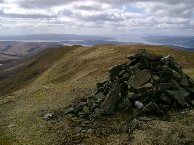 Beinn a' Mhanaich Mountain, Argyll and Bute2.6 km SE
-
Cruach an t-Sidhein Mountain, Argyll and Bute2.6 km E
Sources & licences
Data last updated: · 2 independent sources