- Elevation
- 1 m
- above sea level
- Local time
- UTC+00:00
- Europe/London · UTC+00:00
- Airports
- ILY Islay Airport20 km
- CAL Campbeltown Airport52 km
About Lily Loch
Lily Loch is a lake. Location: Argyll and Bute, Scotland. Elevation: 1 m. The best months to visit are June–August. The nearest airport is Islay Airport (20 km). Nearby sights include Loch Allan and Cnoc Abhail.
Climate of Lily Loch
Best months for sightseeingBest months for sightseeing: June–August.
This month · November
A wet month
Day 10° · Night 6° · Rain 191 mm
- Hottest month
- July (day 18°)
- Coldest month
- February (night 4°)
- Wettest month
- January (210 mm)
- Driest month
- May (78 mm)
Bars: average monthly low and high temperature. Below: precipitation. Monthly averages for 1970–2000 at about 18 km resolution, adjusted for elevation. Highlighted months are mild and relatively dry. Source: WorldClim 2.1 (CC BY 4.0).
Show values as a table
| Month | Jan | Feb | Mar | Apr | May | Jun | Jul | Aug | Sep | Oct | Nov | Dec |
|---|---|---|---|---|---|---|---|---|---|---|---|---|
| Average high (°C) | 8° | 8° | 9° | 11° | 14° | 16° | 18° | 18° | 16° | 13° | 10° | 8° |
| Average low (°C) | 4° | 4° | 5° | 6° | 8° | 10° | 12° | 12° | 11° | 9° | 6° | 5° |
| Precipitation (mm) | 210 | 126 | 160 | 99 | 78 | 88 | 111 | 130 | 167 | 189 | 191 | 187 |
How to get to Lily Loch
The nearest airport is Islay Airport (ILY), 20 km to the southwest as the crow flies. The nearest large city is Glasgow, 116 km to the east.
Airports
- Islay Airport (ILY) Isle of Islay, Argyll and Bute 20 kmsouthwest
- Campbeltown Airport (CAL) Campbeltown 52 kmsoutheast
- Tiree Airport (TRE) Balemartine, Argyll and Bute 87 kmnorthwest
Nearby large cities
- Glasgow Population: 626.4K 116 kmeast
- Belfast Population: 348K 139 kmsouth
- Edinburgh Population: 515K 183 kmeast
- Dundee Population: 148.2K 207 kmeast
- Dublin Population: 1M 279 kmsouth
Straight-line distances; road distances are longer. Airport data: OurAirports.
Day trips from Lily Loch
Within 100 km: 65 historic and cultural sites, 1,824 natural sites, 980 lakes, rivers and coasts.
0–25 km318 places
- Oronsay Island 22 kmNW
- Texa Island Island 25 kmS
- Eilean nan Ròn Island 20 kmNW
- Jura Island 22 kmNE
25–60 km864 places
- Colonsay Island 26 kmN
- Kiloran Beach Beach 30 kmN
- Scarba Island 46 kmNE
- Cala Island 37 kmNE
60–100 km1,687 places
- Isle of Arran Island 60 kmSE
- Great Cumbrae Island Island 75 kmE
- Troon Beach Beach 97 kmE
- Hunterston Sands Beach 77 kmE
Straight-line distances.
Nearest towns and villages
-
Keills Village, Argyll and Bute1 km W
-
Port Askaig Village, Argyll and Bute1.2 km NE
-
Caol Ila Village, Argyll and Bute1.6 km N
-
Feolin Ferry Village, Argyll and Bute1.7 km NE
-
Ballygrant Village, Argyll and Bute3.6 km SW
-
Kilmeny Village, Argyll and Bute4.5 km SW
Nearby attractions & nature
Everything nearby-
Loch Allan Lake, Argyll and Bute0.5 km S
-
Cnoc Abhail Mountain, Argyll and Bute1.6 km NW
-
Cnoc Reamhar Mountain, Argyll and Bute2.7 km NW
-
Dun Bhorariac Mountain, Argyll and Bute2.7 km S
-
Loch nam Ban Lake, Argyll and Bute2.4 km N
-
Loch nan Cadhan Lake, Argyll and Bute2.6 km SW
-
Loch Ballygrant Lake, Argyll and Bute2.9 km SW
-
Ardnahoe Loch Lake, Argyll and Bute3.3 km N
More lakes, rivers and coasts in United Kingdom
-
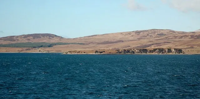 Am Fraoch Eilean Island, Argyll and Bute7 km SE
-
Eilean Mhic Iain Island, Argyll and Bute3.4 km SW
-
Loch Lossit Lake, Argyll and Bute3.5 km SW
-
Loch Staoisha Lake, Argyll and Bute3.6 km NW
-
Eilean Fraoich Island, Argyll and Bute3.7 km SW
-
Eilean Mòr Island, Argyll and Bute3.7 km W
Sources & licences
Data last updated: