- Elevation
- 10 m
- above sea level
- Local time
- UTC+00:00
- Europe/London · UTC+00:00
- Airports
- ILY Islay Airport19 km
- CAL Campbeltown Airport62 km
About Loch an Fhir Mhòr
Loch an Fhir Mhòr is a lake. Location: Argyll and Bute, Scotland. Elevation: 10 m. The best months to visit are June–August. The nearest airport is Islay Airport (19 km). Nearby sights include Airigh Ghlas and Loch Arish.
Photos of Loch an Fhir Mhòr
-
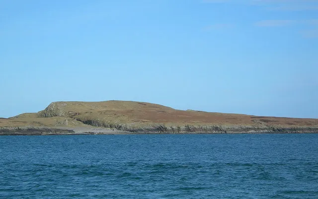
Nave Island Mary and Angus Hogg · CC BY-SA 2.0

Climate of Loch an Fhir Mhòr
Best months for sightseeingBest months for sightseeing: June–August.
This month · November
A wet month
Day 10° · Night 6° · Rain 159 mm
- Hottest month
- August (day 17°)
- Coldest month
- February (night 4°)
- Wettest month
- January (174 mm)
- Driest month
- May (61 mm)
Bars: average monthly low and high temperature. Below: precipitation. Monthly averages for 1970–2000 at about 18 km resolution, adjusted for elevation. Highlighted months are mild and relatively dry. Source: WorldClim 2.1 (CC BY 4.0).
Show values as a table
| Month | Jan | Feb | Mar | Apr | May | Jun | Jul | Aug | Sep | Oct | Nov | Dec |
|---|---|---|---|---|---|---|---|---|---|---|---|---|
| Average high (°C) | 8° | 8° | 9° | 11° | 14° | 15° | 17° | 17° | 16° | 13° | 10° | 9° |
| Average low (°C) | 4° | 4° | 4° | 5° | 8° | 10° | 12° | 12° | 10° | 8° | 6° | 5° |
| Precipitation (mm) | 174 | 106 | 130 | 80 | 61 | 74 | 94 | 112 | 138 | 162 | 159 | 154 |
How to get to Loch an Fhir Mhòr
The nearest airport is Islay Airport (ILY), 19 km to the south as the crow flies. The nearest large city is Glasgow, 132 km to the east.
Airports
- Islay Airport (ILY) Isle of Islay, Argyll and Bute 19 kmsouth
- Campbeltown Airport (CAL) Campbeltown 62 kmsoutheast
- Tiree Airport (TRE) Balemartine, Argyll and Bute 80 kmnorthwest
Nearby large cities
- Glasgow Population: 626.4K 132 kmeast
- Belfast Population: 348K 141 kmsouth
- Edinburgh Population: 515K 199 kmeast
- Dundee Population: 148.2K 222 kmeast
- Dublin Population: 1M 279 kmsouth
Straight-line distances; road distances are longer. Airport data: OurAirports.
Day trips from Loch an Fhir Mhòr
Within 100 km: 51 historic and cultural sites, 1,613 natural sites, 885 lakes, rivers and coasts.
0–25 km213 places
- Oronsay Island 21 kmN
- Eilean nan Ròn Island 19 kmN
- Oversay Island Island 20 kmSW
- Islay Island 12 kmE
25–60 km571 places
- Colonsay Island 27 kmN
- Kiloran Beach Beach 32 kmN
- Scarba Island 56 kmNE
- Cala Island 52 kmE
60–100 km1,765 places
- Isle of Arran Island 75 kmE
- Great Cumbrae Island Island 91 kmE
- Hunterston Sands Beach 93 kmE
- Portstewart Beach Beach 78 kmS
Straight-line distances.
Nearest towns and villages
-
 Sanaigmore Village, Argyll and Bute2.9 km NW
-
Gruinart Village, Argyll and Bute2.9 km SE
-
Kilnave Village, Argyll and Bute2.9 km NE
-
Ardnave Village, Argyll and Bute4.2 km NE
-
Killinallan Village, Argyll and Bute5.5 km NE
-
 Kilchoman Village, Argyll and Bute7.3 km SW
Nearby attractions & nature
Everything nearby-
Airigh Ghlas Mountain, Argyll and Bute0.5 km E
-
Loch Arish Lake, Argyll and Bute1.1 km NE
-
Loch Laingeadail Lake, Argyll and Bute2.1 km N
-
Loch na Làthaich Lake, Argyll and Bute2.1 km N
-
Loch Laingeadail Beag Lake, Argyll and Bute2.4 km N
-
Loch Ruime Lake, Argyll and Bute2.5 km W
-
Sliabh Mor Mountain, Argyll and Bute3.6 km W
-
Loch a' Gheoidh Lake, Argyll and Bute3.6 km S
Sources & licences
Data last updated: