- Elevation
- 357 m
- above sea level
- Local time
- UTC+00:00
- Europe/London · UTC+00:00
- Airports
- PIK Glasgow Prestwick Airport36 km
- GLA Glasgow Airport75 km
About Craigmawhannal
Craigmawhannal is a mountain. Location: East Ayrshire, Scotland. Elevation: 357 m. The best months to visit are July. The nearest airport is Glasgow Prestwick Airport (36 km). Nearby sights include Craigfionn and Craigmawhannal North Top.
Photos of Craigmawhannal
-
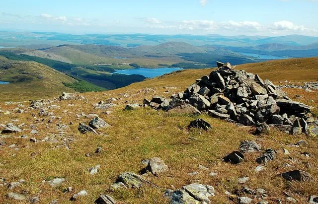
Shalloch on Minnoch Mary and Angus Hogg · CC BY-SA 2.0 -
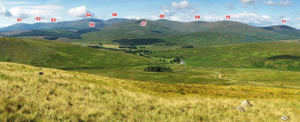
Rhinns of Kells Scothill · CC BY-SA 3.0 -
Merrick w:User:DavidAdamson · CC BY 3.0


Climate of Craigmawhannal
Best months for sightseeingBest months for sightseeing: July.
This month · November
A wet month
Day 7° · Night 2° · Rain 188 mm
- Hottest month
- July (day 16°)
- Coldest month
- February (night -1°)
- Wettest month
- November (188 mm)
- Driest month
- June (90 mm)
Bars: average monthly low and high temperature. Below: precipitation. Monthly averages for 1970–2000 at about 18 km resolution, adjusted for elevation. Highlighted months are mild and relatively dry. Source: WorldClim 2.1 (CC BY 4.0).
Show values as a table
| Month | Jan | Feb | Mar | Apr | May | Jun | Jul | Aug | Sep | Oct | Nov | Dec |
|---|---|---|---|---|---|---|---|---|---|---|---|---|
| Average high (°C) | 4° | 4° | 6° | 9° | 12° | 15° | 16° | 16° | 13° | 10° | 7° | 5° |
| Average low (°C) | 0° | -1° | 1° | 2° | 4° | 7° | 9° | 9° | 7° | 5° | 2° | 0° |
| Precipitation (mm) | 186 | 126 | 145 | 92 | 95 | 90 | 95 | 122 | 160 | 186 | 188 | 183 |
Other places to visit in this season: July
How to get to Craigmawhannal
The nearest airport is Glasgow Prestwick Airport (PIK), 36 km to the north as the crow flies. The nearest large city is Glasgow, 75 km to the north.
Airports
- Glasgow Prestwick Airport (PIK) Prestwick, South Ayrshire 36 kmnorth
- Glasgow Airport (GLA) Glasgow 75 kmnorth
- Campbeltown Airport (CAL) Campbeltown 85 kmwest
Nearby large cities
- Glasgow Population: 626.4K 75 kmnorth
- Edinburgh Population: 515K 114 kmnortheast
- Belfast Population: 348K 118 kmsouthwest
- Dundee Population: 148.2K 168 kmnortheast
- Blackpool Population: 145K 177 kmsoutheast
Straight-line distances; road distances are longer. Airport data: OurAirports.
Day trips from Craigmawhannal
Within 100 km: 208 historic and cultural sites, 2,341 natural sites, 656 lakes, rivers and coasts.
0–25 km354 places
- Isles of Trool Island 15 kmSW
- Holly Island Island 22 kmSE
- Marion's Isles Island 21 kmSE
- Eagle Island Island 22 kmSE
25–60 km1,041 places
- Ayr Beach Beach 33 kmNW
- Troon Beach Beach 42 kmN
- Pladda Island 52 kmNW
- Murrays Isles Island 44 kmS
60–100 km1,810 places
- Isle of Arran Island 70 kmNW
- Great Cumbrae Island Island 71 kmNW
- St. Bees Beach Seafront Beach 94 kmSE
- Powillimount Beach Beach 63 kmSE
Straight-line distances.
Nearest towns and villages
-
Craigmalloch Village, East Ayrshire3.6 km NE
-
Bellsbank Village, East Ayrshire13 km N
-
Dalmellington Village, East Ayrshire14 km N
-
Carsphairn Village, Dumfries and Galloway9.8 km E
-
Craigengillan Village, East Ayrshire11 km N
-
Patna Village, East Ayrshire20 km N
Nearby attractions & nature
Everything nearby-
Craigfionn Mountain, East Ayrshire1.5 km W
-
Craigmawhannal North Top Mountain, East Ayrshire2.2 km NE
-
Blaeberry Isle Island, East Ayrshire2.3 km W
-
Eagles Isle Island, East Ayrshire2.3 km W
-
Deer Isle Island, East Ayrshire2.5 km W
-
Gala Lane River, Scotland2 km E
-
Maccallum Mountain, East Ayrshire3.2 km W
-
Macaterick Mountain, East Ayrshire3.2 km SW
Sources & licences
Data last updated: