- Local time
- UTC+00:00
- Europe/London · UTC+00:00
- Airports
- EDI Edinburgh Airport6 km
- DND Dundee Airport55 km
About Inch Garvie
Inch Garvie is an island. Location: Edinburgh, Scotland.
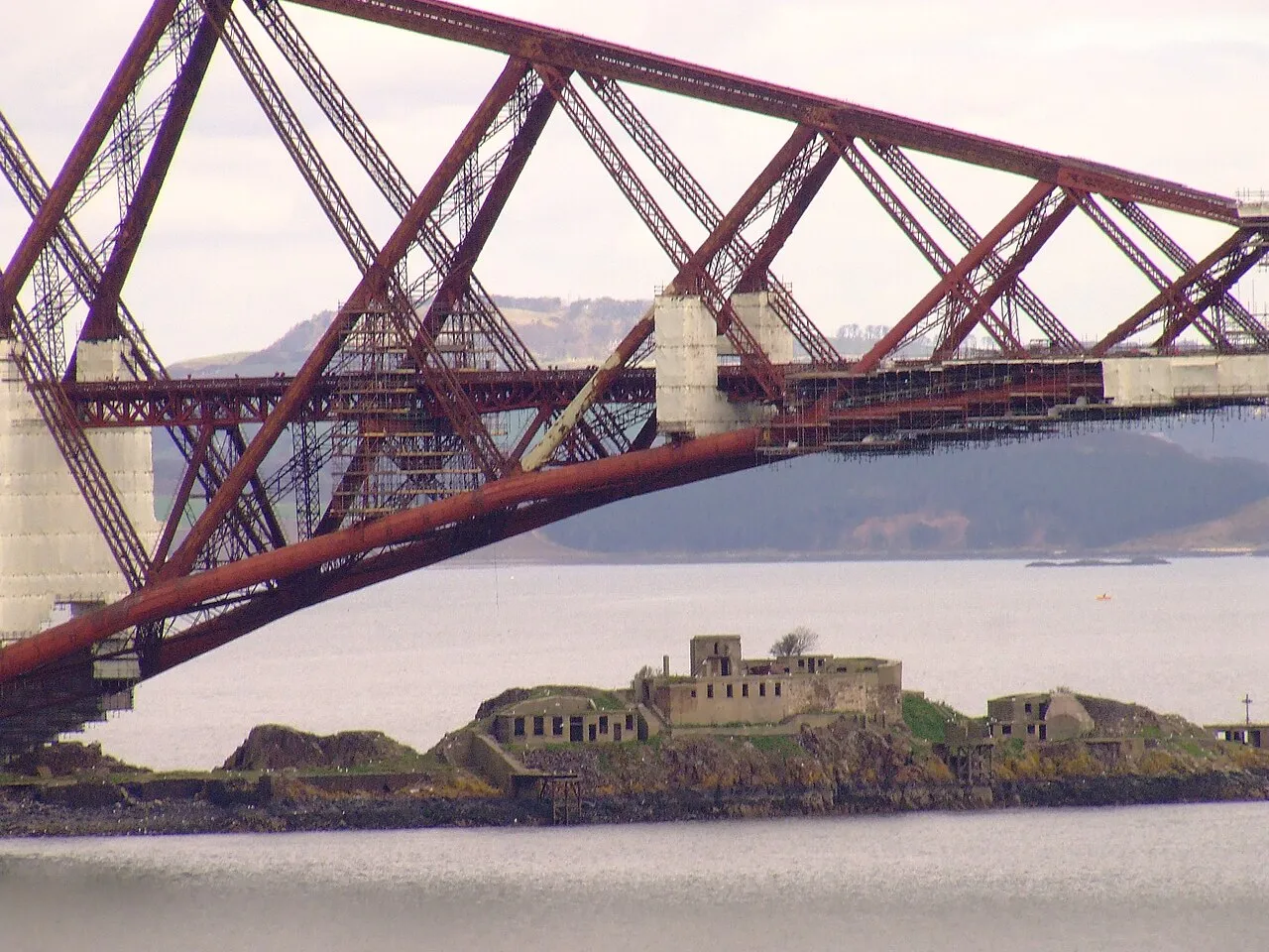
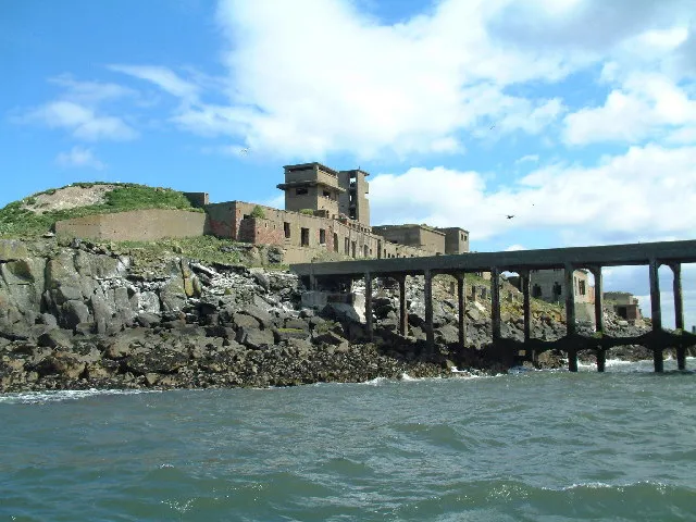
Inchgarvie or Inch Garvie is a small, uninhabited island in the Firth of Forth. On the rocks around the island sit four caissons that make up the foundations of the Forth Bridge. Inchgarvie's fortifications pre-date the modern period. In the days when boats were the only way to cross the Firth of Forth, the island was on the main route between North Queensferry in Fife and South Queensferry in Lothian. This made it strategically important.
Source: Wikipedia · CC BY-SA 4.0
At a glance
- Area
- 0.8 ha
Source: Wikidata
Photos of Inch Garvie
-

Wikimedia Commons · CC BY-SA 3.0 -

Magnus Hagdorn · CC BY-SA 2.0 -

marsupium photography · CC BY-SA 2.0 -

Magnus Hagdorn · CC BY-SA 2.0 -

Andy Hawkins · CC BY-SA 2.0


Climate of Inch Garvie
Best months for sightseeingBest months for sightseeing: June–August.
This month · November
A cold month
Day 9° · Night 2° · Rain 81 mm
- Hottest month
- July (day 19°)
- Coldest month
- January (night 0°)
- Wettest month
- January (91 mm)
- Driest month
- April (50 mm)
Bars: average monthly low and high temperature. Below: precipitation. Monthly averages for 1970–2000 at about 18 km resolution, adjusted for elevation. Highlighted months are mild and relatively dry. Source: WorldClim 2.1 (CC BY 4.0).
Show values as a table
| Month | Jan | Feb | Mar | Apr | May | Jun | Jul | Aug | Sep | Oct | Nov | Dec |
|---|---|---|---|---|---|---|---|---|---|---|---|---|
| Average high (°C) | 6° | 6° | 8° | 11° | 14° | 17° | 19° | 18° | 16° | 12° | 9° | 7° |
| Average low (°C) | 0° | 1° | 2° | 3° | 6° | 9° | 10° | 10° | 8° | 6° | 2° | 1° |
| Precipitation (mm) | 91 | 62 | 72 | 50 | 59 | 61 | 62 | 63 | 77 | 89 | 81 | 85 |
How to get to Inch Garvie
The nearest airport is Edinburgh Airport (EDI), 6 km to the south as the crow flies. The nearest large city is Edinburgh, 13 km to the southeast.
Airports
- Edinburgh Airport (EDI) Ingliston, Edinburgh 6 kmsouth
- Dundee Airport (DND) Dundee 55 kmnortheast
- Glasgow Airport (GLA) Glasgow 67 kmwest
Nearby large cities
- Edinburgh Population: 515K 13 kmsoutheast
- Glasgow Population: 626.4K 57 kmwest
- Dundee Population: 148.2K 58 kmnortheast
- Aberdeen Population: 198.6K 150 kmnortheast
- Newcastle upon Tyne Population: 300.1K 160 kmsoutheast
Straight-line distances; road distances are longer. Airport data: OurAirports.
Day trips from Inch Garvie
Within 100 km: 242 historic and cultural sites, 3,188 natural sites, 722 lakes, rivers and coasts.
0–25 km277 places
- Burntisland Beach Beach 12 kmNE
- Cramond beach Beach 6 kmE
- Portobello Beach Beach 18 kmE
- Inchkeith Island 16 kmE
25–60 km1,097 places
- Gullane Beach Beach 34 kmE
- Seacliff Beach Beach 47 kmE
- Mugdrum Island Island 40 kmN
- Isle of May Island 56 kmE
60–100 km2,778 places
- Great Cumbrae Island Island 99 kmW
- Ayr Beach Beach 99 kmSW
- Troon Beach Beach 95 kmSW
- Hunterston Sands Beach 99 kmW
Straight-line distances.
Nearest towns and villages
-
Queensferry Town, Edinburgh1.3 km SW
-
North Queensferry Village, Fife1 km N
-
 Inverkeithing Town, Fife3.6 km N
-
 Rosyth Town, Fife5.1 km NW
-
Dalgety Bay Town, Fife4.4 km NE
-
Port Edgar Village, Edinburgh1.7 km SW
Nearby attractions & nature
Everything nearby-
Whitehouse Bay Natural site, Edinburgh1.1 km SE
-
Forth Bridge Landmark, Edinburgh0.1 km W
-
Ferry Hills Mountain, Fife1.8 km NW
-
Mons Hill Mountain, Edinburgh2.1 km SE
-
Peatdraught Bay Natural site, Edinburgh1.9 km E
-
Dalmeny Oil Depot Mountain, Edinburgh2.7 km SE
-
New England Mountain, Edinburgh3 km SE
-
North Queensferry Lighthouse Landmark, Fife1 km NW
More lakes, rivers and coasts in United Kingdom
-
 Cramond Island Island, Edinburgh6.1 km E
-
 Inch Mickery Island, Edinburgh7.1 km E
-
Cramond beach Beach, Edinburgh6 km E
-
River Almond River, Edinburgh5.8 km SE
-
Portobello Beach Beach, Edinburgh18 km E
-
Brunstane Burn River, Edinburgh20 km E
Sources & licences
Data last updated: · 2 independent sources