- Elevation
- 63 m
- above sea level
- Local time
- UTC+00:00
- Europe/London · UTC+00:00
- Airports
- GLA Glasgow Airport31 km
- EDI Edinburgh Airport38 km
About Auchincloch
Auchincloch is a village. Location: Falkirk, Scotland. Elevation: 63 m. The best months to visit are June–August. The nearest airport is Glasgow Airport (31 km). Nearby sights include Speirs Island and Myot Hill.
Photos of Auchincloch
-
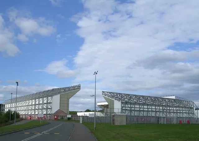
Broadwood Stadium Chris Upson · CC BY-SA 2.0

Climate of Auchincloch
Best months for sightseeingBest months for sightseeing: June–August.
This month · November
A wet month
Day 9° · Night 3° · Rain 148 mm
- Hottest month
- July (day 19°)
- Coldest month
- January (night 1°)
- Wettest month
- January (162 mm)
- Driest month
- April (69 mm)
Bars: average monthly low and high temperature. Below: precipitation. Monthly averages for 1970–2000 at about 18 km resolution, adjusted for elevation. Highlighted months are mild and relatively dry. Source: WorldClim 2.1 (CC BY 4.0).
Show values as a table
| Month | Jan | Feb | Mar | Apr | May | Jun | Jul | Aug | Sep | Oct | Nov | Dec |
|---|---|---|---|---|---|---|---|---|---|---|---|---|
| Average high (°C) | 6° | 7° | 8° | 11° | 15° | 17° | 19° | 18° | 15° | 12° | 9° | 7° |
| Average low (°C) | 1° | 1° | 2° | 4° | 6° | 9° | 11° | 11° | 9° | 6° | 3° | 2° |
| Precipitation (mm) | 162 | 111 | 120 | 69 | 73 | 71 | 77 | 93 | 129 | 150 | 148 | 150 |
How to get to Auchincloch
The nearest airport is Glasgow Airport (GLA), 31 km to the southwest as the crow flies. The nearest large city is Glasgow, 22 km to the southwest.
Airports
- Glasgow Airport (GLA) Glasgow 31 kmsouthwest
- Edinburgh Airport (EDI) Ingliston, Edinburgh 38 kmeast
- Glasgow Prestwick Airport (PIK) Prestwick, South Ayrshire 66 kmsouthwest
Nearby large cities
- Glasgow Population: 626.4K 22 kmsouthwest
- Edinburgh Population: 515K 49 kmeast
- Dundee Population: 148.2K 82 kmnortheast
- Aberdeen Population: 198.6K 173 kmnortheast
- Newcastle upon Tyne Population: 300.1K 188 kmsoutheast
Straight-line distances; road distances are longer. Airport data: OurAirports.
Day trips from Auchincloch
Within 100 km: 188 historic and cultural sites, 3,727 natural sites, 949 lakes, rivers and coasts.
0–25 km176 places
- Inch Island 17 kmNE
- Spiers Island Island 13 kmSE
- Speirs Island Island 3 kmW
- Loch Coulter Reservoir Lake 5 kmN
25–60 km1,415 places
- Burntisland Beach Beach 48 kmE
- Cramond beach Beach 43 kmE
- Portobello Beach Beach 55 kmE
- Inchlonaig Island 41 kmW
60–100 km3,273 places
- Isle of Arran Island 90 kmSW
- Great Cumbrae Island Island 64 kmW
- Ayr Beach Beach 72 kmSW
- Troon Beach Beach 65 kmSW
Straight-line distances.
Nearby attractions & nature
Everything nearby-
Speirs Island Island, North Lanarkshire2.8 km W
-
Myot Hill Mountain, Falkirk4 km NE
-
Darrach Hill Mountain, Falkirk4 km N
-
Airdriehead Hill Mountain, North Lanarkshire3.4 km SW
-
Broadwood Stadium Landmark, North Lanarkshire5.9 km SW
-
Court Hill Mountain, North Lanarkshire4.2 km W
Sources & licences
Data last updated: