Falkirk
Located in Scotland, United Kingdom Coordinates: 56°00′00″ N 3°45′00″ W
- Population
- 159,380
- 159.4K
- Elevation
- 8 m
- above sea level
- Local time
- UTC+00:00
- Europe/London · UTC+00:00
- Places inside
- 120
- listed under Falkirk
About Falkirk
Falkirk is a district. Location: Scotland, United Kingdom. Population: 159,380.
In comparison
- 23 sights and natural places within 10 km Falkirk Stadium, Callendar Lake
- Listed here: Village: 48, Neighbourhood: 42, Landmark: 7, Mountain: 7
Climate of Falkirk
Best months for sightseeing: June–August.
| Month | Jan | Feb | Mar | Apr | May | Jun | Jul | Aug | Sep | Oct | Nov | Dec |
|---|---|---|---|---|---|---|---|---|---|---|---|---|
| Average high (°C) | 7° | 7° | 9° | 12° | 15° | 18° | 19° | 19° | 16° | 13° | 9° | 7° |
| Average low (°C) | 2° | 2° | 3° | 4° | 7° | 10° | 12° | 12° | 9° | 7° | 4° | 2° |
| Precipitation (mm) | 153 | 105 | 114 | 66 | 70 | 70 | 75 | 89 | 121 | 141 | 139 | 144 |
Monthly averages for 1970–2000 at about 18 km resolution, adjusted for elevation. Highlighted months are mild and relatively dry. Source: WorldClim 2.1 (CC BY 4.0).
Airports nearest to Falkirk
- Edinburgh Airport (EDI) Ingliston, Edinburgh 24 km
- Glasgow Airport (GLA) Glasgow 45 km
- Dundee Airport (DND) Dundee 67 km
Straight-line distance; airports with scheduled flights only. Source: OurAirports (public domain).
Places in Falkirk
120 places-
Callendar Park Natural site
-
Callendar Wood Natural site
-
Candiehead Mountain
-
Carmuirs Neighbourhood
-
Carriden Neighbourhood
-
Castleloan Neighbourhood
-
Coneypark Neighbourhood
-
Corbiehall Neighbourhood
-
Crosshall Terrace Village
-
Darrach Hill Mountain
-
Deanfield Neighbourhood
-
Dhillon Terrace Village
-
Falkirk Stadium Landmark
-
Fankerton Village
-
Gardrum Moss Mountain
-
Glensburgh Neighbourhood
-
Glen Village Village
-
Grahamsdyke Neighbourhood
-
Grahamston Village
-
Grangepans Neighbourhood
-
Grayrigg Mountain
-
Greenbank Neighbourhood
-
Jawcraig Village
-
Kinneil Neighbourhood
-
Ladysmill Neighbourhood
-
Langlees Neighbourhood
-
Letham Village
-
Limerigg Village
-
Loan Village
-
Maidenpark Neighbourhood
-
Manuel Priory Historic site
-
Merchiston Neighbourhood
-
Middlefield Neighbourhood
-
Mingle Neighbourhood
-
Mungal Neighbourhood
-
Myot Hill Mountain
-
Newtown Neighbourhood
-
North Broomage Neighbourhood
-
Ochilview Park Landmark
-
Old Polmont Neighbourhood
-
Parkfoot Neighbourhood
-
Parkhill Neighbourhood
-
Pow Burn River
-
River Carron River
-
Rosebank Neighbourhood
-
Skea Craig Mountain
-
South Alloa Village
-
South Bellsdyke Village
-
South Broomage Neighbourhood
-
Standburn Village
-
Summerford Neighbourhood
-
Tamfourhill Neighbourhood
-
Tappoch Mountain
-
Torwood Village
-
Wholeflats Neighbourhood
-
Woodlands Neighbourhood
Nearby attractions & nature
Everything nearby-
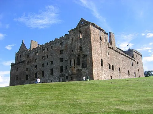 Linlithgow Palace Historic site, West Lothian9.6 km E
-
Black Devon River, Scotland7.4 km N
-
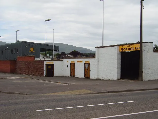 Recreation Park Landmark, Clackmannanshire13 km N
-
Bowden Hill Mountain, West Lothian8.8 km SE
-
Cow Hill Mountain, West Lothian8.8 km SE
-
Airngath Hill Mountain, West Lothian9.5 km E
Sources & licences
Data last updated: