- Elevation
- 471 m
- above sea level
- Local time
- UTC+00:00
- Europe/London · UTC+00:00
- Airports
- SYY Stornoway Airport74 km
- INV Inverness Airport84 km
About Creag Dhubh
Creag Dhubh is a mountain. Location: Highland, Scotland. Elevation: 471 m. The nearest airport is Stornoway Airport (74 km). Nearby sights include Cul Beag and Meall Dearg.
Photos of Creag Dhubh
-
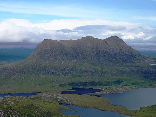
Cul Mor Foxie001 · Public domain -
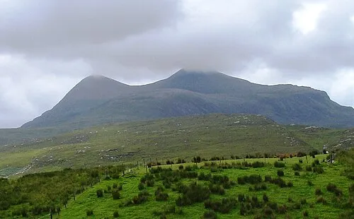
Cul Beag Foxie001 · Public domain -
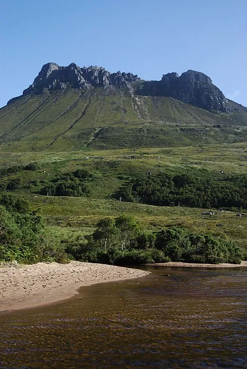
Stac Pollaidh Mehmet Karatay · CC BY-SA 3.0


Climate of Creag Dhubh
This month · November
A wet month
Day 6° · Night 1° · Rain 231 mm
- Hottest month
- July (day 15°)
- Coldest month
- December (night -2°)
- Wettest month
- November (231 mm)
- Driest month
- May (96 mm)
Bars: average monthly low and high temperature. Below: precipitation. Monthly averages for 1970–2000 at about 18 km resolution, adjusted for elevation. Highlighted months are mild and relatively dry. Source: WorldClim 2.1 (CC BY 4.0).
Show values as a table
| Month | Jan | Feb | Mar | Apr | May | Jun | Jul | Aug | Sep | Oct | Nov | Dec |
|---|---|---|---|---|---|---|---|---|---|---|---|---|
| Average high (°C) | 4° | 4° | 6° | 8° | 11° | 13° | 15° | 14° | 13° | 10° | 6° | 4° |
| Average low (°C) | -1° | -1° | 0° | 1° | 3° | 6° | 8° | 8° | 6° | 4° | 1° | -2° |
| Precipitation (mm) | 214 | 149 | 184 | 109 | 96 | 109 | 120 | 140 | 192 | 218 | 231 | 214 |
How to get to Creag Dhubh
The nearest airport is Stornoway Airport (SYY), 74 km to the west as the crow flies. The nearest large city is Aberdeen, 206 km to the southeast.
Airports
- Stornoway Airport (SYY) Stornoway, Western Isles 74 kmwest
- Inverness Airport (INV) Inverness, Highland 84 kmsoutheast
- Wick John O'Groats Airport (WIC) Wick 130 kmnortheast
Nearby large cities
- Aberdeen Population: 198.6K 206 kmsoutheast
- Dundee Population: 148.2K 216 kmsoutheast
- Glasgow Population: 626.4K 246 kmsouth
- Edinburgh Population: 515K 258 kmsoutheast
- Belfast Population: 348K 384 kmsouth
Straight-line distances; road distances are longer. Airport data: OurAirports.
Day trips from Creag Dhubh
Within 100 km: 38 historic and cultural sites, 3,124 natural sites, 914 lakes, rivers and coasts.
0–25 km475 places
- Eilean a' Char Island 18 kmW
- Tanera More Island 16 kmW
- Summer Isles Island 18 kmW
- Soyea Island Island 18 kmNW
25–60 km1,416 places
- Eilean Dubh Island 33 kmN
- Whale Islet Island 46 kmN
- Eilean Sùbhainn Island 41 kmSW
- Eilean Ruairidh Mòr Island 42 kmSW
60–100 km2,185 places
- Isle of Harris Natural site 100 kmW
- Island of Raasay Island 90 kmSW
- Dailbeag Beach Beach 100 kmW
- Scalpay Island 92 kmW
Straight-line distances.
Nearest towns and villages
-
Strathcanaird Village, Highland5.6 km S
-
Knockan Village, Highland7.3 km E
-
Elphin Village, Highland8 km NE
-
Ullapool Village, Highland13 km S
-
Culnacraig Village, Highland9.1 km SW
-
 Ardmair Village, Highland9.9 km S
Nearby attractions & nature
Everything nearby-
Cul Beag Mountain, Highland1.6 km NW
-
Meall Dearg Mountain, Highland1.3 km N
-
Druim Donn Mountain, Highland2.6 km E
-
An Laogh Mountain, Highland3.1 km N
-
Cul Mor Mountain, Highland4.7 km N
-
Stac Pollaidh Mountain, Highland5.2 km NW
-
Loch Lurgainn Lake, Highland3.2 km NW
-
Cnoc Loch an Doire Dhuibh Mountain, Highland3.7 km N
Sources & licences
Data last updated: