- Elevation
- 755 m
- above sea level
- Local time
- UTC+00:00
- Europe/London · UTC+00:00
- Airports
- GLA Glasgow Airport102 km
- INV Inverness Airport111 km
About Mam na Gualainn East Top
Mam na Gualainn East Top is a mountain. Location: Highland, Scotland. Elevation: 755 m. The nearest airport is Glasgow Airport (102 km). Nearby sights include Mam na Gualainn and Beinn na Caillich.
Photos of Mam na Gualainn East Top
-
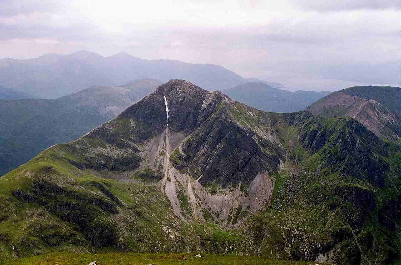
Stob Bàn Mick Knapton at English Wikipedia · CC BY-SA 3.0 -
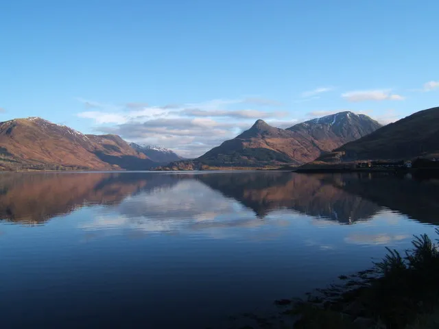
Pap of Glencoe Meg Megson · CC BY-SA 2.0 -
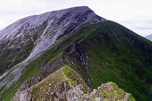
Sgurr a' Mhaim Mick Knapton at English Wikipedia · CC BY-SA 3.0 -
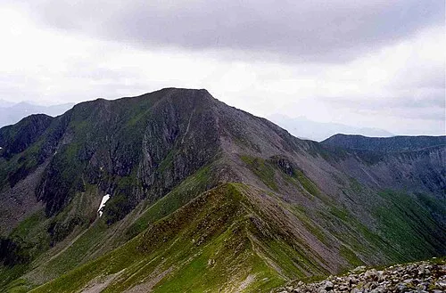
Am Bodach Mick Knapton at English Wikipedia · CC BY-SA 3.0 -
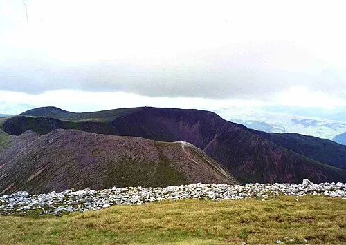
Mullach nan Coirean Mick Knapton at English Wikipedia · CC BY-SA 3.0


Climate of Mam na Gualainn East Top
This month · November
A wet month
Day 4° · Night -1° · Rain 266 mm
- Hottest month
- July (day 13°)
- Coldest month
- February (night -3°)
- Wettest month
- January (288 mm)
- Driest month
- May (106 mm)
Bars: average monthly low and high temperature. Below: precipitation. Monthly averages for 1970–2000 at about 18 km resolution, adjusted for elevation. Highlighted months are mild and relatively dry. Source: WorldClim 2.1 (CC BY 4.0).
Show values as a table
| Month | Jan | Feb | Mar | Apr | May | Jun | Jul | Aug | Sep | Oct | Nov | Dec |
|---|---|---|---|---|---|---|---|---|---|---|---|---|
| Average high (°C) | 2° | 2° | 4° | 7° | 10° | 12° | 13° | 13° | 11° | 8° | 4° | 3° |
| Average low (°C) | -2° | -3° | -2° | -1° | 2° | 5° | 7° | 7° | 5° | 2° | -1° | -2° |
| Precipitation (mm) | 288 | 189 | 229 | 120 | 106 | 113 | 133 | 157 | 222 | 248 | 266 | 279 |
How to get to Mam na Gualainn East Top
The nearest airport is Glasgow Airport (GLA), 102 km to the southeast as the crow flies. The nearest large city is Glasgow, 107 km to the southeast.
Airports
- Glasgow Airport (GLA) Glasgow 102 kmsoutheast
- Inverness Airport (INV) Inverness, Highland 111 kmnortheast
- Tiree Airport (TRE) Balemartine, Argyll and Bute 113 kmwest
Nearby large cities
- Glasgow Population: 626.4K 107 kmsoutheast
- Dundee Population: 148.2K 132 kmeast
- Edinburgh Population: 515K 144 kmsoutheast
- Aberdeen Population: 198.6K 187 kmeast
- Belfast Population: 348K 242 kmsouth
Straight-line distances; road distances are longer. Airport data: OurAirports.
Day trips from Mam na Gualainn East Top
Within 100 km: 64 historic and cultural sites, 4,817 natural sites, 1,378 lakes, rivers and coasts.
0–25 km392 places
- Shuna Island Island 24 kmSW
- Sgeir Dubh Island 24 kmSW
- Tom an t-Seallaidh (Shuna) Island 24 kmSW
- Eilean Molach Island 23 kmSE
25–60 km2,238 places
- Oronsay Island 53 kmW
- Eriska Island 30 kmSW
- Eilean Shona Island 49 kmW
- Seil Island 59 kmSW
60–100 km3,629 places
- Isle of Skye Island 97 kmNW
- Island of Raasay Island 96 kmNW
- Eigg Island 70 kmW
- Kiloran Beach Beach 97 kmSW
Straight-line distances.
Nearest towns and villages
-
 Glencoe Village, Highland4.4 km SW
-
 Kinlochleven Village, Highland5.9 km E
-
 Ballachulish Village, Highland6.3 km SW
-
Caolasnacon Village, Highland2.6 km SE
-
Carnach Village, Highland3.9 km S
-
Invercoe Village, Highland4.3 km SW
Nearby attractions & nature
Everything nearby-
Mam na Gualainn Mountain, Highland0.8 km W
-
Beinn na Caillich Mountain, Highland1.8 km E
-
Pap of Glencoe Mountain, Highland3.3 km S
-
Mullach nan Coirean Mountain, Highland3.6 km N
-
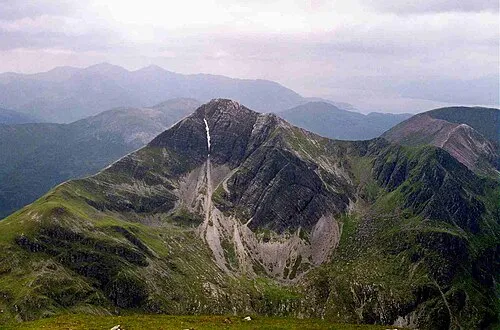 Stob Bàn Mountain, Highland3.7 km NE
-
Torr a' Phloda Mountain, Highland2.5 km SE
-
Mullach nan Coirean SE Top Mountain, Highland2.9 km N
-
Meall a' Chaorainn Mountain, Highland3.1 km N
More nature in United Kingdom
-
Am Bodach Mountain, Highland5.8 km NE
-
Sgurr a' Mhaim Mountain, Highland5.8 km NE
-
Aonach Eagach - Sgorr nam Fiannaidh Mountain, Highland4.7 km SE
-
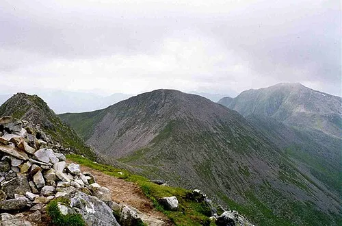 Stob Coire a' Chairn Mountain, Highland7.2 km NE
-
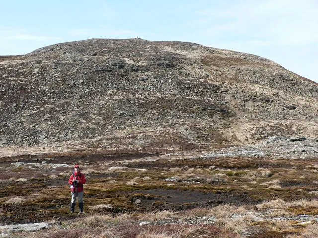 Aonach Eagach - Meall Dearg Mountain, Highland5.8 km SE
-
Tom Meadhoin Mountain, Highland3.6 km W
Sources & licences
Data last updated: