- Elevation
- 15 m
- above sea level
- Local time
- UTC+00:00
- Europe/London · UTC+00:00
- Airports
- WIC Wick John O'Groats Airport41 km
- KOI Kirkwall Airport67 km
About Reay Burn at Reay
Reay Burn at Reay is a river. Location: Highland, Scotland. The best months to visit are July–August. The nearest airport is Wick John O'Groats Airport (41 km). Nearby sights include Burn of Isauld and Sandside Burn.
Climate of Reay Burn at Reay
Best months for sightseeingBest months for sightseeing: July–August.
This month · November
A wet month
Day 9° · Night 4° · Rain 124 mm
- Hottest month
- August (day 16°)
- Coldest month
- February (night 2°)
- Wettest month
- November (124 mm)
- Driest month
- May (58 mm)
Bars: average monthly low and high temperature. Below: precipitation. Monthly averages for 1970–2000 at about 18 km resolution, adjusted for elevation. Highlighted months are mild and relatively dry. Source: WorldClim 2.1 (CC BY 4.0).
Show values as a table
| Month | Jan | Feb | Mar | Apr | May | Jun | Jul | Aug | Sep | Oct | Nov | Dec |
|---|---|---|---|---|---|---|---|---|---|---|---|---|
| Average high (°C) | 6° | 7° | 8° | 9° | 12° | 14° | 16° | 16° | 14° | 12° | 9° | 7° |
| Average low (°C) | 2° | 2° | 2° | 4° | 6° | 8° | 10° | 10° | 9° | 7° | 4° | 2° |
| Precipitation (mm) | 108 | 79 | 97 | 64 | 58 | 62 | 70 | 81 | 104 | 116 | 124 | 112 |
How to get to Reay Burn at Reay
The nearest airport is Wick John O'Groats Airport (WIC), 41 km to the east as the crow flies. The nearest large city is Aberdeen, 186 km to the southeast.
Airports
- Wick John O'Groats Airport (WIC) Wick 41 kmeast
- Kirkwall Airport (KOI) Kirkwall, Orkney Islands 67 kmnortheast
- Eday Airport (EOI) Eday 91 kmnortheast
Nearby large cities
- Aberdeen Population: 198.6K 186 kmsoutheast
- Dundee Population: 148.2K 237 kmsouth
- Edinburgh Population: 515K 292 kmsouth
- Glasgow Population: 626.4K 301 kmsouth
Straight-line distances; road distances are longer. Airport data: OurAirports.
Day trips from Reay Burn at Reay
Within 100 km: 47 historic and cultural sites, 1,553 natural sites, 494 lakes, rivers and coasts.
0–25 km119 places
- Clett Island 15 kmNE
- Glass Islands Island 15 kmW
- Garbh-eilean Island 15 kmW
- Glas-eilean Mor Island 15 kmW
25–60 km692 places
- Hoy Island 43 kmNE
- Flotta Island 49 kmNE
- Hesta Head Natural site 56 kmNE
- Switha Island 47 kmNE
60–100 km1,283 places
- Shapinsay Island 75 kmNE
- Rousay Island 80 kmNE
- Eday Island 90 kmNE
- Wyre Island 78 kmNE
Straight-line distances.
Nearest towns and villages
-
 Reay Village, Highland0.4 km NW
-
 Achvarasdal Village, Highland1.6 km E
-
Isauld Village, Highland1.4 km NE
-
 Fresgoe Village, Highland1.9 km NW
-
Dunreay Village, Highland2.6 km NE
-
Upper Dounreay Village, Highland3.6 km E
Nearby attractions & nature
Everything nearby-
Burn of Isauld River, Highland0.9 km NE
-
Sandside Burn River, Highland0.9 km SW
-
Sandside Bay Natural site, Highland1.6 km N
-
Reay Burn River, Highland1.8 km NE
-
Sandside Head Natural site, Highland1.8 km NW
-
Creag Leathan Mountain, Highland2.1 km SE
-
Cnoc na Moine Mountain, Highland3 km W
-
Creag Mhor Mountain, Highland3 km SE
More lakes, rivers and coasts in United Kingdom
-
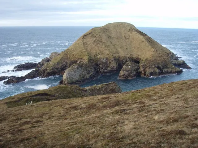 Boursa Island Island, Highland16 km W
-
Loch Akran Lake, Highland6.3 km SW
-
Loch Saorach Lake, Highland6.8 km SE
-
Loch Thormaid Lake, Highland6.9 km SE
-
Loch na Seilge Lake, Highland7.2 km SW
-
Forss Water River, Highland7.9 km NE
Sources & licences
Data last updated: