- Elevation
- 34 m
- above sea level
- Local time
- UTC+00:00
- Europe/London · UTC+00:00
- Airports
- SYY Stornoway Airport87 km
- INV Inverness Airport97 km
About Shieldaig Island
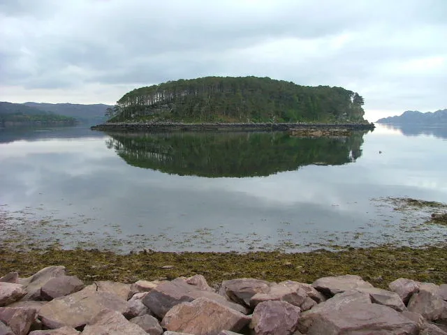
Shieldaig Island is an island. Location: Highland, Scotland.
Shieldaig Island is an island in Loch Shieldaig, in the council area of Highland, Scotland. It is located 400 metres (1⁄4 nmi) offshore from Shieldaig. Its area is 13 hectares (32 acres) and it rises to a maximum elevation of 41 metres (134 feet). Shieldaig Island has been the property of the National Trust for Scotland since 1970 and has a thriving bird population. It is almost entirely covered in Scots pine which was thought to have been planted over 100 years ago. The seeds were probably taken from Speyside.
Source: Wikipedia · CC BY-SA 4.0
Climate of Shieldaig Island
Best months for sightseeingBest months for sightseeing: July.
This month · November
A wet month
Day 10° · Night 5° · Rain 273 mm
- Hottest month
- July (day 18°)
- Coldest month
- February (night 3°)
- Wettest month
- November (273 mm)
- Driest month
- May (107 mm)
Bars: average monthly low and high temperature. Below: precipitation. Monthly averages for 1970–2000 at about 18 km resolution, adjusted for elevation. Highlighted months are mild and relatively dry. Source: WorldClim 2.1 (CC BY 4.0).
Show values as a table
| Month | Jan | Feb | Mar | Apr | May | Jun | Jul | Aug | Sep | Oct | Nov | Dec |
|---|---|---|---|---|---|---|---|---|---|---|---|---|
| Average high (°C) | 7° | 8° | 9° | 11° | 15° | 16° | 18° | 18° | 16° | 13° | 10° | 8° |
| Average low (°C) | 3° | 3° | 3° | 4° | 7° | 10° | 11° | 11° | 9° | 7° | 5° | 3° |
| Precipitation (mm) | 263 | 176 | 219 | 123 | 107 | 120 | 133 | 151 | 227 | 255 | 273 | 264 |
Other places to visit in this season: July
How to get to Shieldaig Island
The nearest airport is Stornoway Airport (SYY), 87 km to the northwest as the crow flies. The nearest large city is Dundee, 201 km to the southeast.
Airports
- Stornoway Airport (SYY) Stornoway, Western Isles 87 kmnorthwest
- Inverness Airport (INV) Inverness, Highland 97 kmeast
- Benbecula Airport (BEB) Balivanich 102 kmwest
Nearby large cities
- Dundee Population: 148.2K 201 kmsoutheast
- Glasgow Population: 626.4K 204 kmsoutheast
- Aberdeen Population: 198.6K 219 kmeast
- Edinburgh Population: 515K 231 kmsoutheast
- Belfast Population: 348K 327 kmsouth
Straight-line distances; road distances are longer. Airport data: OurAirports.
Nearest towns and villages
-
Shieldaig Village, Highland0.7 km SE
-
Ardheslaig Village, Highland3.6 km NW
-
Inveralligin Village, Highland4.5 km NE
-
Wester Alligin Village, Highland4.3 km NE
-
Lower Diabaig Village, Highland4.6 km N
-
Upper Diabaig Village, Highland4.6 km N
Nearby attractions & nature
Everything nearby-
Meall a' Choire Bhuidhe Mountain, Highland1 km E
-
Camas an Leim Mountain, Highland1.3 km NE
-
Camas Ruadh Mountain, Highland1.6 km N
-
Eilean Dùghaill Island, Highland1.6 km W
-
Eilean an Inbhire Bhàin Island, Highland1.8 km W
-
Meall an Inbhire Bhain Mountain, Highland2.2 km W
-
Eilean a' Chaoil Island, Scotland1.9 km N
-
Ben Shieldaig NW Top Mountain, Highland2.6 km SE
Sources & licences
Data last updated: · 2 independent sources