- Elevation
- 80 m
- above sea level
- Local time
- UTC+00:00
- Europe/London · UTC+00:00
- Airports
- WIC Wick John O'Groats Airport54 km
- KOI Kirkwall Airport83 km
About The Uair
The Uair is a river. Location: Highland, Scotland. The best months to visit are July–August. The nearest airport is Wick John O'Groats Airport (54 km). Nearby sights include Beinn nam Bo East Top and Beinn Ruadh.
Climate of The Uair
Best months for sightseeingBest months for sightseeing: July–August.
This month · November
A wet month
Day 8° · Night 4° · Rain 142 mm
- Hottest month
- July (day 17°)
- Coldest month
- February (night 1°)
- Wettest month
- November (142 mm)
- Driest month
- May (70 mm)
Bars: average monthly low and high temperature. Below: precipitation. Monthly averages for 1970–2000 at about 18 km resolution, adjusted for elevation. Highlighted months are mild and relatively dry. Source: WorldClim 2.1 (CC BY 4.0).
Show values as a table
| Month | Jan | Feb | Mar | Apr | May | Jun | Jul | Aug | Sep | Oct | Nov | Dec |
|---|---|---|---|---|---|---|---|---|---|---|---|---|
| Average high (°C) | 6° | 6° | 8° | 10° | 13° | 15° | 17° | 17° | 14° | 12° | 8° | 6° |
| Average low (°C) | 1° | 1° | 2° | 3° | 6° | 8° | 10° | 10° | 8° | 6° | 4° | 1° |
| Precipitation (mm) | 126 | 91 | 113 | 75 | 70 | 77 | 84 | 96 | 121 | 133 | 142 | 128 |
How to get to The Uair
The nearest airport is Wick John O'Groats Airport (WIC), 54 km to the east as the crow flies. The nearest large city is Aberdeen, 188 km to the southeast.
Airports
- Wick John O'Groats Airport (WIC) Wick 54 kmeast
- Kirkwall Airport (KOI) Kirkwall, Orkney Islands 83 kmnortheast
- Inverness Airport (INV) Inverness, Highland 105 kmsouth
Nearby large cities
- Aberdeen Population: 198.6K 188 kmsoutheast
- Dundee Population: 148.2K 233 kmsouth
- Edinburgh Population: 515K 286 kmsouth
- Glasgow Population: 626.4K 292 kmsouth
Straight-line distances; road distances are longer. Airport data: OurAirports.
Day trips from The Uair
Within 100 km: 49 historic and cultural sites, 1,681 natural sites, 533 lakes, rivers and coasts.
0–25 km223 places
- Eilean nan Ron Island 20 kmNW
- Rabbit Islands Island 22 kmW
- Neave Island Island 18 kmNW
- Eilean Iosal Island 22 kmNW
25–60 km704 places
- Hoy Island 58 kmNE
- Clett Island 32 kmNE
- Island of Stroma Island 57 kmNE
- Eilean Hoan Island 40 kmW
60–100 km1,336 places
- Shapinsay Island 91 kmNE
- Rousay Island 95 kmNE
- Flotta Island 65 kmNE
- Wyre Island 93 kmNE
Straight-line distances.
Nearest towns and villages
-
Aultivullin Village, Highland11 km N
-
Dalhalvaig Village, Highland7.2 km E
-
Croick Village, Highland7.5 km E
-
Trantlebeg Village, Highland8.6 km SE
-
Lednagullin Village, Highland8.2 km N
-
Strathy Village, Highland8.8 km N
Nearby attractions & nature
Everything nearby-
Beinn nam Bo East Top Mountain, Highland2.2 km NW
-
Beinn Ruadh Mountain, Highland3.6 km NE
-
Beinn nam Bo Mountain, Highland4.4 km NW
-
Cnoc Meala Mountain, Highland4.5 km W
-
Loch Baligill Lake, Highland4.7 km NE
-
Baligill Head Natural site, Highland9.5 km N
-
Cnoc Badaireach na Gaoithe Mountain, Highland5.2 km S
-
Loch Eileanach Lake, Highland5.4 km NW
More lakes, rivers and coasts in United Kingdom
-
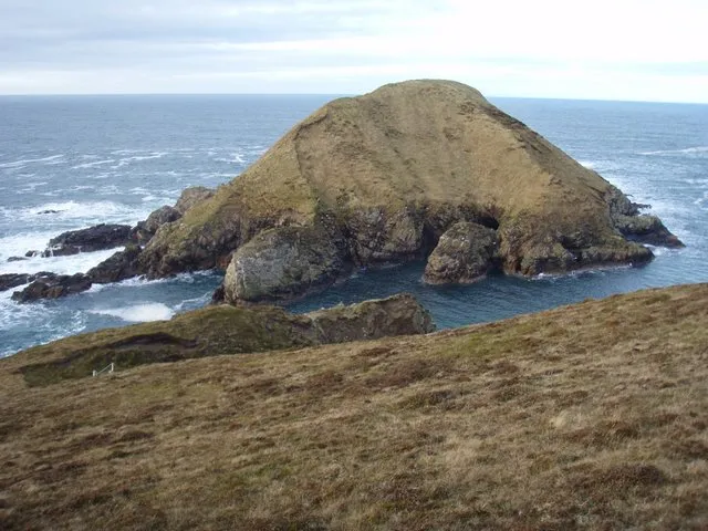 Boursa Island Island, Highland11 km N
-
Loch Mor na Caorach Lake, Highland6.9 km SW
-
Loch Meadie Lake, Highland7.1 km W
-
Allt a’ Mhuilinn River, Highland7.1 km E
-
Armadale Burn River, Highland8 km N
-
Loch na Caorach Lake, Highland8 km E
Sources & licences
Data last updated: