- Elevation
- 117 m
- above sea level
- Local time
- UTC+00:00
- Europe/London · UTC+00:00
- Airports
- INV Inverness Airport60 km
- DND Dundee Airport127 km
About Torr a' Choiltreich
Torr a' Choiltreich is a mountain. Location: Highland, Scotland. Elevation: 117 m. The best months to visit are June–August. The nearest airport is Inverness Airport (60 km). Nearby sights include Creagan a' Chip and Eilean Floda.
Photos of Torr a' Choiltreich
-
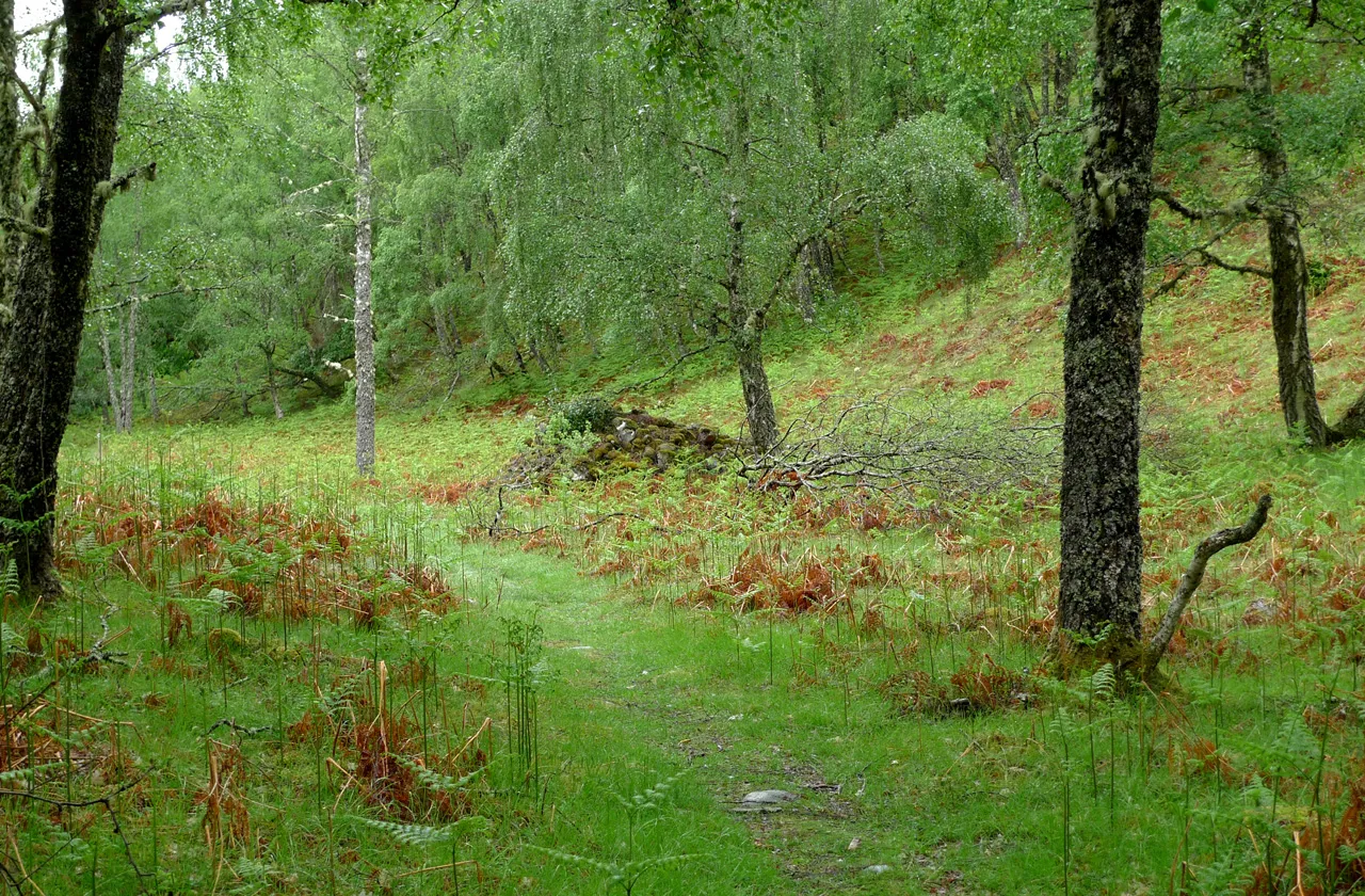
Glen Moriston Kendall K. Down · Public domain

Climate of Torr a' Choiltreich
Best months for sightseeingBest months for sightseeing: June–August.
This month · November
A wet month
Day 8° · Night 3° · Rain 228 mm
- Hottest month
- July (day 18°)
- Coldest month
- February (night 1°)
- Wettest month
- January (255 mm)
- Driest month
- May (94 mm)
Bars: average monthly low and high temperature. Below: precipitation. Monthly averages for 1970–2000 at about 18 km resolution, adjusted for elevation. Highlighted months are mild and relatively dry. Source: WorldClim 2.1 (CC BY 4.0).
Show values as a table
| Month | Jan | Feb | Mar | Apr | May | Jun | Jul | Aug | Sep | Oct | Nov | Dec |
|---|---|---|---|---|---|---|---|---|---|---|---|---|
| Average high (°C) | 6° | 6° | 8° | 11° | 14° | 16° | 18° | 18° | 15° | 12° | 8° | 6° |
| Average low (°C) | 1° | 1° | 2° | 3° | 6° | 8° | 11° | 10° | 8° | 6° | 3° | 1° |
| Precipitation (mm) | 255 | 162 | 198 | 98 | 94 | 96 | 104 | 125 | 186 | 211 | 228 | 240 |
How to get to Torr a' Choiltreich
The nearest airport is Inverness Airport (INV), 60 km to the northeast as the crow flies. For international flights: Glasgow Airport (GLA) (141 km). The nearest large city is Dundee, 128 km to the southeast.
Airports
- Inverness Airport (INV) Inverness, Highland 60 kmnortheast
- Dundee Airport (DND) Dundee 127 kmsoutheast
- Glasgow Airport (GLA) Glasgow 141 kmsouth
Nearby large cities
- Dundee Population: 148.2K 128 kmsoutheast
- Glasgow Population: 626.4K 143 kmsouth
- Aberdeen Population: 198.6K 157 kmeast
- Edinburgh Population: 515K 160 kmsoutheast
- Belfast Population: 348K 292 kmsouth
Straight-line distances; road distances are longer. Airport data: OurAirports.
Day trips from Torr a' Choiltreich
Within 100 km: 50 historic and cultural sites, 5,013 natural sites, 1,107 lakes, rivers and coasts.
0–25 km445 places
- Eilean na h-Ealaidh Island 8 kmSW
- Bàn Eilean Island 6 kmNE
- Eilean nan Sasunnach Island 11 kmSW
- Eilean na Cloinne Island 19 kmW
25–60 km1,901 places
- Moy Island Island 49 kmN
- Eilean Ràrsaidh Island 56 kmW
- Eilean Donan Island 53 kmW
- Eilean Tioram Island 53 kmW
60–100 km3,824 places
- Isle of Skye Island 96 kmW
- Island of Raasay Island 87 kmW
- Eigg Island 93 kmW
- Scalpay Island 80 kmW
Straight-line distances.
Nearest towns and villages
-
 Fort Augustus Village, Highland1.8 km NE
-
Auchteraw Village, Highland1.9 km W
-
Newtown Village, Highland3 km SW
-
Cullochy Lock Village, Highland4.3 km SW
-
Inverness-shire Municipality, Highland5.4 km S
-
Aberchalder Village, Highland4.9 km SW
Nearby attractions & nature
Everything nearby-
Creagan a' Chip Mountain, Highland0.6 km SW
-
Eilean Floda Island, Highland0.6 km NW
-
Eilean Ardachy Island, Highland0.9 km E
-
Meall a' Cholumain NE Top Mountain, Highland1.6 km S
-
Creag Ard Achaidh Mountain, Highland2.6 km SE
-
Creag an-Iarlain Mountain, Highland2.6 km N
-
Loch Uanagan Lake, Highland2.3 km SE
-
Meall a' Cholumain Mountain, Highland2.8 km S
More nature in United Kingdom
-
Glen Moriston Natural site, Highland4.5 km NE
-
Glen Doe Natural site, Highland5 km E
-
Carn na Saobhaidhe Mountain, Highland3.7 km E
-
Fuaran Doire Cluig Mountain, Highland3.8 km SE
-
Liath Dhoire Mountain, Highland3.8 km S
-
Carn Doire Chaorach Mountain, Highland4.7 km SE
Sources & licences
Data last updated: